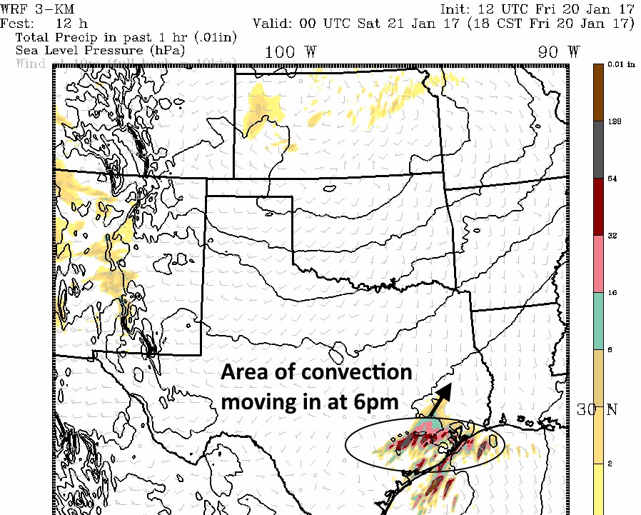
As expected some thunderstorms have develop near, and south of Victoria this afternoon along a warm front stretching across coastal Texas. As these storms migrate to the northeast toward the Houston metro area, it appears likely that a weak disturbance in the upper atmosphere will add an additional impetus to strengthen them this evening over Houston.

Practically, this means the region will see a pretty healthy chance of showers sometime between 4 and 8pm this evening, and a decent chance of thunderstorms. Tornadoes appear unlikely to form with this system, but some hail is possible due to vertical wind shear. Most areas will likely see 1 inch of rain or less, but a few areas might see more rain where the heaviest storms set up. Any lingering showers should exit the area by about 9pm.
Saturday should be mostly sunny, with a high in the upper 70s, and a slight chance of rain toward the evening hours. Sunday still looks sunny, but quite blustery as a front moves in. Look for gusts in the 30s, which could play havoc with outdoor activities.
Posted at 2:40pm CT on Friday by Eric
(Space City Weather is sponsored by Westbury Christian School for this month)
Hold on, Eric! I was under the impression the worst of the storms would occur south and east of the Houston metro. How come the forecast has them coming into town now? What changed?
To tag onto Worry bugs comment, do you think most of the metro area will see rain?
Yes, I do. Showers at least. Thunderstorms will likely be more scattered.
We got 4-inches over a couple of hours during the 6-ish timeframe in the Space Center and Eldorado Blvd area…some local street flooding was an issue…
Wow, what a storm in Katy area last night….woke me up. lightening heavy rain…..