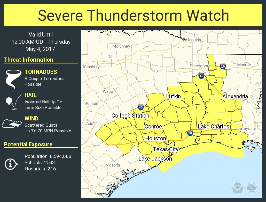
As a cold front approaches the Houston area, the National Weather Service has issued a severe thunderstorm watch for the metro region. The watch, in effect until midnight, calls attention to the possibility of hail, damaging winds, and possibly a tornado or two.

Here’s what we know for sure. A capping inversion (warmer air aloft) has held firm throughout the day Wednesday, limiting shower activity while areas to our east, along the Texas-Louisiana border, have received heavy rain. As the front pushes south into Houston this evening that cap is going to weaken, and break in some places.
However, because the storms are moving southward at a pretty good clip, I think the showers and thunderstorms that do develop will be fairly brief. So expect a lot of thunder, lightning, and possibly some hail—this is more likely to the east and northeast of Houston—but then for the show to end pretty quickly. I’d expect the storms to hit Houston around sunset, earlier for areas up north, and later for areas closer to the coast. All over by midnight.
Posted at 5:20pm CT on Wednesday by Eric
(Space City Weather is sponsored this month by Jetco Delivery)
Thank you for the update: Was trying to decide if I should go out this evening or stay in. Think I’ll stay in!
Thanks for the update. I really enjoy having my “own” weather forecast!
Seriously craving a good thunderstorm. Seems like we get fewer of them every spring.