As of 12:15, the severe weather threat in and around Metro Houston is now pretty much over, as the cold front has swung through the area (with the exception of places like Texas City, Galveston, and Lake Jackson, where that threat will end by about 1 PM). Rain will continue, heavy at times, behind the front. There could also be some thunderstorms still too, but any threat of damaging winds and tornadoes is shifting off to our east and will continue pulling away through the afternoon.
A map of temperatures tells the story quite well.
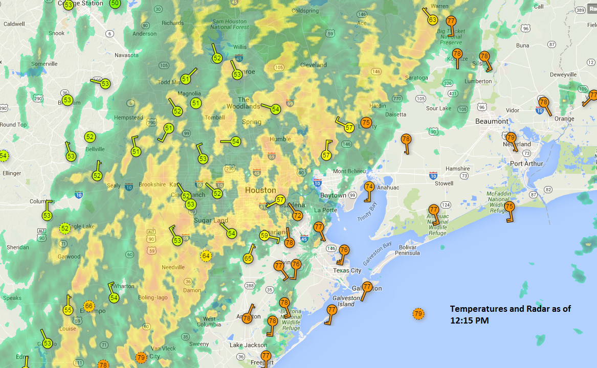
It’s turned into a raw, chilly autumn day here, and you can see the dividing line as of 12:15 clearly. Temperatures fell about 20 degrees as the front moved through. Those of you to the east, get ready: It gets cold quickly! Breezy, rainy conditions will continue in Houston proper through about 3 PM, give or take an hour. The rain should taper off to drizzle or intermittent showers for the evening commute. It’s likely that roads will still be a bit wet though, so plan accordingly.
Everything clears out completely overnight, and tomorrow looks like a winner.
Posted at 12:15 PM CT
Thanks Eric, it is so great to be able to get updates like this.
Well done as usual Eric. Much appreciated.
Great site