In brief: Storms are firing up to the west of Houston this afternoon, and the region will face an unsettled pattern through Wednesday morning, at least. This post describes our latest thinking on timing and impacts from these storms.
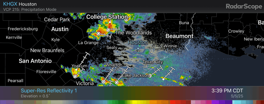
Good afternoon. Some fairly strong thunderstorms have developed near Brenham, and they are part of a system that is slowly moving to the east, and therefore toward the Houston metro area. I have some doubts about how much of this activity is going to hold together later this afternoon, but it is possible that some parts of the Houston region, including Montgomery County, will experience thunderstorms late this afternoon or this evening before midnight. After this we should experience a reprieve over night.
Tuesday and Wednesday
It is difficult to forecast the next couple of days with high confidence, so I’m going to share what we’re thinking now. But this is a fluid situation. (Both literally and figuratively). Tomorrow morning a fairly strong line of storms is likely to develop along the I-35 corridor around sunrise and then progress eastward across the state. A lot of our modeling suggests this line of storms will remain rather strong as it reaches I-45 late during the morning or around noon-ish. All of the threats are in place here: heavy rainfall, damaging winds, hail, and possibly tornadoes.
Here’s the tricky part. I’m fairly confident in strong storms for places like College Station and Huntsville, but the further south one goes, the less chance of inclement weather. It is possible that much of Harris County, and points south, see only scattered showers and thunderstorms on Tuesday, rather than a seriously disruptive and severe event.
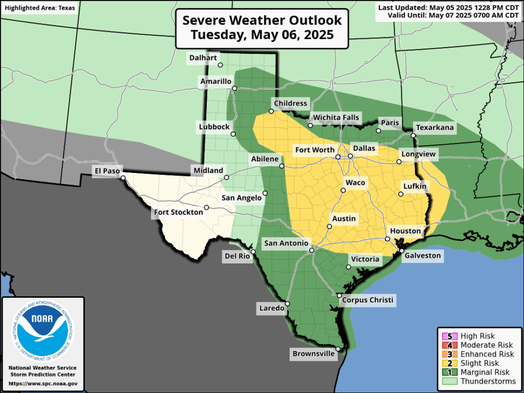
However, that won’t be the end of it. The atmosphere will be supportive of a second round of showers and thunderstorms that are more likely to impact central and southern regions of the Houston area. Whether this occurs late on Tuesday evening, overnight, or on Wednesday morning simply is not something I can say with confidence right now.
The bottom line is that from now through Wednesday morning you should be prepared for the possibility of strong thunderstorms and heavy rainfall. We have put a Stage 1 flood alert in place to account for street flooding, but there is also the threat of hail, damaging winds, and tornadoes.
We will continue to keep you posted.

Thanks.
Thanks for the afternoon update.
Appreciate the updates!!
A strong storm produced a ton of hail in Bay City and Van Vleck over an hour ago. Fortunately it wasn’t very big and I don’t know if any damage occurred.
Yep – we got drenching rain Mon evening, about 5-6pm, then a second round a bit later. I’d estimate 2-3 hours overall.
And to add to the rain, green pea sized hail pounded down, for about 20-30 minutes.