Good morning. A cold front is pushing into the Houston area this morning, and its passage should be a mostly dry one due to a capping inversion over the region that is limiting the upward movement of air at the surface. We’ll then enjoy some drier air for about 48 hours before the weekend weather turns a little more uncertain.
Thursday
Cloudy and overcast skies this morning will give way to sunshine and drier air later this morning, or early afternoon, as drier air associated with the front moves into Houston. Highs will reach the upper 70s. Winds will also be notable, gusting up to 20 mph or so from the north and northwest as this drier air moves in. Overnight lows will drop into the 50s, and this will be the coldest night for some time in the region.

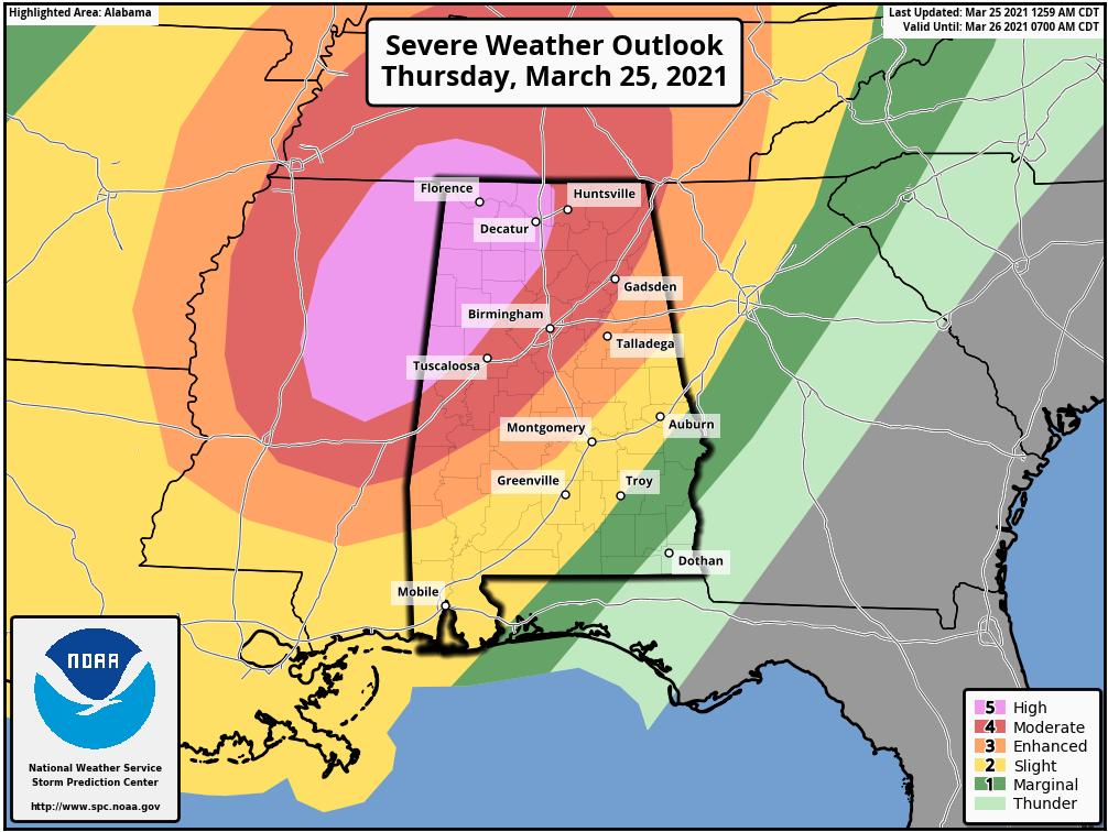
We’re also keeping a wary eye on the potential for storms—related to the front that moved through Houston—over the southeastern United States. Parts of Mississippi, Alabama, and Tennessee again find themselves in the crosshairs of tornadoes and other severe weather later today and tonight.
Friday
This should be a sunny, splendid day, with highs in the upper 70s. Winds will shift to come from the south later in the day, and this will make for a warmer night, with lows only dropping into the 60s.
Saturday
The first half of the weekend is shaping up to be warm, with highs in the low 80s, and partly sunny skies. As moisture levels rise due to southerly winds, we may see some very scattered, light showers during the daytime and overnight hours. Lows near the coast likely won’t drop below 70 degrees.
Sunday
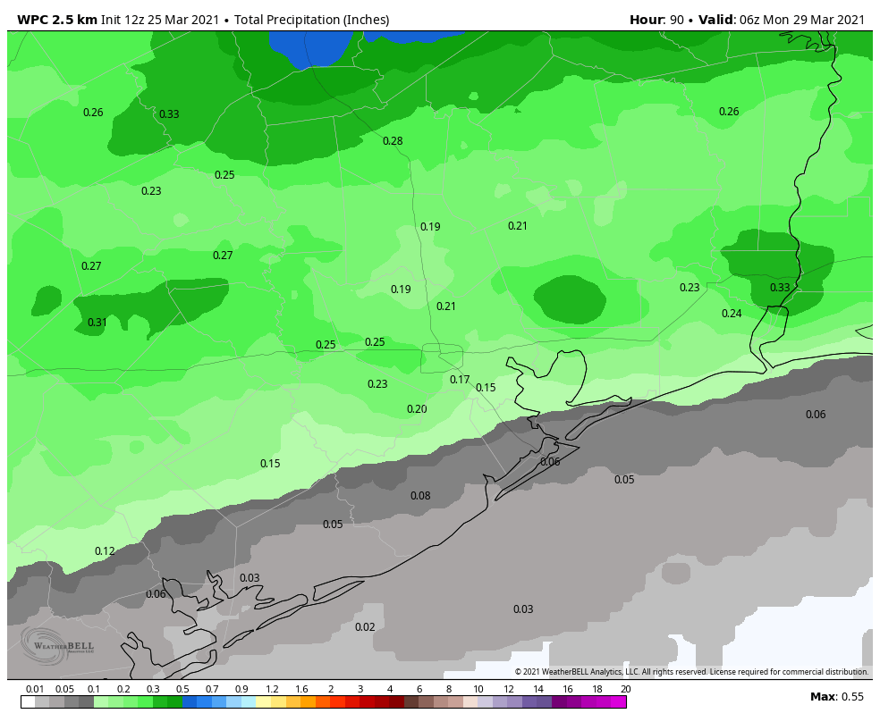
Sunday’s weather will depend on how far a cold front reaches into the Houston region. We’re still not sure whether it will make it to about Interstate 69, or all the way to the coast, and our sensible weather is difficult to predict as a result. I think we’ll see better rain chances on Sunday, with scattered to widespread showers, and accumulation so perhaps a tenth or two of an inch. Highs for most will be in the upper 70s. Probably.

Next week
The aforementioned front may finally shove off the coast on Monday, but we’re likely to see something of a warming trend through the middle of the week. It looks like a stronger front will push through during the middle of next week, and this may bring some lows in the 40s into Houston, although I have very little confidence in such details. Still, the second half of next week could see one of the last reasonably cold spells of this spring.
Any guesses yet on Easter weekend near the coast? Big family egg hunt riding on it!
Since the theme of today’s posting is “not much confidence” applying even to just 2-3 days from now, I’m betting that ‘guess’ would be a pretty good term to use with any forecast that far out…
Regarding next week’s cold front, bring it on! As Count Basie would say, “One more once!”
Old editor here…in the Sunday forecast “…and our sensible weather is difficult to predict…”? Maybe “seasonal”? I know. I know. But, I can’t help myself. Ha.
I wonder if in future y’all might include pollen info in the forecast? I would love to know, for example, when the oak pollen will be gone so I can enjoy this gorgeous weather in person and not from behind glass.
Next week is Holy Week, so it is traditional that there will be a cool snap, “the Easter Spell,” which is always the last cool weather of spring.
Y’all are the weather people for me. 👍🏽 How’s the app coming along? Timeline?
A glorious day in The Woodlands!