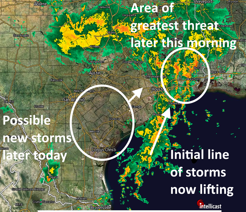
Storms this morning have generally dropped 1 to 2 inches across northern, eastern and southeastern parts of the Houston metro area. But the good news is that these storms have been fairly progressive, allowing them to move through instead of setting up shop and not really budging for hours.
In the next few hours we’re going to see deep tropical moisture moving into the upper Texas coast generally in an area between Houston and Beaumont, and on the radar you can see a long tail of moisture moving north-northeast. These areas definitely don’t need the rain, but they have not been hardest hit in recent weeks so they can probably handle an additional 2 to 4 inches as this system continues to move to the north-northeast.

Some areas of west Houston are now reporting some welcome sunshine, and I expect most of the metro area to gradually clear out over the next few hours (expect for east-northeast Houston) as the first round of storms lifts out of the region. However an unstable, moist airmass remains over much of Texas. Forecast models suggest another broad area of storms is likely to develop to the west-southwest of Houston later today, and possibly move into the metro area by late afternoon or early evening hours. My biggest concern is that these storms may move directly over the areas hardest hit by Brazos River flooding. In any case, this second system could bring locally heavy rainfall and we can’t be sure these storms will move as progressively as this morning’s rains have.
So if you’re rain free now, enjoy. Unfortunately it probably won’t last. We’ll continue updating as we know more.
Posted by Eric Berger at 10:50am CT on Thursday
Thanks for the updates. Please keep them coming.
Will they be more severe (these storms) than what we saw this morning, Eric?
Sorry just getting to this now. For areas that get them, yes, I think this afternoon’s storms are a little more severe in the Houston area.
Thank you for your frequent updates.