Unfortunately, as expected, we’ve seen some smaller but intense rain bands move into the Houston area this afternoon. This has prompted the National Weather Service to issue two flash flood warnings for central and northern segments of Houston, effective until 7pm CT. They are shown in blue boxes below.
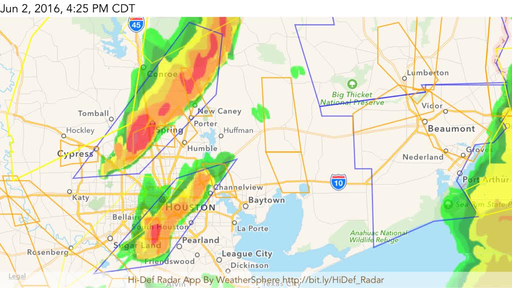
These storms have produced 1 to 2 inches of rainfall in the warned areas during the last hour or so, which has led to some street flooding. They are moving only slowly off to the northeast. I’d expect the threat of scattered, heavy rain showers to persist through the evening hours before (hopefully) we see a bit of a break late tonight and early Friday.
However the upper-level storm system isn’t really going anywhere, so we’ll continue to see the threat of very heavy rain on Friday, Friday night and into Saturday morning. Accordingly the National Weather Service has extended the flash flood watch for the entire metro area until 7pm CT. We’ll continue to track these storms.
Posted at 4:40pm CT on Thursday by Eric Berger
This is getting old. 🙁
We are all getting old … but the heavy rain especially.