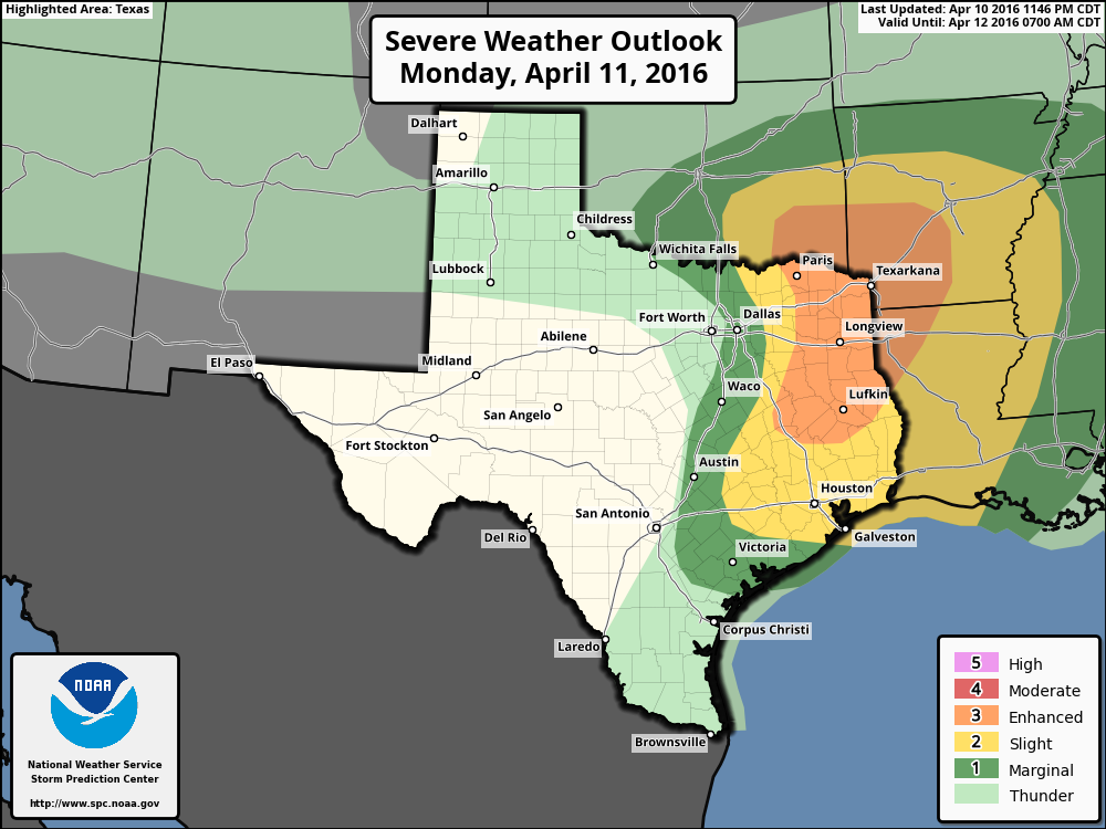
Good morning. A few areas have picked up some light rain this morning, but the forecast models that predicted reasonably heavy showers for the region this morning have largely busted. That does not give me great confidence in the forecast for the rest of the day.
TODAY
The big question is whether a capping inversion over the region will break, or not, today. As an atmospheric disturbance moves over Texas today this will create a fair amount of atmospheric stability such that, if the cap breaks we’ll probably see some significant showers and thunderstorms. According to NOAA’s Storm Prediction Center the primary threat will come from hail and wind damage, with a very slight chance of tornadoes. Right now any severe weather that does develop seems more likely to the north and east of Houston, rather than the south and west where the cap is weakest.
My best guess for rain totals today is less than one-half inch of rain south of Interstate 10, and the potential for one-half or more north. But after this morning’s bust my confidence is not high.

TUESDAY
We should see fairly benign weather on Tuesday in the wake of a cool weak cool front, with mostly cloudy skies and highs around 80 degrees. A slight chance of rain returns during the evening.
WEDNESDAY
There is the potential for heavy rain (1 to 2 inches for some parts of Houston) on Wednesday, especially for areas near the coast, but the timing remains uncertain. In one scenario a coastal low pressure system brings heavy rain beginning late Tuesday night through the morning hours on Wednesday. Yet it is also possible this heavy rain comes a little later in the day. This one may be a game time decision, but the atmospheric conditions should still favor widespread rain showers sometime on Wednesday.
THURSDAY and FRIDAY
High pressure should settle over the region and bring us considerably more calm and pleasant weather, with highs in the upper 70s, lows in the lower 60s, and mostly sunny days. Two days to definitely enjoy.
NEXT WEEKEND
Moisture begins returning from the Gulf by Friday or so, setting up the potential for at least some scattered showers next weekend and highs around 80 degrees.
If you’re riding in the MS-150 bike ride, we can’t rule out some rain. However I’m fairly confident in strong southerly to southeast winds. In other words, I’d be modestly confident in having a decent tailwind (10 to 20 mph) the whole way to Austin. Certainly the chances of any headwind are quite low.
Well, thank goodness for the tail wind. Should make riding while wet not as terrible!
On what day do you feel that you will have a good prediction for the weekend?
Eric, Thanks for the MS150 preview. Any thoughts on the wide range of different forecasts for the weekend? Weather.com says 80% with thunderstorms likely, accuweather says 50-60% with thunderstorms possible, NWS says 20-30% with slight chance of thunderstorms, and the GFS model shows next to nothing for rainfall. Any thoughts on which one is likely to actually be correct?
Yeah, i put those into a post this morning. I’m not optimistic about Sunday.