Good morning. It’s another muggy and warm morning across Houston, but change is definitely coming.
TODAY
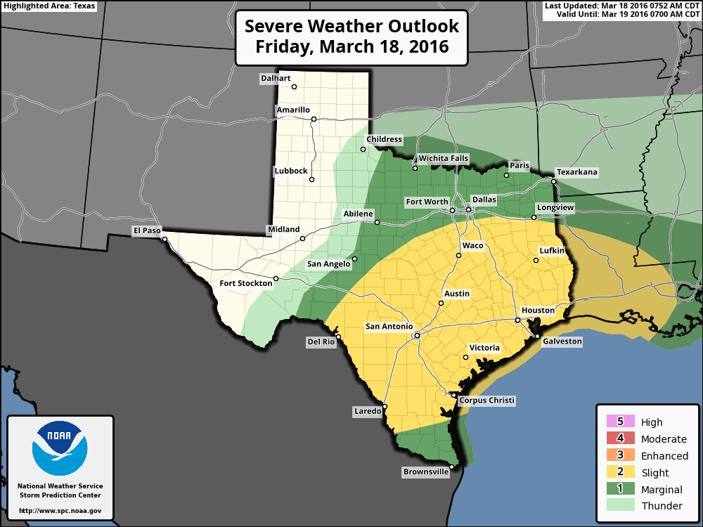
We’ll see slight rain chances through the early afternoon hours and temperatures rising to near 80 degrees. As a cold front approaches storms will be possible this evening and during the overnight hours. NOAA’s Storm Prediction Center has placed the region under a “slight” chance for severe weather. This means, in addition to thunderstorms, there’s the potential for strong winds and hail. Although most areas probably won’t see weather all that severe, it’s something to take into account for any plans tonight.

I still don’t expect exceptional amounts of rain, and I think most areas will see between 0.5 and 1.5 inches of rain between this afternoon and Saturday morning.
SATURDAY
The front itself should begin to move into Houston between about 9 p.m. Friday and 3 a.m. Saturday. As a result we feel some fairly strong northerly winds by Saturday morning, and rain chances should fall off during the morning hours. Highs on Saturday should remain in the mid-60s, with a bit of sunshine by the afternoon hours.
SUNDAY
We’ll start off cool, in the mid- to upper-40, and have a gorgeous, sunny day with highs in the mid-60s.
MONDAY
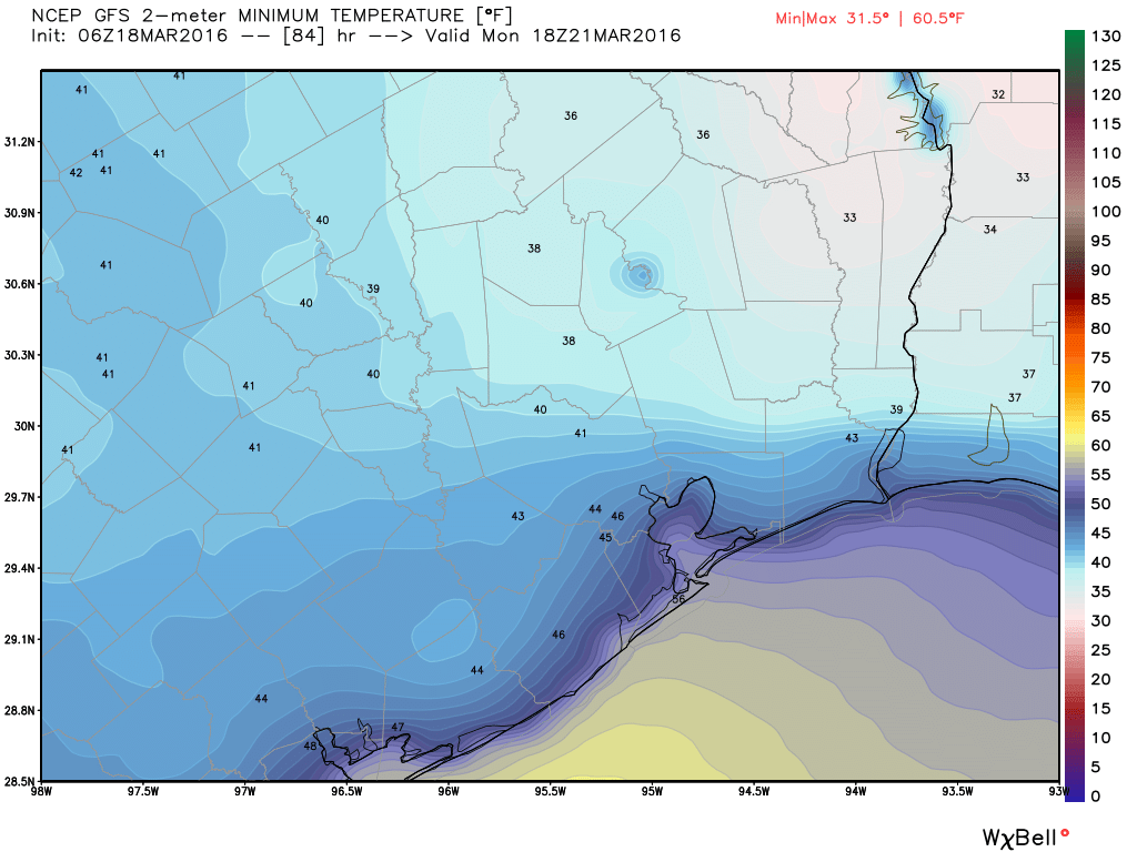
Are you ready for some cold weather? It’s not clear quite how cold we’ll get Monday morning, but it’s possible northern parts of the metro region could fall into the upper 30s, while the central part of Houston gets down to about 40 degrees.

This may be our coldest morning until November, although it won’t be our last cold front of the season. Highs Monday will warm to a pleasant upper 60s under sunny skies.
AFTER THAT
The middle of next week could see highs warm back into the upper 70s before another cold front by Friday or so.
Ready for some cold weather? YES, please!!! Just happy to have some cooler weather before the summer heat hits.
I’ll enjoy it and then start my countdown to November
People in Katy are getting nervous.