Hi all, just a quick update to say that this morning’s storms are winding down over the Houston metro area as anticipated. Although we still expect intermittent moderate to heavy rainfall throughout the early afternoon hours, the general trend toward less coverage and less intense rainfall rates should continue. Area roadways and bayous are generally handling this precipitation just fine. Even better: rain chances will fall back significantly this evening and through the weekend.
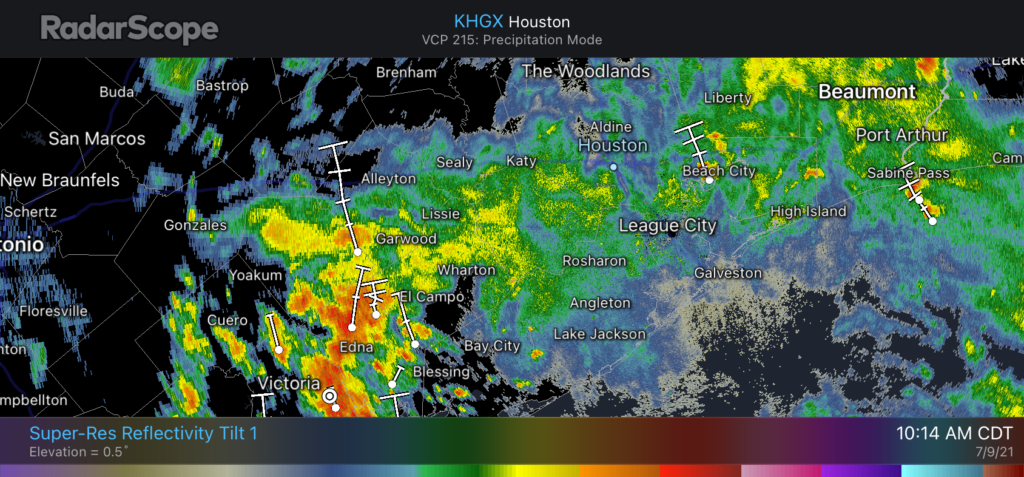
Unfortunately the same cannot be said right now for the Coastal Bend area, from Rockport to Matagorda Bay, where heavy rains are continuing this morning and may do so for the next several hours. But that area, too, should finally see a reprieve later this afternoon and evening as a low pressure system in South Texas continues to move away from the region.
Have a great weekend, everyone, and enjoy the sunshine when it returns.
Thank you, we like your weather report gives us Insight as to what is going on with the weather!
For sure! Enjoy this short period between gloomy rain and arrival of Saharan Dust!
Wow!! This morning was chilly for a Houston summer!! It was a mere 75 when I woke up at 11 am!!! The low this morning was 69 after the heavy rain came through the woodlands!! Not only did I not need my A C for a week but I actually had to sleep with a blanket last night!!
I’m loving this summer!! The rain, the humidity, the mildness is all super nice!! I wouldn’t mind a continuation of this pattern with a few hotter mid-upper 90s thrown in as well!!