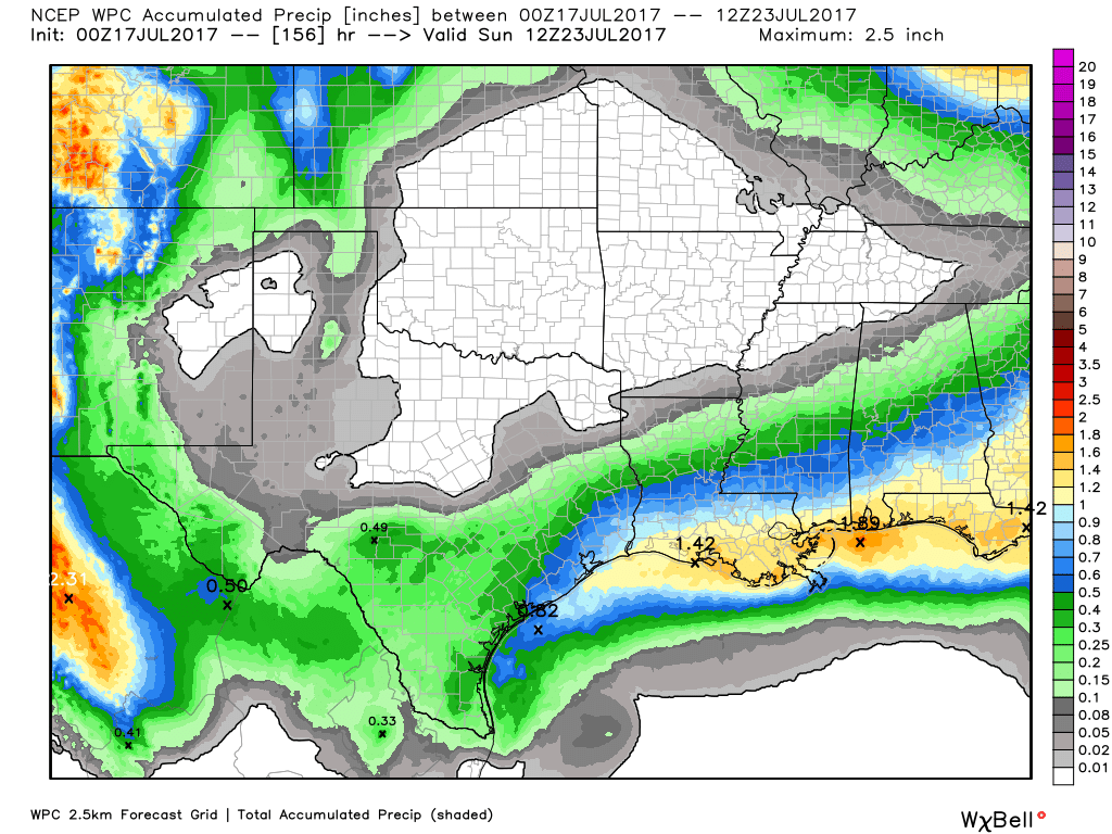
Mother Nature spared much of the Houston metro area rainfall on Sunday, however with a very moist atmosphere in place we can expect a chance of episodic heavy rainfall for at least the first half of the coming week. This is what happens in July in Houston when there is no high pressure or capping inversion to inhibit tropical rain showers.
Monday, Tuesday and Wednesday
Moisture levels are quite high in the atmosphere, with precipitable water values at 2.0 to 2.2 inches across the region. This means that if you measured the volume of water between the surface and outer space of a certain column of atmosphere, it would have a depth of around 2 inches. This is a lot, and tends to produce rainfall when there are no factors to stop it. For the start of this week there aren’t any—and in fact the upper-level atmosphere favors the development of some storms.

So what does this mean? We’re going to continue to see some potentially stormy days. Last week we talked about how some areas will see mostly sunny skies, some areas mostly gray skies, and some areas will get slow-moving tropical showers. That pattern will continue through Tuesday or Wednesday of this week, with some areas getting 2 to 3 inches of rain in a couple of hours, and others none. Rain chances are likely to be higher (around 50 percent) closer to the coast during the morning, and then the best chances will migrate inland during the afternoon and evening hours. Heavy rains and lightning are the primary threats. The upside of potentially stormy days is that they should limit highs to around 90 degrees.
Thursday and Friday
By the second half of the week precipitable water levels are forecast to fall back below 2.0 inches, which should moderate the potential for very heavy rains. Also, high pressure should build in from the north. This will push rain chances down a bit, and probably drive high temperatures into the low- to mid-90s.
Saturday and Sunday
Rain chances should fall back to summertime norms by the weekend, as Houston lies on the periphery of high pressure, and some showers could form along the sea breeze during the afternoon hours. However, the primary concern is likely to be heat—with searing July highs in the mid- to upper-90s possible.
Posted at 7:20am CT on Monday by Eric
“This means that if you measured the volume of water between the surface and outer space of a certain column of atmosphere, it would have a depth of around 2 inches”
So how large is this “certain column” of atmosphere. I assume something like a column that has a cross-section of a single square inch or something? Just trying to get a feel for the precipitable water value. If the “specific column” is an inch in diameter or several feet… makes a big difference.
Two inches deep, so the column could be a single square inch or a single square mile or whatever.