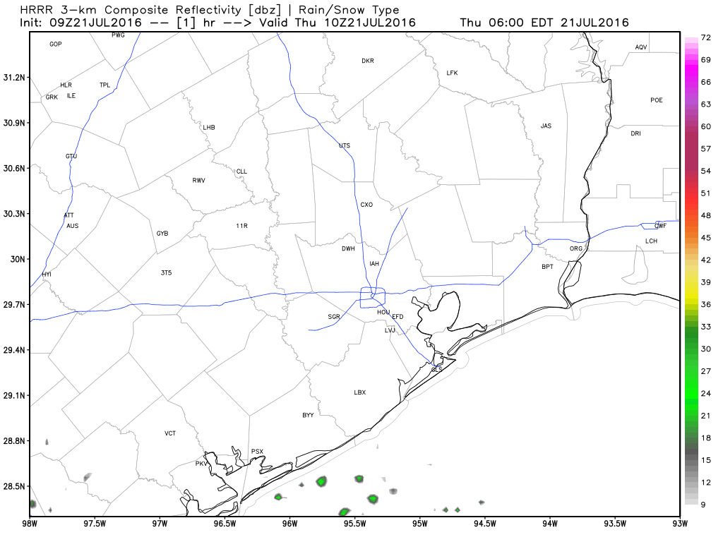
We had a few showers again on Wednesday, but nothing too exciting by Southeast Texas standards. We may do it once again today, but heat will be the main story.
In case you missed it, Braniff Davis was back with another “Weather Whys” post last evening, discussing the sea breeze and the Gulf of Mexico and how they influence our weather. Check it out here.
TODAY AND FRIDAY
No big changes in the weather for the next couple days. I still expect it to be hot and humid both days, and I still anticipate we will see at least a couple showers blossom on radar each day. Exactly where they go and how widespread they’ll be is up for debate. A weak disturbance rotating around the Plains heat dome will probably set off more organized, but scattered storms in western Louisiana today. I doubt these make it to Houston, but if you live east of the city (particularly, if you live closer to Beaumont/Port Arthur), you may get a downpour later this afternoon. We may try and repeat this on Friday with another disturbance, perhaps getting a bit closer to Houston. High temperatures should again aim for the mid to upper 90s both days (hottest inland, cooler at the coast).
WEEKEND AND BEYOND
The only change to the weekend forecast, and the forecast beyond for that matter, would be an increase in daytime thunderstorms versus what it’s looked like coming into this heat event. Originally, I was wondering if we would go Wednesday through Monday without a drop of rain. Now, it looks like we will need to keep the mention of showers in on both Saturday and Sunday. I don’t expect anything widespread, but at least we will be able to get a few showers and storms in the area each afternoon, continuing into the first half of next week.
Temperatures will hurt still (mid 90s, maybe upper 90s on a couple days). And humidity will remain high. So regardless of rain risk, hot weather continues.
STATS
If the month ended yesterday, 2016 would still rank as Houston’s hottest July on record (though the lead over 1980 and 2009 has shrunk a bit since last week). I’m guessing the next few days will help maintain that lead.
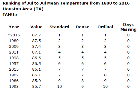
It will end up being a close call for #1, but Houston is virtually assured a top 5-10 hottest July on record, barring anything crazy next week. For those curious about other Texas cities, we aren’t alone. Austin, San Antonio, Beaumont/Port Arthur, and Corpus Christi are all having one of their hottest July months since records began. Dallas may be the biggest exception in Texas, having yet to lodge a 100 degree day (their first 100 typically occurs by June 30).
Posted at 6:25 AM by Matt
That’s pretty close to what my air conditioner thermostat displayed this morning!