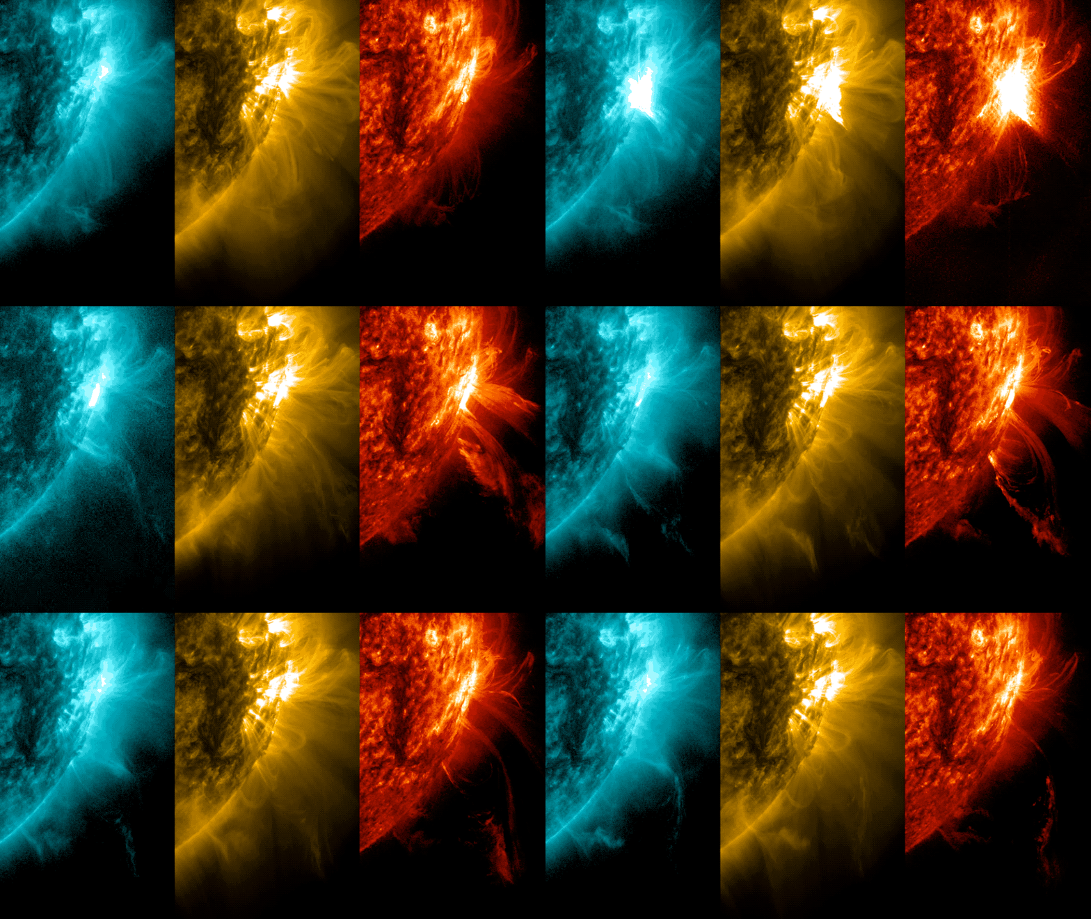
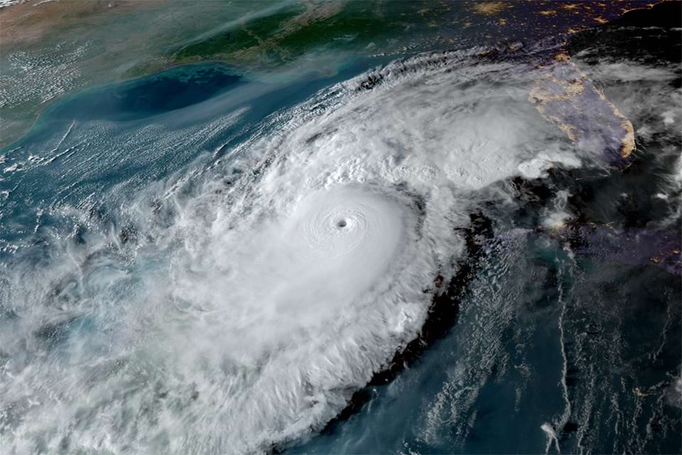
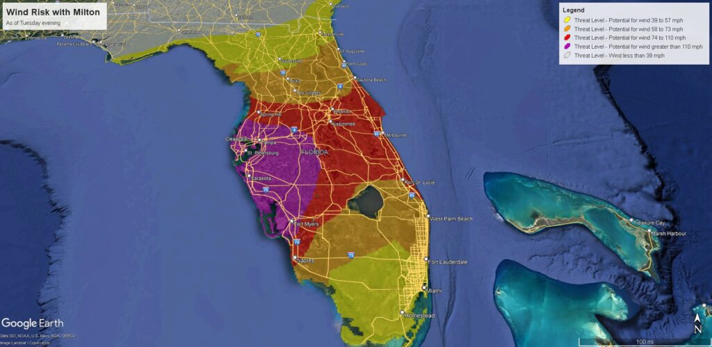
We’re cutting it so close to the end of the month that it’s … scary! 👻 But here’s October’s SCW Q&A post, just in the nick of time! As usual, Eric and Matt address a wide variety of topics from the solar flares and the damage they do; to the damage a Hurricane Milton-type storm might do locally; to classic weather maps with front lines … and more!
Got a question for next month’s entry? Drop it in the comments below, in the Contact link above, or on social media at […takes long breath…] Facebook, X, Threads, Instagram, Mastadon or Bluesky.
Q. Whenever there’s a solar flare big enough to push the Northern Lights as far south as Texas, I always read that they can also disrupt communications and even affect power lines. But I have never seen reports of that actually happening. Are there any instances of flares disrupting these things?
A. I recently wrote about solar storms for Ars Technica, so I’m familiar with the issue. Just to recap: solar storms are triggered when the Sun ejects a significant amount of its magnetic field and plasma into the solar wind. When these coronal mass ejections reach Earth’s magnetic field, they change it and can introduce significant currents into electricity lines and transformers, leading to damage or outages.

The solar storms we’ve been seeing of late, earlier this month and back in May, were very strong, rated G5 or ‘extreme’ on the most commonly used scale. There have been some modest effects, such as on satellites. But by and large, our planet’s strong magnetic field has shielded us from the worst. The sobering thing to think about is that these recent storms, although strong, are far from the strongest storms imaginable. The most intense geomagnetic storm on record occurred in 1859, during the so-called Carrington Event. If such an event were to happen today, it likely would be rather damaging to our power and telecommunications systems. But just how damaging? We really don’t know for sure.
– Eric
Q. After seeing Hurricanes Beryl, Helene and Milton and seeing all the damage, what would have happened if we had been hit by Helene or Milton? I live on the border of Bellaire and Houston and love living here. I am seriously considering moving.

A. What would happen? Bad things. It really depends on where a storm makes landfall, but for the purposes of this question let’s say the storm makes landfall at San Luis Pass (the southern end of Galveston Island), perpendicular to the coast. We’ll focus on Helene, since it was stronger at landfall (140 mph sustained winds). This is what I consider to be a realistic worst-case scenario for the Houston region as it puts a significant storm surge into Galveston Island and Galveston Bay, potentially also pushing a large surge into the extensive chemical facilities along the Houston Ship Channel. This is an environmental disaster waiting to happen.
Worse, however, would be the winds. Such a track and landfall intensity would put a majority of the greater Houston area under Category 1 to 2 winds (approximately 40 mph higher than experienced during Beryl). This would likely knock out electricity not for days, or weeks, but rather months for some people. Damage to roofs and structures would be catastrophic, likely exceeding $200 billion. The long-term consequences of the power outages, future insurance costs, and damage would likely forever alter our community. Sorry for going so negative, but a powerful Category 4 hurricane striking Galveston Island and moving into Houston is exactly the kind of storm that keeps me up at night. I very much hope to never live to see it.
– Eric
Q: I have been astounded by the sheer volume of, for lack of a better term, hurricane denial following Hurricane Milton. Aside from the weather control/manipulation “preposteria,” there has been a great deal of discussion of Milton being a lesser storm at landfall (Cat 1 or tropical storm) than the 120-mph Cat 3 figure given by the National Hurricane Center. The basis for this claim is focused upon observed sustained wind values on land as the storm moved inland. With a storm like Milton, what are reasonable expectations of observed wind speeds given the 120mph max sustained values at landfall? How does the interaction with land affect observations? How do observed values in other storms correlate with NHC figures?
A: This is a great question, and it’s a great opportunity for education. In terms of “weather manipulation,” we’ve already addressed how this is simply not possible to do with a hurricane. So I won’t dwell on that. But there is a huge, huge misconception on hurricanes and wind speed.
Land affects wind speed. Because there’s so much “stuff” on land (trees, buildings, rocks, dirt, etc.) there is friction to slow the wind down. Compare running your hand over the surface of a bathtub to a surface of sidewalk concrete. There’s a difference there. Wind will slow down significantly over land than water. So when you have hurricane hunters measuring the intensity of a storm over water, they’re getting what is basically a “true” capture of what’s happening because the surface winds are dramatically less impeded by friction when they’re over the ocean surface. But every hurricane will have lower wind than that on land. With every storm, we have people, even meteorologists complaining that no one observed wind on land at the levels the NHC said the storm was at. Scientifically, that’s what is supposed to happen! It’s not always easy to explain to people though. Some even say it’s “their” way of hyping up a storm.
Every so often a storm will be able to mix down stronger winds over land, something that is dependent on a number of things. We probably saw this with Beryl here in Houston where we had 80 mph wind gusts make it well inland. That doesn’t mean that Beryl was a category 2 storm at landfall (that will be assessed in the postseason), but it was a case where the measured intensity of the storm over water matched what was observed over land as well.

There’s a broader point to be made here that would qualify the Saffir-Simpson scale for hurricanes as an antiquated way of measuring a storm’s true intensity and power. But the simpler point here is that measuring wind is hard, and the system we have now is what it is. So now you know: Friction is usually your friend.
–Matt
Q: Does the surface temperature over land have any effect on how quickly a hurricane/tropical storm abates? Nighttime temperatures fell to the mid-40’s in Asheville, NC. If it had been that cold on September 26-27, would the storm damage have been less severe to any significant extent?
A: Simply put, the answer is that it has little impact. If a hurricane is coming, the circulation ahead of it will almost always usher in warm, humid air concurrent with the heavy rain and stronger winds. In this case, Helene approached from the south and tracked just southwest of Asheville. Because of this, winds were out of the southeast ahead of the storm, which tapped into much warmer and humid air. Had Helene tracked 250 miles east of where it did, winds in Asheville would have been out of the north and it would have been much cooler and less humid. Basically, the track of the hurricane helps dictate the temperature, but the intensity of the hurricane is unlikely to be impacted in any way by the actual land temperature.
Now, land can impact a hurricane via the brown ocean effect. Essentially that’s when the ground is either so saturated ahead of a storm or so much rain falls in front of the hurricane that it acts more like a shallow body of water than land. It also needs to be warm. In that case, a tropical storm’s intensity can ebb more slowly or in some cases it can even maintain intensity. It’s unlikely that happened during Helene, but we have seen that in other storms before. This was most notable during 2007’s Tropical Storm Erin in Oklahoma and north Texas.
–Matt
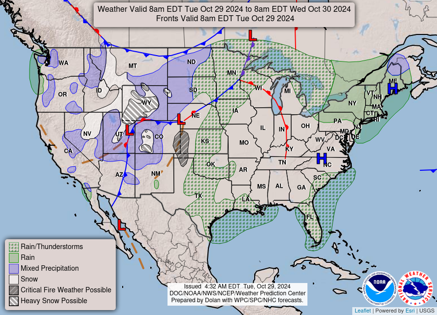
Q. Love your reporting. Just curious, is there a map that shows where fronts are on the map and their path? I see it on tv weather all the time and with all the talk about fronts pushing through, I was just curious the best way to see those fronts on a map.

A. The best such map available online comes courtesy of the National Weather Service, and it is updated daily during the pre-dawn hours. Here’s a direct link to the national map, and here’s the overview page. Note that if you click on the “animated forecast maps” link from this second page you can see a seven-day forecast that includes fronts. Enjoy!
–Eric
Another point regarding observed wind is that ASOS/AWOS stations typically start going out when gusts start getting up near 100mph. I consistently see this when hurricanes make landfall, and the Venice, FL site (KVNC), which was the closest observation site on the dirty side of the storm failed after gusts hit 102mph. Quite uncommon to get observations much stronger than that from an official site.
I’m still trying to convince people that Beryl was just a cat 1 when it hit us. The max gusts reported in Beryl was 92 mph at Sargent. That is very bad, but it was still 4 mph away from the minimum sustained winds of a cat 2. Beryl’s impact was pretty bad for us, but it would have been a lot worse if it had strengthened into a cat 2 or god forbid a 3.
I’ve said this before, but alot of people don’t understand how bad just a cat 1 can be when you are hit directly by them especially when all people ever hear about are the worst cat 4 and 5s. That is why I always say that if it is called a hurricane, it’s bad news regardless of strength.
And I believe the tree damage people keep bringing up is most likely because we had between 6 to 8 inches of rain in just a few hours all over the region. That softened the grown alot making it easier for big trees to topple over. Our trees have also been weakened by the constant whiplash they have taken from the frequent extreme weather we have dealt with over the past few years. I don’t state that as fact, but it is a theory of mine.
Wind of even Cat 3 won’t collapse a house and kill people. That leaves property damage (roof tiles gone and partial collapse) and misery of weeks without power. Just saying, modern construction protects our lives mostly, so even Cat 3 hitting Houston if evacuate Galveston will be under 100 dead (or if G not evaced 1000 dead), and other 5 million survive. 99.999% survival is a blessing. I could be wrong.
Always love your reports via email, X, and other social media outlets.!! I have a question that I’m sure in this day and age is on a lot of people’s mind. “Weather Sensationalism” seems to be loud and proud on just about every local and national station. It’s almost as bad as regular journalism. Back story about me: prior to me going to culinary school, I was an inch away from enrolling into the Meteorology department at Cornell(grades weren’t high enough). Weather has always been in my DNA .. I was raised here in Houston, but got the hell out and moved to NY in my early years. I can remember the local meteorologist(Sam Champion-aka “Ken Doll”)in the city always going over the top with regards to weather system forecasting. Many times, the storms never came to fruition, but meanwhile, people would plan accordingly. With all of the billions spent on satellites and more modern mapping(alliteration unentended!) technology, one would think forecasting weather would be just a little more accurate than say, back when Velcro clouds, suns, and rain stickers were the only option. Look, my query isn’t meant to bash on you amazing people. It’s just that, like with news headlines, many meteorologists tend to do the same thing with regards to the unnecessary sensationalism. Houston peeps included. If things in a weather system are unknown, why not just say that? I mean, you are super honest with your forecasting and many of us truly appreciate that.
Thanks so much for your time!!
Best,
Chef Craigers..
I just want to express my appreciation for the efforts you both make. I think it is pretty unusual and special. Everybody cares about this stuff and you make it as clear as possible. Science is our friend if we can just get over the paranoia we have created with our new awesome communication tools. Your site is a welcome antidote to some of this, so thanks.
Don’t want to get political here, but given where we are with election season could you touch on how a proposed change to the NOAA in Project 2025 would affect you and the team at Space City Weather?
Not sure about them. But cutting NOAA flights in the EPAC will terminate. Mexico will be on its own. Even leeward and windward islands in Caribbean might get cut off. So Puerto Rico and Virgin Islands will be on their own.
It looked to me like the Gulf of Mexico and the waters south east of there were very warm in the time period of the two hurricanes that hit Florida. Was that a major factor in their continuing strength?
Lack of wind shear and Saharan dust.
Me too, and the only thing I can do about it is move 200 miles inland, which we should probably at least think about doing.
Are there any recommended budget weather instruments that can go in my room?
Thank you. Thank you. This is excellent information. I used to share blogs with Frank Billingsley before he retired that were very helpful and informative. Keep it up 👍
Ahhhh, hurricanes are not for the faint of heart. I grew in Oak Forest in Houston where we did not today’s technology. All we could do was track on a map that the newspapers passed out every year. But now I live in Brazoria County. I have never evacuated from a hurricane, but I’m sure it will eventually happen. The house that I grew up in had a 70 plus year pine tree that fell on the carport during Beryl. I was shocked, but it was on channel 13. Where I live now, we got flooded during Harvey, but FEMA paid out so we could rebuild our home. During Ike, we were in the eye wall and it ripped off the roof of our garage, but the former owner had put on that roof and it was not done properly. The one we put on was windstorm certified.
It seems building code and materials got better around 2000, so new stuff under 25 years which is about 1/4 of buildings will be fine in wind of hurricane. So an old house in Katy is at risk of tilting of wall a bit, or losing roof tiles, but new 2020 house not at risk. Only water surge will 100% totally knock down a house?.. Should people who worry be told hey don’t buy it keep an old house if there’s a alternative??
The weather is only going to keep getting worse. I can’t imagine making this city my forever home. It was always a temporary situation and I’m so glad I am being transferred back north after the holidays. The unbearable heat, hurricanes, outages, failing grid, crime, poor air quality, rising property taxes, and insane insurance rates are not for me. The nightmare is almost over. I can’t stand this place.