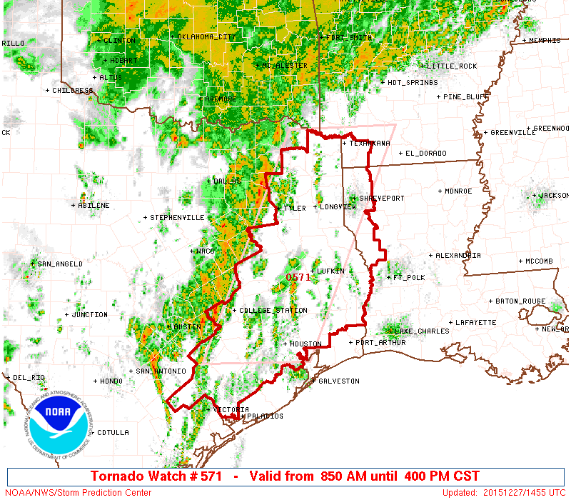
The National Weather Service has gone ahead and posted a Tornado Watch for most of Metro Houston until 4 PM. It includes the City of Houston and points north and west. The watch does *not* include Matagorda, Brazoria, Galveston, or Chambers Counties. Everyone else, however, is under the watch. A Tornado Watch means that the atmospheric conditions are favorable for severe thunderstorms that could produce tornadoes over the next several hours. The best chance of tornadic storms will be north of I-10, but I would advise that if you live in Houston, keep an eye on the weather.

Showers and thunderstorms have been impacting the area mostly west of I-45 and north of I-10 all morning. Thus far, everything has behaved nicely. That may begin to change as the cold front edges closer and we turn warmer and more unstable.
Obviously, with the tragic tornado event in the Dallas area last night, many folks will be a little extra on edge today. While the setup here in Southeast Texas is not as robust as it was in Dallas yesterday, it is still quite conducive for strong to severe thunderstorms and definitely the possibility of a few tornadoes. Whether you’re under the watch or not, you’ll want to have a method to receive weather warnings today and if a Tornado Warning is posted for your location, have a designated place to shelter in. No reason to panic, but certainly best to be prepared. We’ll be monitoring things throughout the day.
Keep up the good work, Eric and Matt. We really rely on your your forecasts and information. Thank you for helping to keep us safe.
Please sign Dr Edwards up for your daily weather notices and alerts. I have been forwarding mine to him an he likes the detail of your posts.
Thanx
Michael Fife ( Creighton’s wife)
Just input his e-mail into the box on the right-hand side of the site.