Good morning. A “cool” front has essentially stalled across the metro area, and this will lead to partly sunny conditions today and Monday, with about a 50 percent chance to rain to go along with temperatures in the low- to mid-90s. Some rains today could briefly pulse up into strong thunderstorms, so be weather aware if you are outdoors.
The main purpose of this post, however, is to discuss the tropics and impacts to the Gulf of Mexico. We have had lots of questions over the last day because a single model run of the GFS on Saturday appeared to bring “Hurricane Grace” toward Texas late this week. We cannot emphasize this enough: a single model run, especially an outlier, should always be looked up with a high amount of skepticism. Anyway, herein is what we know as of Sunday morning about Fred and Grace.

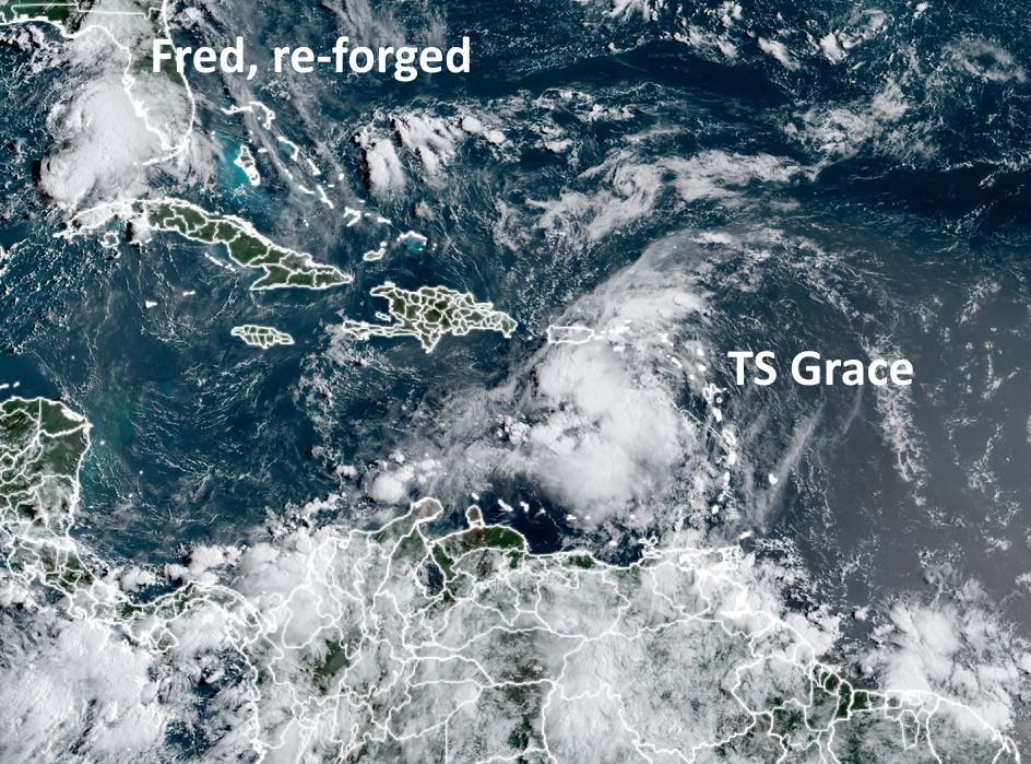
Tropical Storm Fred
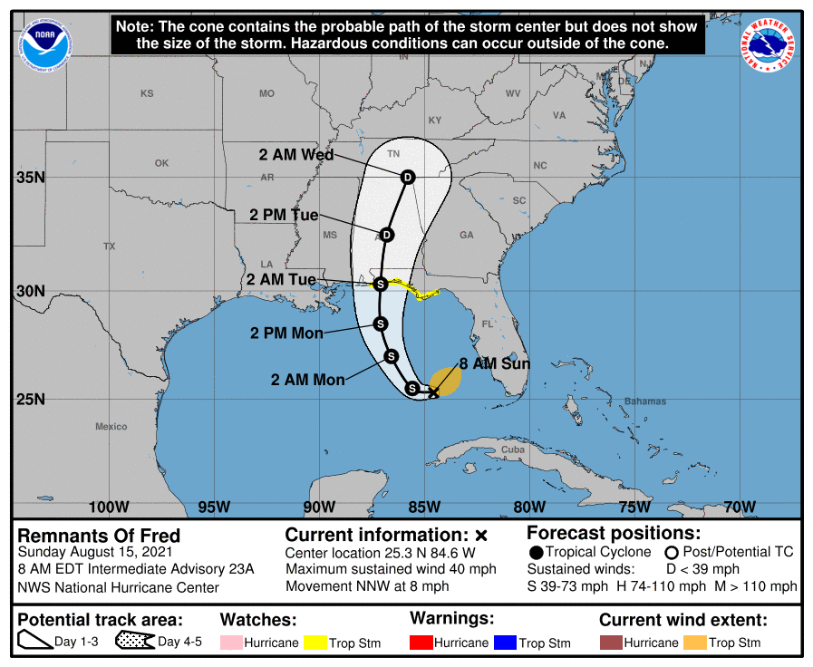
Fred has re-formed in the southeastern Gulf of Mexico, and confidence is fairly high that it will get pulled north later today, and head toward Alabama and the Florida Panhandle. Fred could become a strong tropical storm before landfall, so there may be some wind impacts in the Panhandle to go along with several inches of rainfall. By Tuesday afternoon it should be moving well inland and weakening quickly.

Tropical Storm Grace
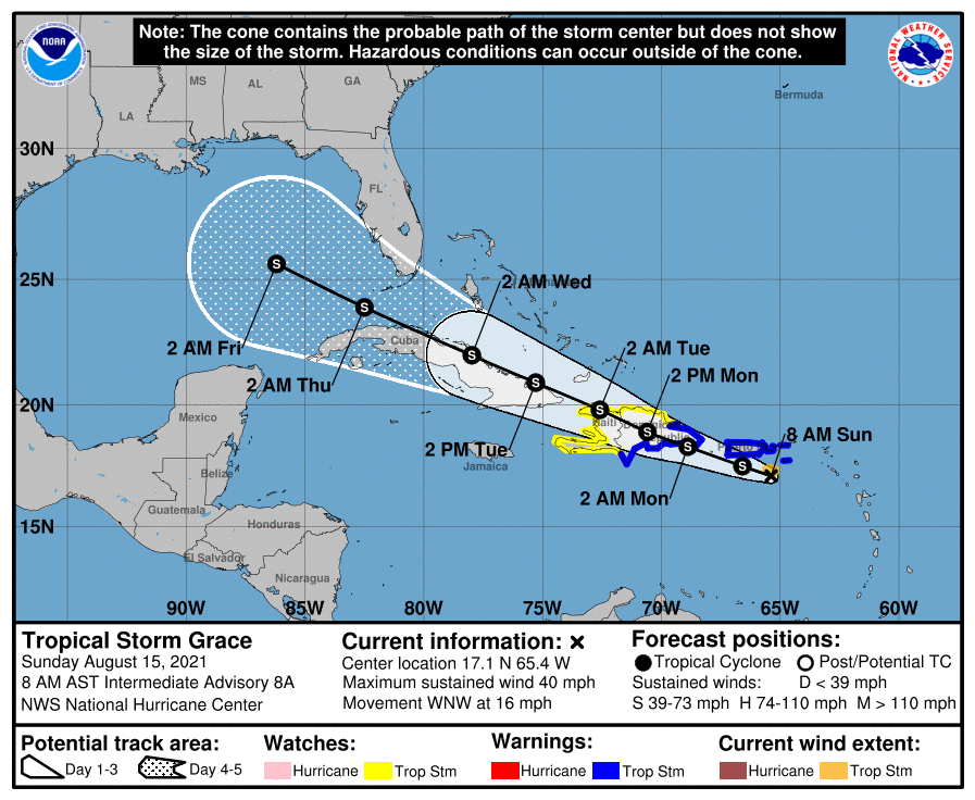
For our purposes, Grace is the storm of more interest, although the forecast is highly uncertain. As of 8am CT on Sunday morning, Grace is rather disorganized and barely a tropical storm. Its center is south of Puerto Rico and likely to move onshore Hispaniola (which is two countries, the Dominican Republic and Haiti) during the next 24 hours. After a devastating earthquake on Saturday the last thing Haiti needs is a tropical storm, but that is nonetheless what is coming on Monday.

The first real question is whether Grace survives its interactions with Hispaniola and Cuba from Monday through Wednesday. I think there is probably at least a 50 percent chance the tropical system gets shredded by the terrain of these two large Caribbean islands.
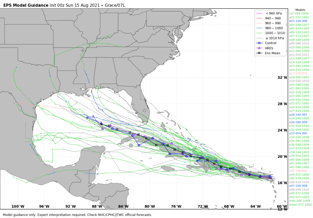
However, if some low-pressure center emerges into the Gulf of Mexico around Wednesday, what happens then? The environment in the Gulf of Mexico, in terms of dry air and shear, will be OK but not ideal for intensification. I would put the chance of Grace ultimately becoming a hurricane in the Gulf of Mexico at about 10 to 20 percent. That is a rough estimate based upon ensemble forecasts, and is only to help you calibrate your own expectations right now.
In terms of track, Grace is really hard to pin down because a) its center is ill defined, b) this center will likely to jump around as it interacts with land and/or re-forms in a new location, and c) where it would ultimately make landfall in the Gulf of Mexico is a forecast still 6 to 8 days from now. However, should a center survive interactions with the Caribbean Islands and emerge into the Gulf next week, I expect it would move more generally westerly, toward Texas or Mexico, with impacts perhaps next weekend.

However I can’t stress enough the uncertainty with all of this, and that there will probably be some wild swings in model forecasts in the coming days.
The bottom line is that we’re in the middle of August, and this is a time of year when we are always watching the tropics keenly. Any time there is the possibility of a low-pressure center entering the Gulf of Mexico during August we need to monitor it. And we will. But for now the overall chance that Grace becomes a serious and direct threat to Texas remains fairly low.
We’ll have a full update on Houston’s weather and the tropics on Monday morning.
Thanks Eric…appreciate this short update…helps me position this “worry bead” in today’s chain of stuff…
Thanks Matt. I’ll channel my worry energy into more productive activity.
If only the G name were “Ginger!”
Thank you for the update.
Thank you!!
Thank you for your diligence and the updates!
Eric, do you know why Grace didn’t strengthen over the past day like it was forecast to? It was just downgraded to a depression, before it even reached Hispaniola. It isn’t very lopsided; it doesn’t appear to be getting dry air in it or battling much wind shear. What is keeping it so weak?
Only Cat 4, and one of the few models that make it a hurricane.
Mid-August to late September…… every year……….God how I love living here……..