Houston officially only hit 84° yesterday, several degrees shy of our average of 90° this time of year. Clouds and showers certainly helped. What does our weekend have in store?
Friday & Saturday
It’s very difficult to have a day in summer in Southeast Texas where you don’t have a chance of showers or hit and miss thunderstorms. That means we have to find ways to express which days have better chances than others. If yesterday was a five out of ten, today and tomorrow should be about a three or four out of ten. One of the key reasons is precipitable water (PWAT), a basic gauge of how much moisture is available in the atmosphere. Our PWAT value yesterday morning was around 1.8″ (or higher). Both today and tomorrow it should be more like 1.6-1.7″.
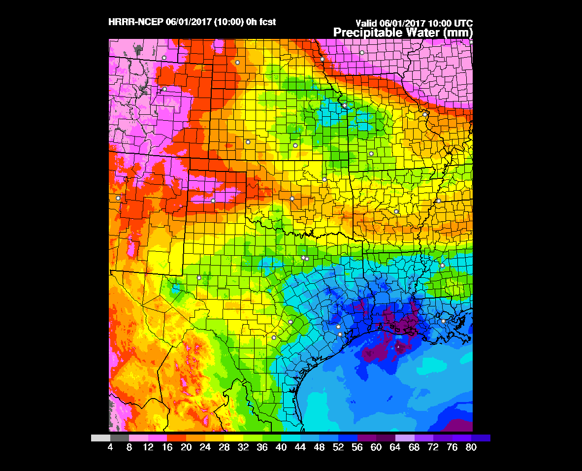
This means we’ll almost certainly have scattered downpours around, but by no means should either day be a total washout. Have an umbrella handy and just be ready to scoot to shelter if you’ve got outdoor plans. Lightning will definitely be possible in the storms, as it almost always is during summer. Storms may also have heavy rain. There was some very localized street flooding in the Sugar Land area yesterday, and it’s conceivable that a handful of places may see a similar situation today or tomorrow.
Sunday through Tuesday
Atmospheric moisture increases as a couple disturbances approach later Sunday. Those PWATs I mentioned above increase to around 1.8-1.9″ on Sunday, and 2″ or higher Monday and Tuesday. This will mean an increasing chance of showers and storms through that period. I do think the chances will peak Monday, ahead of a Tuesday cold front (! Yes, an actual cold front in June, albeit a weak one) that should make a clean cut through Southeast Texas by Wednesday.
As of now, the remnants of Eastern Pacific Tropical Storm Beatriz, which formed yesterday off the southern Mexico coast will likely stay out of impacting our rain chances, but we’ll continue to watch.
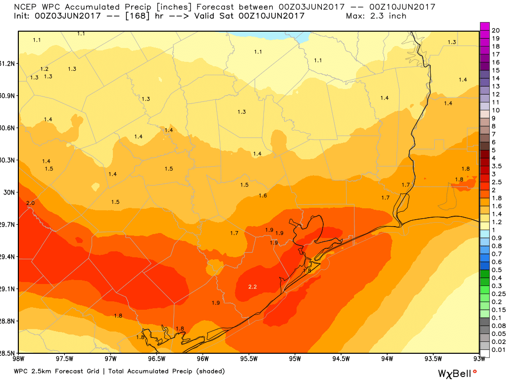
Bottom line: Sunday through Tuesday will see increasing chances of afternoon downpours or storms, likely peaking on Monday. Rain totals will be widely variable, with some places seeing a half inch or so, and others possibly picking up 3-4″ or more, probably most likely near the coast. Temperatures will peak in the mid to upper 80s (perhaps cooler Monday or Tuesday). Morning lows will bottom out in the low 70s.
Wednesday through Friday
Behind the cold front on Wednesday, we’ll see falling humidity. In fact, it might be reasonably comfortable by Wednesday evening. Even more thrilling to discuss is the fact that we might actually see lows in the 60s Thursday morning! Fingers crossed, but the way things have gone the last six weeks or so, it seems very plausible.
Outside of the potential for AM 60s next Thursday or even Friday mornings, it will likely turn mostly sunny and pleasant for June in Houston, with highs in the upper 80s to near 90° each afternoon Thursday and Friday. Rain chances will be as close to zero as they can be for this time of year.
Posted at 6:40 AM Friday by Matt
Hey Matt, I know it’s kind of early but we are flying out of Hobby on Wednesday morning at around 5am. Will the front be though by then you think?
Most likely, yes. Even if it’s not, I doubt you’d have anything too serious or problematic!
At Hwy 6 & Westheimer, 2″ of rain, traffic lights knocked, street flooding on Briar Forest, traffic snarled. Forecast exceeded.
Hey Matt, any chance Post-Tropical Cyclone Beatriz, apparently crossing through Mexico may reform in the Gulf? Thanks
No, that is very unlikely.