Summary: After a warm weekend, winter has blown back into Houston overnight. We’ll be sunny and colder for a few days before a warming trend begins Wednesday. Showers and thunderstorms are likely on Friday and Friday night ahead of another front that should bring drier and cooler weather next weekend.
Monday
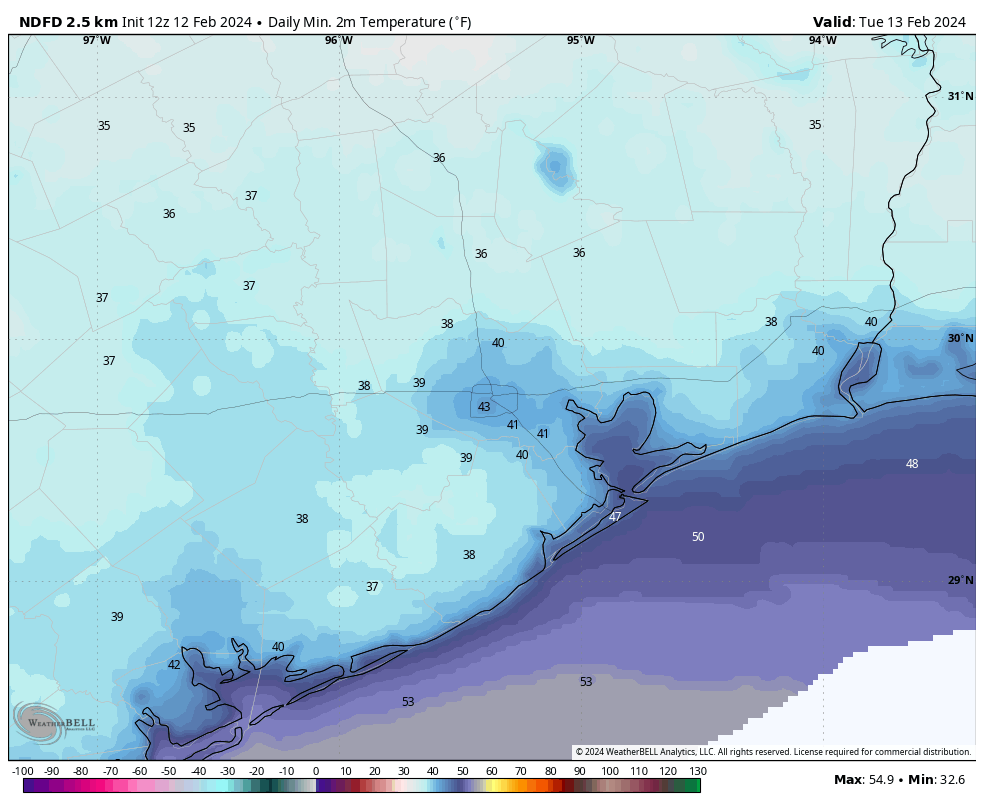
You’ll want a jacket this morning, with temperatures in the 40s across the metro area, and winds gusting up to 30 mph. Winds will remain gusty this morning, but should start to ease up later this afternoon and this evening. Skies will be sunny today, but with the influx of colder air highs will likely remain capped in the 50s. Tonight will bring the coldest temperatures of the week, with lows in the 30s for inland parts of the region, and 40s closer to the coast. With clear skies and light winds we’ll see ideal conditions for cooling.
Tuesday
After a chilly start, this will be a fine day with sunny skies, light winds, and temperatures in the mid-60s. Temperatures on Tuesday night will be a few degrees warmer, and as winds shift to come from the southeast, we’ll see the beginnings of an onshore flow overnight.
Wednesday
This will be another pleasant day, with temperatures in the mid- to upper 60s. I think skies will bring a mix of clouds and sunshine, with the likelihood of mostly cloudy skies by Wednesday evening. With a light southerly flow expect lows on Wednesday night to drop only into the 50s.
Thursday
Temperatures will push into the low 70s on Thursday, with mostly cloudy skies. It looks like rain chances will hold off until the overnight hours, at the earliest.
Friday
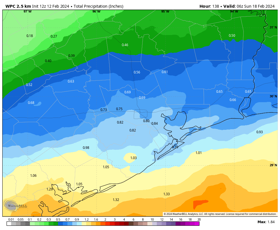
This should be the most dynamic weather day of the week. The combination of an increasingly moist atmosphere, low pressure over the Gulf, and an advancing front will pump up rain chances. In terms of accumulations, I expect most of the area to pick up between 0.5 and 1 inch of rain starting early Friday and running into Saturday morning. The closer to the coast you live live, the greater accumulations are likely to be. Highs, otherwise, will be in the upper 60s on Friday.
Saturday and Sunday
The aforementioned front will push into Houston during the overnight hours, and likely be off the coast by around sunrise on Saturday or shortly thereafter. Rain showers should end during the morning hours but clouds will linger. So expect a cool day, with highs perhaps around 60 degrees. Saturday night will be cold, with lows dropping to around 40 degrees in Houston, and with colder conditions for outlying areas likely. Sunday looks to be sunny, with highs around 60 degrees. Expect another chilly night.
Next week
I don’t have great confidence in conditions next week, but I’d bet on something like highs in the 70s, lows in the 50s, and partly sunny skies. After Friday’s rain chances things look dry for awhile.

Last week you mentioned another polar vortex and even a possible freeze… Gardeners would appreciate an update and outlook! Safe to plant?
Lowest forecast is currently only 41-39°. Might wait a few days for the forecast to be clearer.
I was thinking exactly that this morning! You’d think such a late freeze would be getting talked about. According to the GFS long-range forecast, there seems to be no indication of it through the end of the month.
http://wxmaps.org/pix/iahgfsb.png
The internet fodder about another vortex was addressed, you may want to check the previous post on the subject.
The PV is staying north where it belongs. However the temperature forecast for Sunday morning after the next front looks a little frightening — mid to high 30s in the URBAN CORE. Rather colder than tomorrow’s forecast. After that, I think we’re good.
Here b4 Wayne Dunham, cold front arrived during the day yesterday!
Hobby Airport had its first 80 degree day of the year as well.
Thank u for continued effort on the app to restore its functionality. Hoping it will be fixed soon.
Saw the first bluebonnets yesterday at church in Spring Branch!
planned a picnic for the 14th, glad to see the weather is looking good that day!
It’s been so warm trees ars starting to bud even earlier than last year.