Good morning. Temperatures are in the low- to mid-60s this morning and we’re going to have a couple of pleasant days before we have to worry about the potential for some very heavy rain.
TODAY and FRIDAY
We’ll see highs in the low 80s for the next couple of days with partly to mostly sunny skies. Mornings will be in the low 60s. Near perfect weather for mid-April.
SATURDAY
On Saturday we’ll begin to transition toward rain, as moisture streams in from the Gulf of Mexico. Under mostly cloudy skies we’ll see temperatures rise into the upper 70s, and strong southeasterly winds gusting up to 20 mph. This will ramp up atmospheric moisture levels, and while we can’t rule out rain on Saturday, most likely it is just setting the stage for the next few days.
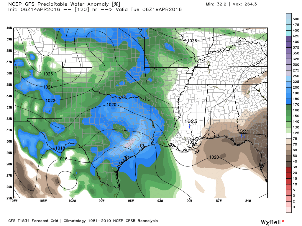
SUNDAY to TUESDAY
As moisture accumulates overhead a potent upper-level low pressure system will sweep down across the western United States toward Texas, creating conditions for potentially heavy rain.
At this time it is simply not possible to predict when and where the heaviest rain will fall. Thunderstorms will be possible throughout the three day period for the greater Houston area. With that being said it appears that atmospheric moisture levels (precipitable water) will be highest from early Monday through Tuesday morning, suggesting those days have the potential for the heaviest rain.
So how much is coming? There likely will be wide variations in rainfall amounts. For example, this morning’s European forecast model shows as much as 10 inches over northwest Harris County during the three days, and less than 3 inches over southeast Harris County. All this tells about is the potential for heavy rain, not where the heaviest storms will set up. My best guess is that most areas will see 2 to 5 inches of rain during the three day period, but that remains highly uncertain.
WEDNESDAY
Although the potential for rain remains, the worst should be over by next Wednesday.
MS 150 Ride
I don’t think there will be any problems with getting out of Houston on Saturday, in fact there will be a nice tail wind. However Sunday remains the concern. Beginning Sunday morning and into the early afternoon, the potential for heavy rain and severe weather, including hail, begins to increase for central Texas, including Austin. Ride officials say they are monitoring conditions closely.