Houston is off to its tenth hottest start to a July on record (matching July 1-6, 1931 for #10), with an average temperature of 85.9° so far this month. It hasn’t been extreme heat by our standards, but it’s been steadily hot and humid. A bunch of folks saw some cooling showers on Thursday, and as we kick off the weekend, a few more will see some relief as well. But don’t count on substantial, prolonged relief anytime soon. Summer is in control. Let’s walk through it.
Today & Saturday
Fairly similar weather is expected both for today and tomorrow. Expect a few showers near the coast in the morning (you can see those on radar this morning), expanding and spreading inland during the afternoon.
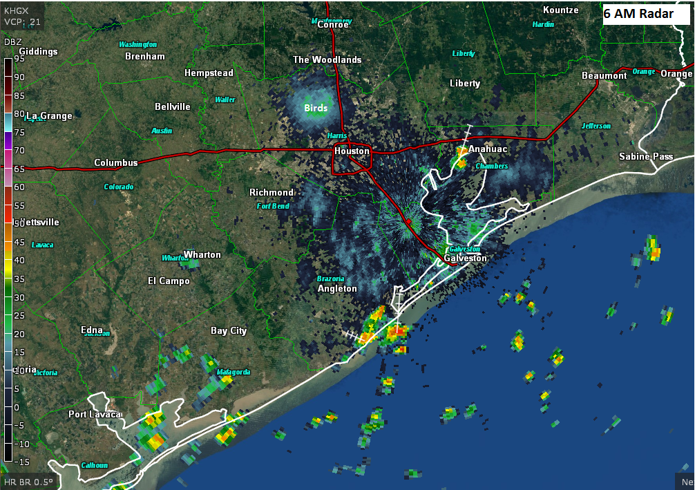
While coverage will likely not be widespread, I do think a good chunk of the area will see at least a shower. A few others will see downpours. And a few others still will just have to stare longingly at dark clouds in the distance, hearing the thunder of relief that has passed them by. Alas, Houston in the peak of summer can be cruel in that way.
Rainfall totals will obviously vary, with some places seeing squat, while others under a more persistent downpour could see one or two inches of rain. Shower coverage should be slightly greater on Friday than Saturday.
Expect high temps today and Saturday to be perhaps a touch cooler than they have been running thanks to better coverage of showers than we’ve seen lately. Some will see low-90s. If you aren’t fortunate enough to see a shower, you’ll probably do mid-90s.

Sunday into Next Week
The atmospheric squeeze is on as we head into next week. First, we have to get through Sunday. Initially it looked like Sunday would be quiet, with just a few scattered storms. Now it looks a little trickier, with perhaps a slightly better chance of storms. If I had to peg things down right now, I’d favor areas east of I-45 on Sunday for the best shot at storms. Something to watch this weekend but nothing too crazy.
Bottom line on the weekend: If you have outdoor plans, Saturday gets a very slight edge over Sunday, but not by much. Neither day looks to be a washout, but you may need to sneak indoors for a little while on either day.
So for next week, high pressure in the upper atmosphere is likely to sneak out of the West (where Las Vegas is currently riding an all-time record streak of 105° days) and into the Plains. This means the daily dose of relief from the Gulf of Mexico will slow down (though there still should be a few showers around each afternoon, just fewer and fewer as time goes on), and temperatures will sneak upward.
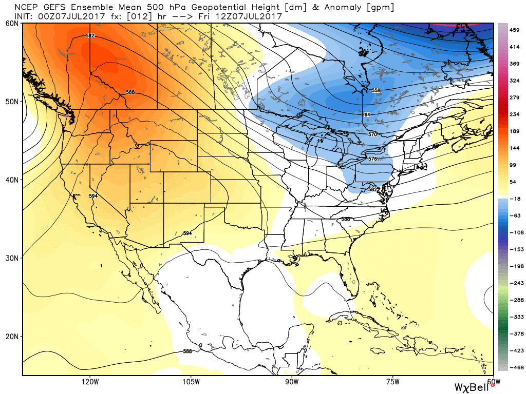
Similar to how July has started, we’re probably not looking at any record or extreme heat here in Houston, but steady, uncomfortable heat will be the story heading into most of next week. Low-to mid-90s will be common, with upper-90s possible perhaps on a day or two late in the week.
The tropics, as they relate to our region, remain quiet. Let’s hope that continues.
Posted at 6:15 AM Friday by Matt
Your misfortune of having the stubborn western high move east is the opening to our southwestern monsoon. Sorry we both can’t get relief.
As I keep telling, you Eric. This might be part of the same system that’s causing punishing storms up in the Midwest.
Red Alert Eric! A cold front is moving toward Houston, possibly bringing heavy rain and severe storms. Best blog on that right away!
Eric, is there any change in thinking on that high pressure ridge now that the front has come through?