Good morning. Houston remains at the southern edge of a high pressure system, which should build over the metro region during the next couple of days. We’ll see some rain chances before that happens.
TODAY
I suspect rain chances later this afternoon will be similar to those on Sunday. While much of the area saw little or no rain, pockets of the city saw 0.5 to 1.0 inch of rain Sunday during primarily afternoon thunderstorms. Highs will likely climb into the low 90s.
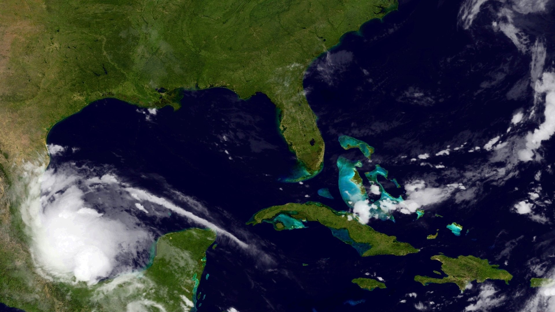
This high pressure over the southeastern United States has kept a tropical system away from the Texas coast, and that’s probably a good thing. Tropical Storm Danielle formed in the southern Bay of Campeche this morning, but proximity to land is likely to prevent it from strengthening too much. Had it been allowed to move north toward the Texas coast, it would have had more time for development over open water. In any case, the system is going to be a rainmaker for Mexico, and is also notable as the earliest fourth tropical storm on record, beating Debby 2012 (June 23) and Dennis 2005 (July 5). It’s still not clear to me that this augurs a particularly bad overall hurricane season, because all the systems we’ve seen form have been fairly weak tropical storms.
TUESDAY
We may see similar rain coverage on Tuesday—or we may not. It’s not easy to determine whether high pressure is going to take over by later on Tuesday. So it’s probably best to just forecast a chance of showers and thunderstorms, with again some locally heavy rainfall. But we must just as easily be hot and sunny in the low-90s. We’ll see.
WEDNESDAY and THURSDAY
With high pressure overhead I don’t expect much rain activity, and temperatures should climb into the low-to-mid 90s under partly to mostly sunny skies. It shouldn’t be quite as hot as last week, however.
FRIDAY and NEXT WEEKEND
It looks like high pressure will back off a bit by Friday or so of next week, which should allow for at least some slight afternoon rain chances due to the sea breeze. With highs in the low 90s, or so, it’s going to be very much like a pattern one would expect in late June.
Posted by Eric Berger at 7am CT on Monday
Why do I get the impression that the powers that be are over eager to classify a system as a tropical system these days?
Red Alert, Eric!
ECMWF aims a tropical system at Houston/Galveston on June 30, 2016!
Paul, do not pay attention to individual model runs. The GFS has been suggesting a system may develop in the Gulf at the end of this month, but the Euro has mostly not been on board with this. I would not have too much (any) concern at this point about it.