Pleasant weather this week, but strong storms possible after that

From now on, for the convenience of mobile users, I’m going to begin each post with a brief summary: Houston will have several pleasant fall days before a slight chance of rain returns on Sunday. Strong storms are possible on Monday and Tuesday ahead of significant front.

TODAY-SATURDAY

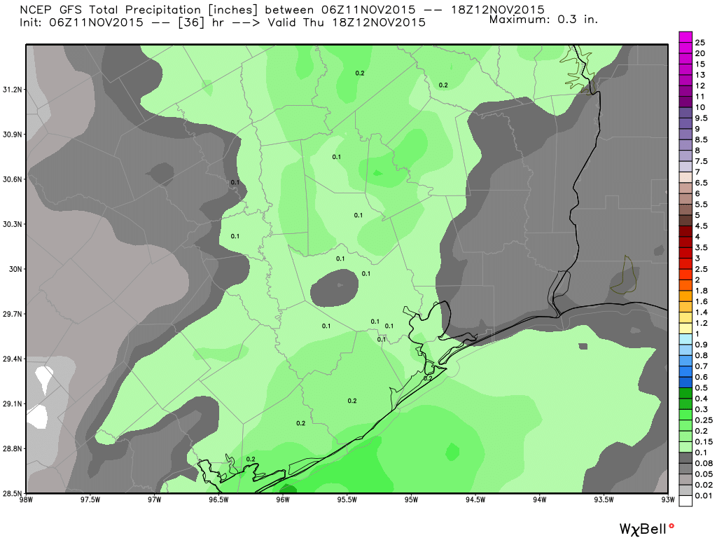
After 0.1 to 0.5 inches of rain fell across most of the Houston area on Wednesday night showers are moving out of the area, and being replaced by much drier air. Highs climbed into the mid-80s for much of Houston on Wednesday, and temperatures for now through Saturday will feel much cooler, in the upper 60s to about 70 degrees. Nighttime temperatures will also feel great, in the low 50s. Expect partly sunny days.

Saturday should be the nicest weekend day in several weeks.

See full post

After the front tonight, a gorgeous second half of the week

What a contrast in conditions this morning across Houston compared to the last couple of days, with temperatures generally in the low- to mid-70s out there. It’s September-like.

TODAY

It also won’t last. A cold front remains on track to cross through the region, likely between about 9 p.m. and early Thursday morning. There’s a chance of rain with the front but I think we’re looking at a tenth of an inch or two, at most. As a result I expect to see scattered light rain this afternoon, with short-duration showers of moderate intensity between 6 p.m. and midnight.

GFS model forecast for rain accumulation tonight. (Weather Bell)


Highs today, before the front, will be in the low 80s. It’ll definitely be a muggy day.

See full post

Warming up through Wednesday, and hark, is that a decent weekend forecast?

Good morning and welcome to my look at the week ahead.

TODAY

Moist air has begun returning from the Gulf of Mexico, in fact the relative humidity at Bush Intercontinental Airport was 100 percent this morning at 6 a.m. We’ll nonetheless have a pleasant enough day, with highs in the upper 70s and mostly sunny skies.

A gorgeous morning across Houston. (Matt Lanza)


WEDNESDAY

We’ll see very warm conditions for mid-November on Wednesday, with high temperatures likely rising into the low 80s across most of the area and ample humidity. During the afternoon and evening hours we’ll also see scattered rain chances as a front approaches Houston, and crosses through sometime on Wednesday evening or Thursday morning. I can’t see most areas getting more than a few tenths of an inch of rain, if that.

See full post

Thanksgiving … is beginning to feel a lot like Christmas?

I will get to the outlook for later this month in a minute. Let’s start with today.

TODAY

It’s a wonderfully cool start to the morning, with temperatures in the low 50s across most of the Houston area. We’ll have another dry, pleasant day with highs in the low 70s. Enjoy the splendid fall weather!

TUESDAY-WEDNESDAY

Beginning tonight we’ll see a return flow of more moist air from the Gulf of Mexico, allowing highs to rise into the upper-70s on Tuesday, and low-80s on Wednesday. Additionally Tuesday night’s low temperatures should fall only to around 70 degrees for much of the metro area. Blech! But it won’t last.

See full post