Warmer, and a bit wetter, before a cooler weekend

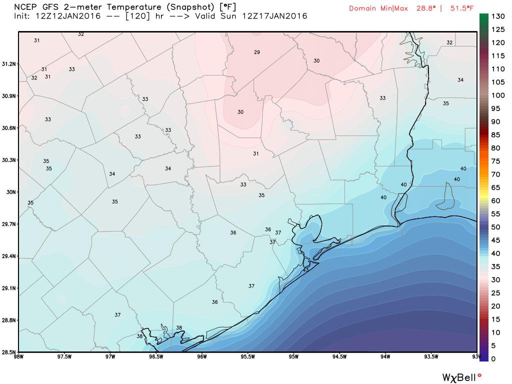
Temperatures are quite a bit warmer this morning — falling only to around 50 degrees — and this warming trend will continue through Friday afternoon before another cold front.

TODAY

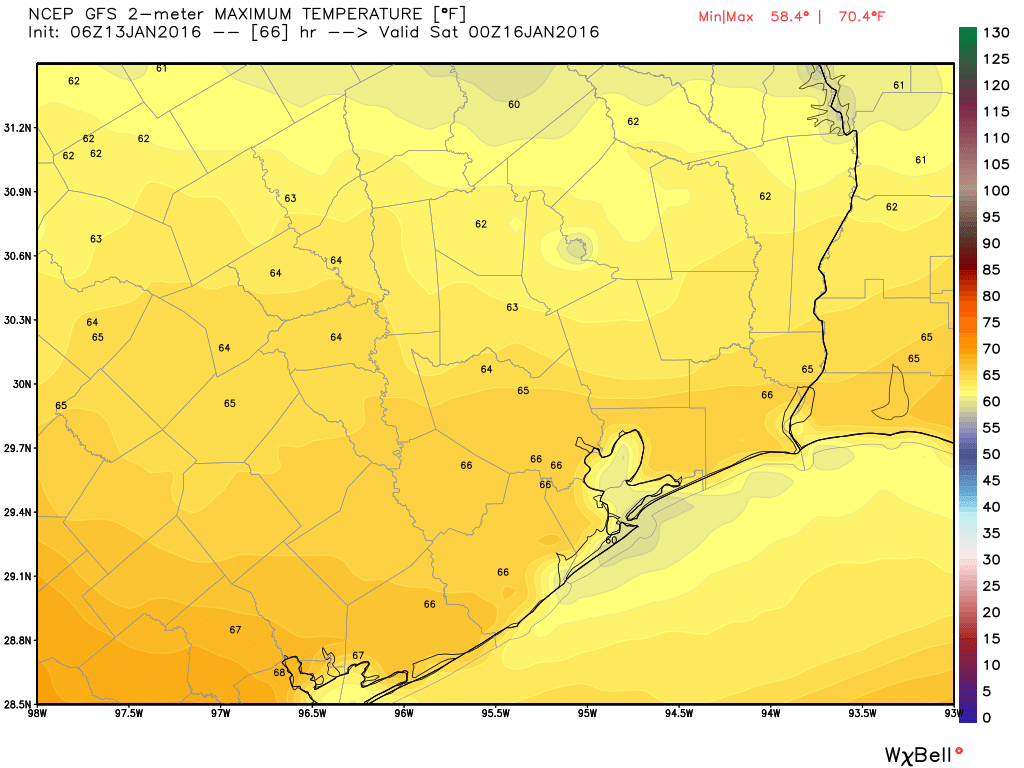
As we warm into the low- to mid-60s today, and atmospheric moisture levels increase, there will be some scattered showers and possibly a few thunderstorms develop across Houston later today. Chances are best between the city and the coast. Not expecting any kind of washout, with a few tenths of an inch of rain at most.

FRIDAY

Drier air will move in behind the rain, and it won’t bring very cold air initially. This, along with sunshine, will allow highs on Friday to warm to about 70 degrees. Houston hasn’t had a 70 degree day since two days after Christmas, so for many a bit of warmth may be welcome.

See full post

Winter’s chill to give way for a few days now, but will return for the weekend

Good morning. It’s another cool start to the day with temperatures in the upper 30s and low 40s, but now we’re going to warm up.

TODAY

Mostly sunny skies will allow temperatures to rise into the low 60s today with light winds. It should be a very pleasant afternoon and evening. Tonight will be warmer, with temperatures only falling to around 50 degrees.

THURSDAY

More southerly winds will bring moisture back into the atmosphere, and an upper-level disturbance will increase rain chances somewhat, but the heaviest showers will remain off the coast. Highs will climb into the upper 60s under partly cloudy skies.

FRIDAY

A cold front, almost certainly with no rain, will push through Houston during the day, limiting afternoon temperatures to the upper 60s. This will return colder, and drier air to the region, allowing Friday night’s low temperatures to dip back into the mid-40s.

Looking for a respite from winter? Friday afternoon may be your best bet. (Weather Bell)

See full post

Houston Marathon: Five days to go, forecast looks near ideal

As we get closer to the Houston Marathon the forecast remains close to what I’ve been describing for most of the last week.

A cold front remains on track to reach Houston on Friday or early Saturday, and we’ll continue to see cold air moving into Houston through Sunday. This will lead to cold conditions on the morning of the marathon, and I’m expecting a low temperature that morning most likely between 35 and 40 degrees. It certainly won’t be above 45 degrees. During the course of the morning temperatures will rise into the low 50s.

GFS model for forecast low temperatures on Sunday morning. (Weather Bell)

See full post

Warmer now through Friday, before another cold front this weekend

It’s chilly again this morning — generally in the upper 30s across the Houston metro area. After another cold start to today we’ll warm up until this weekend.

TODAY and WEDNESDAY

Both days should bring mostly sunny skies, with highs in the low 60s. Temperatures tonight will fall to around 40 degrees, and as clouds return on Wednesday night temperatures will only drop into the low 50s.

THURSDAY

Increasing clouds on Wednesday night and Thursday morning will herald the return of higher moisture levels, and an upper-level disturbance will move overheadĀ the area later on Thursday. Still, conditions for severe storms aren’t good, and much of the region should only see only modest accumulations of rain. Chances are best along the coast.

Rain accumulation forecast for Thursday and Thursday night. (Weather Bell)

See full post