It’s snow joke—can’t rule out a wintry mix tonight for Houston

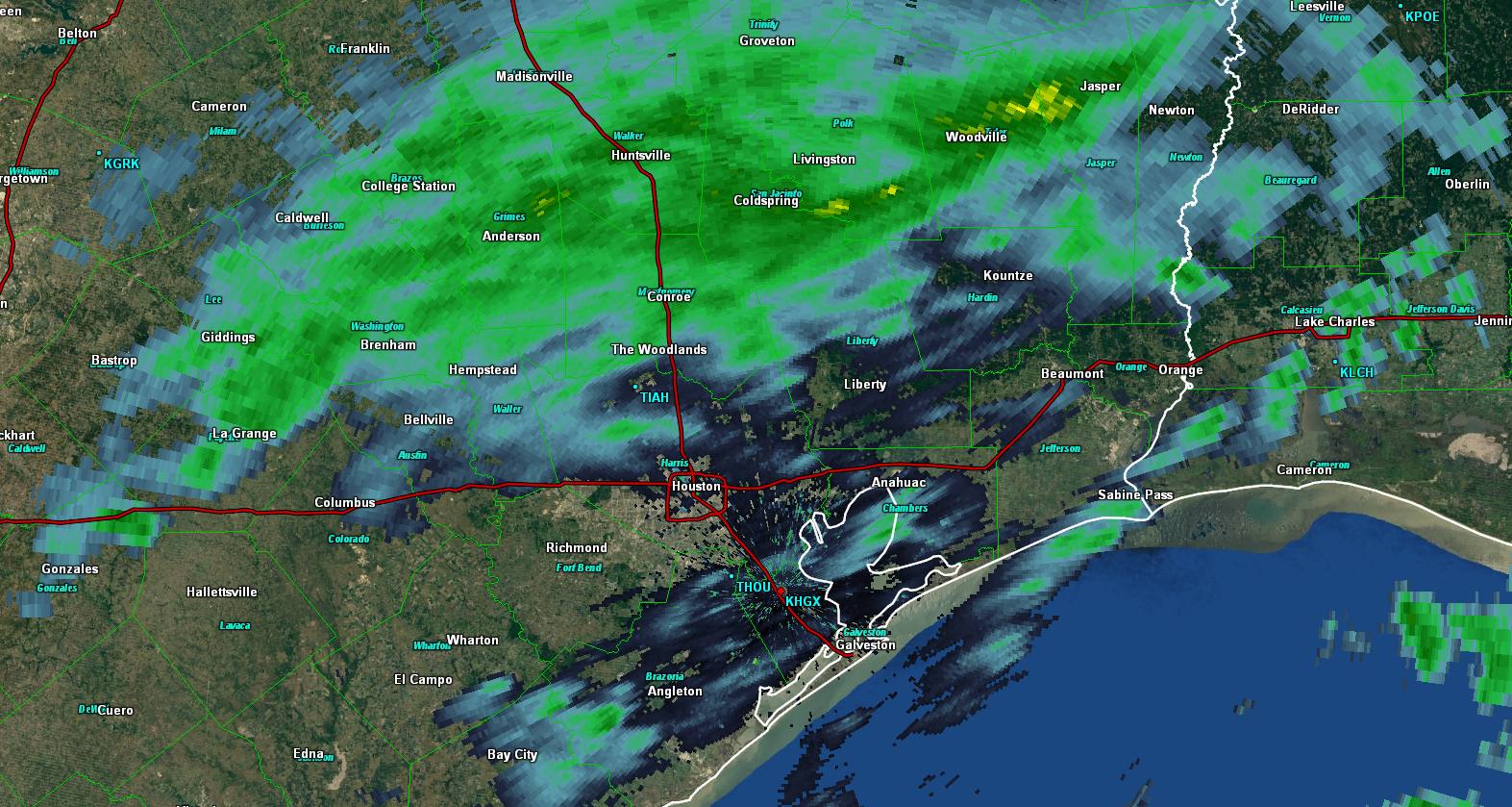
It’s snowing in Houston—or rather above Houston. By looking at the radar this morning we can see that snow is falling down to around 2,000 feet above the surface and then melting. This is not uniform, and I expect that a few areas around, and north of town this morning may see a few snowflakes or sleet. We don’t expect anything to stick, so it shouldn’t affect travel around the area. More of this wintry mix will be possible tonight—including the possibility of some real snow falling right along the coast.

Thursday

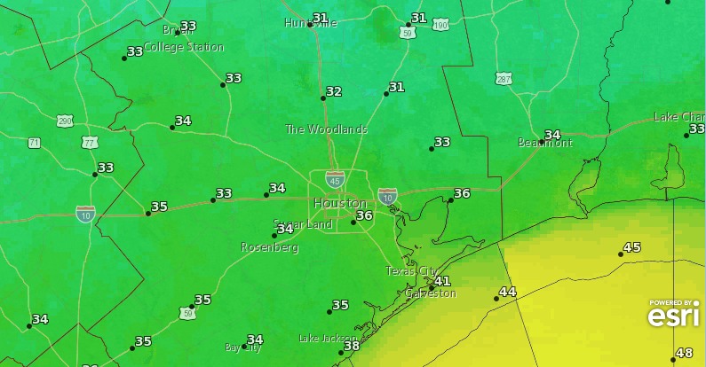
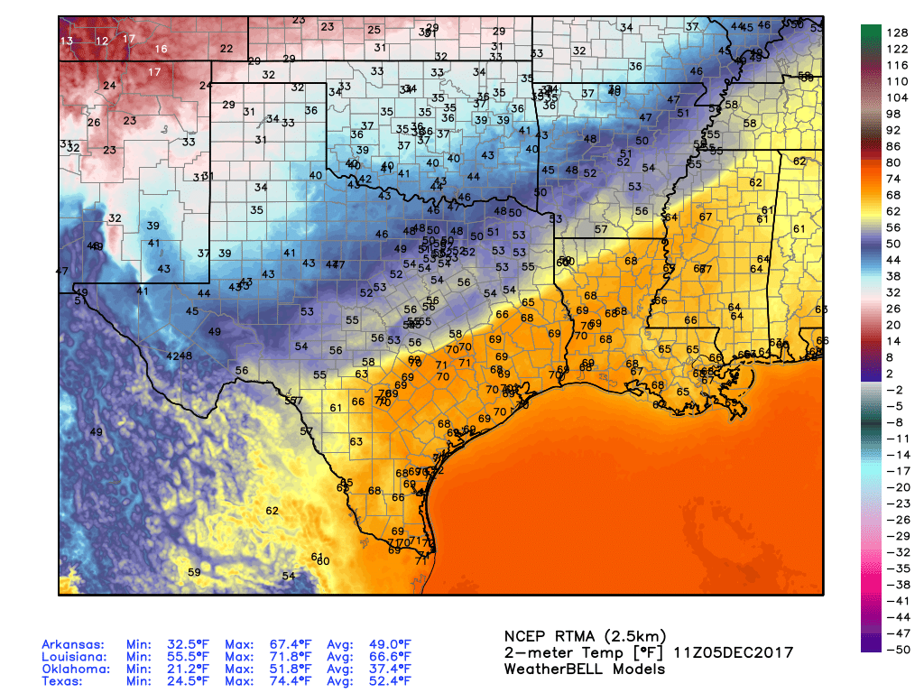
We’re going to see one more dreary, winter day today as an upper-level storm system slowly moves through the area and off to the east. Rainfall accumulations won’t be a concern—we’re just seeing light to moderate precipitation—but the cold rain will add to an already cold day. Highs Thursday are unlikely to reach 50 degrees.

Forecast low temperatures for Friday morning in Houston. (National Weather Service)

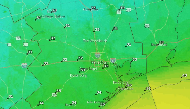
Things get interesting tonight, as temperatures are forecast to come down into the mid-30s in Houston. However, even as we’re cooling down this evening, precipitation should be ending from northwest to the southeast. This means for inland areas, likely north of Interstate 10, the rain may end before it gets cold enough to produce a wintry mix of snowflakes or sleet.

Likely, then, the best chance for a wintry mix will be closer to the coast, where precipitation will probably linger into Thursday night or early Friday morning. (As Matt explained in depth last night, such forecasts are very, very tricky.  A lot of things have to go right to make snow in Houston). Our best guess is that coastal areas see some snowflakes later tonight, although kids may have to stay up fairly late to catch them. There’s the potential for some snow accumulations south of Houston, perhaps in Matagorda County, or well to the east of us in Southern Louisiana. Locally we don’t expect that, at least right now. Regardless of what falls from the sky, expect a very chilly night.

(Space City Weather is brought to you this month by the Law Office of Murray Newman)

See full post

Could Houston see ice pellets or snowflakes in the air this week?

As Eric noted this morning, it looked possible that areas well north of Houston could see some ice pellets (sleet) mix in with the rain tonight. That continues to look like a possibility, and the forecast looks intriguing beyond tonight too. Let’s talk wintry weather chances.

Tonight

Radar as of 5:30 PM Wednesday shows a good bit of shower activity in the region, especially north of Houston. Rain has been pretty light and mostly just added to the dreary ambiance of the atmosphere today.

Radar as of 5:40 PM showed light rain north and west of Houston, with a smattering of patchy drizzle elsewhere. (GRLevel3)

As we go into tonight, expect a few more rounds of rain, perhaps steady at times. Temperatures tonight should hold steady or continue a slow drop over most of the area, and I’d expect overnight lows to bottom out in the 38-42° range on average. That’s safely above freezing, so in and around Houston, I’d honestly be surprised to see anything other than plain rain tonight. North of Houston (say up toward Conroe, Hempstead, or Brenham), I wouldn’t be shocked if you hear some “pings” of ice pellets mixed in with the rain late tonight.

Thursday

I think Thursday is pretty straightforward here. We should see continued light rain much of the day. Temperatures aren’t going to warm up much. Upper-40s should be about as good as we do in some spots. Mid-40s will suffice in others. But mild-ish temperatures should prevent any wintry precipitation from mixing in.

(Space City Weather is brought to you this month by the Law Office of Murray Newman)

See full post

Dreary today and Thursday, but the weekend looks festive for Houston

Winter has come to Houston, and along with it we’re seeing widespread light rainfall for a couple of days before sunny and cool weather.

Wednesday

Today is definitely winter coat weather—even if you’re one of those hardy souls from the north who mocks those of us accustomed to Houston weather. High temperatures will probably top out in the mid- to upper-40s today, and a 10 to 15-mph northerly breeze will keep things brisk, with higher gusts along the coast. Clouds are likely all day as well, with intermittent light rain showers adding to the fun. I’m not worried about accumulations, as most areas should see less than 1 inch of rain. But my, this will be a dreary day.

Thursday

Some northern areas have a slight chance of sleet (tiny, clear pellets of ice) on Wednesday night—I’m thinking of areas like Washington, Grimes, and Walker counties, and points north of there. However, the ground is warm enough still that any such wintry mix should melt on contact. In Houston, we’ll just see cold rain. This day should be a lot like Wednesday, albeit with slightly warmer temperatures and diminishing rain coverage later in the day.

Low temperatures for Thursday night into Friday morning will be quite cold. (National Weather Service)

Some clearing skies (generally from the northwest to the southeast) should allow temperatures on Thursday night to get a bit colder, perhaps in the upper 30s for the Houston area, but a freeze seems unlikely in the city.

(Space City Weather is brought to you this month by the Law Office of Murray Newman)

See full post

Dare we say it? You’ll need your winter coats this week

Temperatures this morning, just before sunrise, were about 70 degrees in the greater Houston area with essentially 100 percent humidity. This soupy weather is considerably warmer than normal for Houston, but it will now come to an end with the passage of a strong cold front Tuesday, and several reinforcing fronts over the next week. In short, winter has come to Texas.

A big change is coming to Houston’s weather on Tuesday. (Weather Bell)

Tuesday

The cold front is on track to move through Houston later this morning, likely reaching the coast by around noon, give or take an hour or two. The radar shows a broken band of light to moderate showers, with a few thunderstorms, accompanying the front as it sweeps down through Texas. I expect this pattern to more or less hold, and accumulations will be relatively low given the fairly rapid movement of the front to the southeast. Our weather will cool quickly with strong northerly winds blowing in behind the front.

Rain chances will return later this afternoon and evening, however, The dry air at the surface moving in with the cold front won’t extend very far up into the atmosphere, and due to the moisture aloft we are likely to see some continued light rain showers Tuesday night and on Wednesday.

(Space City Weather is brought to you this month by the Law Office of Murray Newman)

See full post