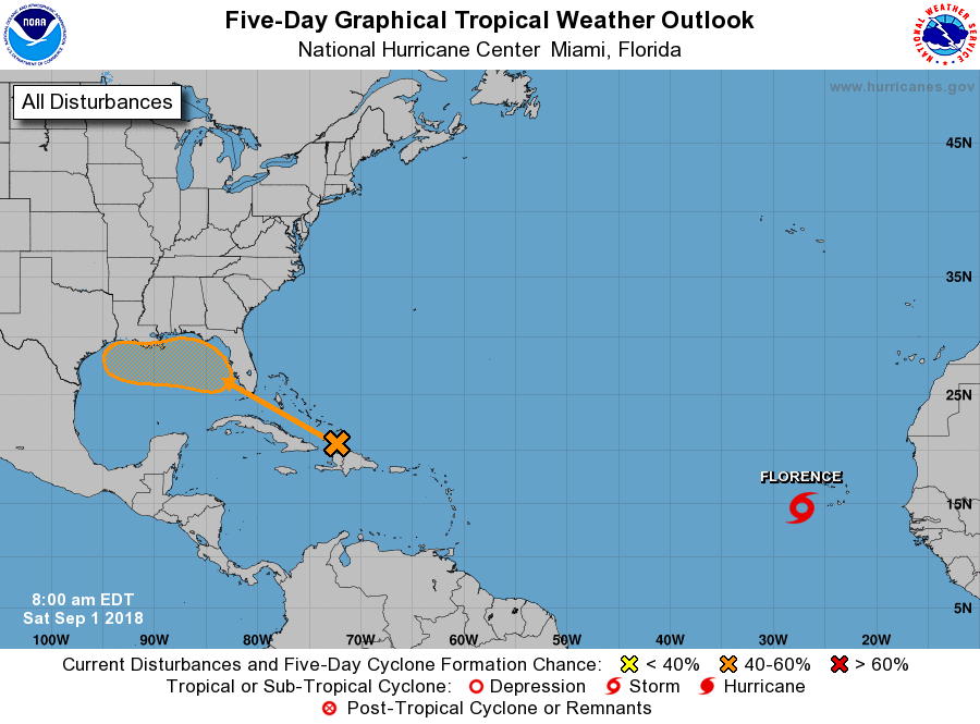
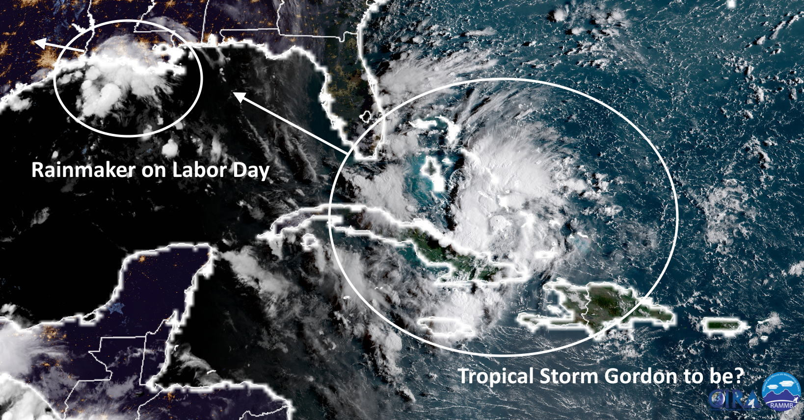
In regard to rainfall and the Houston metro area, we have two separate issues to discuss. There is the potential for heavy rainfall on Sunday, Monday, and Tuesday; and then the renewed potential for heavy rain toward next weekend, as a tropical disturbance—perhaps Tropical Storm Gordon—brings rainfall to the northern Gulf of Mexico coast.
Labor Day Weekend
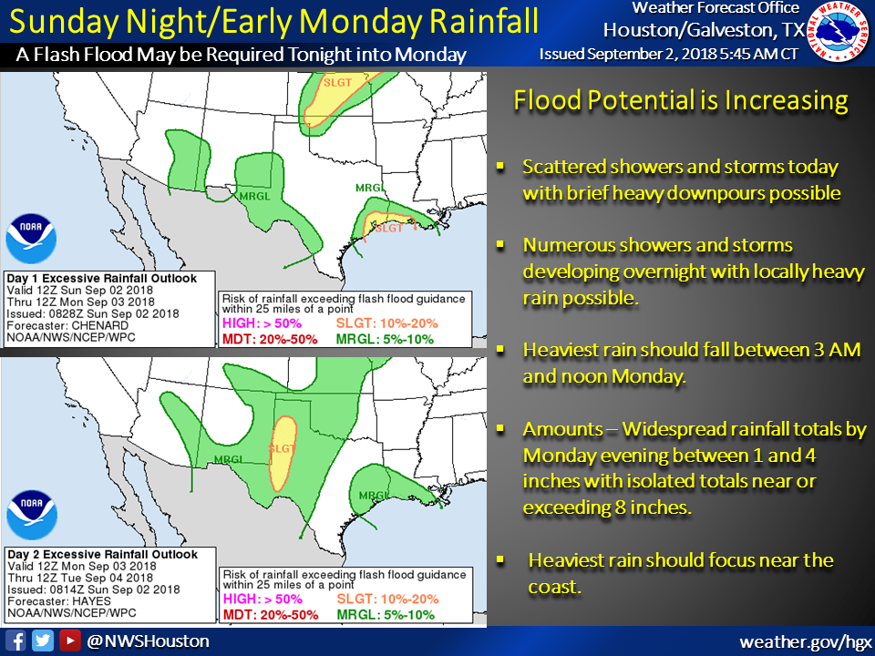
A weak low pressure system over southern Louisiana and the northern Gulf of Mexico will drift westward over the next few days, bringing an excellent chance of rain to the Houston metro area on Sunday, Monday, and Tuesday. The National Weather Service will issue a “Flash Flood Watch,” and there is a general expectation of 1 to 4 inches of rainfall, with isolated areas seeing as much as 8 inches. The best chance for heavy rainfall will come on Sunday night, and throughout Labor Day. If you have travel plans on Monday, please to check conditions before venturing out. For the most part we expect street flooding, but can’t rule out some more serious effects in areas where the storms establish themselves and don’t really move.
We have reasonable confidence that after this system clears the area, we should see somewhat drier conditions on Wednesday and Thursday for Houston, with partly sunny skies and more scattered showers. Which is a good thing, because …