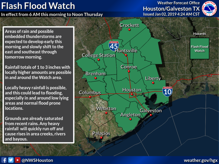
Houston got a taste of sunshine to start the new year, but now we’ve returned to cloudy weather. Soon, rain will follow, and due to the nature of our saturated soils and lesser ability of dead vegetation to absorb rainfall, a flash flood watch is in effect through noon Thursday. We’re not overly concerned with the possibility of widespread flooding, but certainly the next day or so will be a wet, chilly affair.
Wednesday through midday Thursday
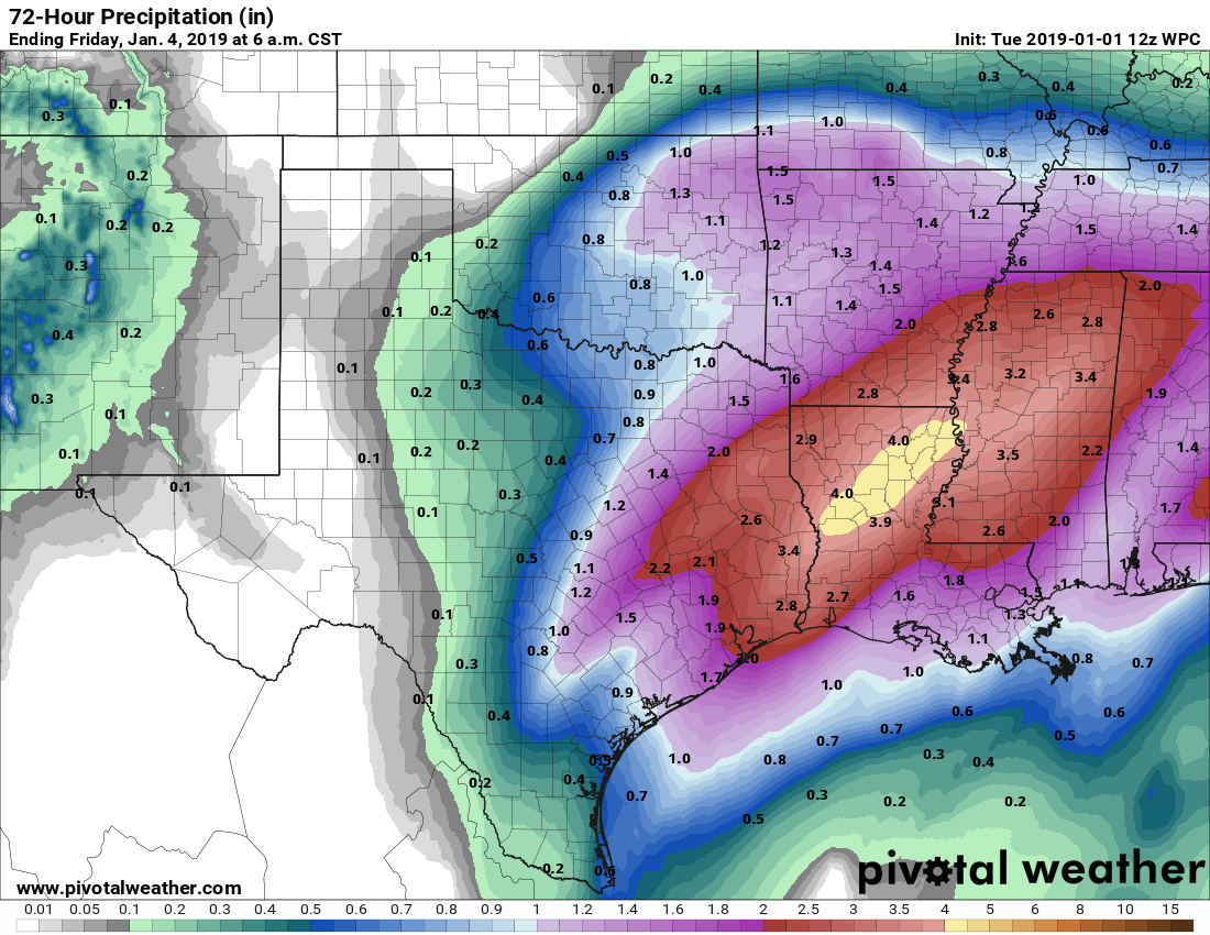
A combination of moisture streaming into the area from the Gulf of Mexico (this is occurring above the surface, because winds near the ground are out of the northeast), as well as a disturbed atmosphere will drive the potential for rain today, tonight, and Thursday morning. While much of the rain will likely be of the light-to-moderate variety, a few embedded heavier showers are possible. Moreover, because the rain could last for hours in some locations, we may eventually see accumulations of up to about 3 inches. Because soils simply cannot handle much (any) of this rain, almost all it will run off into streets and bayous.
Overall, this messy weather should eventually move off to the east by Thursday morning, or early afternoon time frame, as a cold front moves through. Before then, highs will be in the 50s, lows in the 40s, and skies leaden. I know some of you love winter weather like this, so enjoy it while it lasts.