Space City Weather long-range forecast for the Houston Marathon

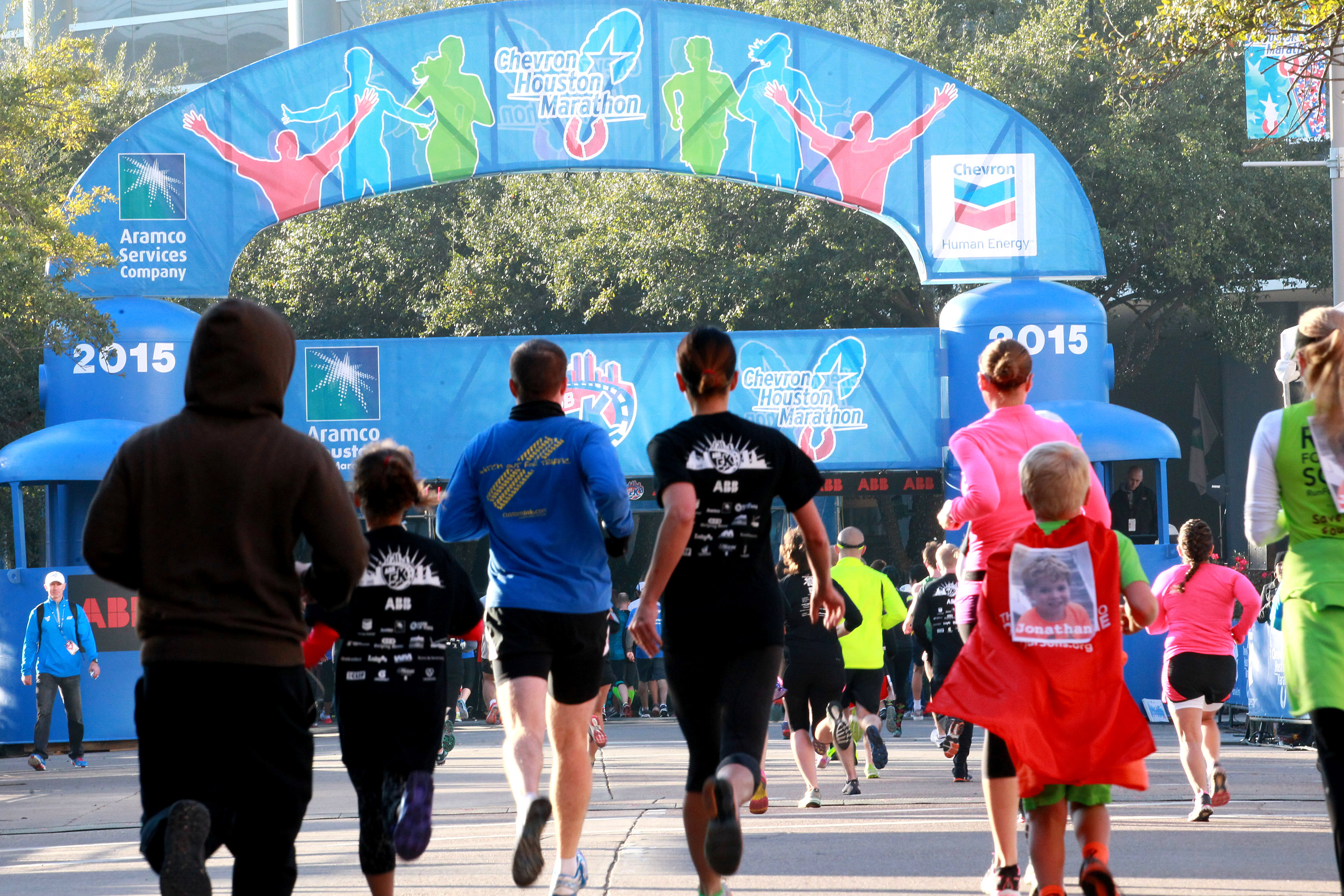
Apologies if you could not care less about the marathon, which will take place on Sunday, Jan. 20, in downtown Houston and nearby roadways. However, for the tens of thousands of people who have trained over the last four months (yours truly, included) the weather for that morning is of profound importance. Anything too warm—for me that’s above 55 degrees—and it’s going to be a long, long day. After today’s post, I’ll append a short marathon outlook at the bottom of the daily updates.

Before jumping into the forecast, let me set some expectations. Until about 10 days before the race, we can’t have much confidence in the forecast. We can set some constraints, but not much more than that. From 7 to 10 days we can glean some better insight from the ensemble models, and then about a week out we can begin to have some confidence in the overall forecast. Alright, enough caveats!

Fingers crossed for a cold-ish start to this year’s marathon. (Houston Marathon)

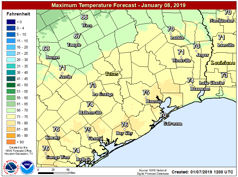
For this week, we’re going to see a front later on Tuesday, and then another one in the Friday-Saturday timeframe (that one may yield 0.5 to 1.0 inch of rain). After this front, the first half of next week (Jan. 13 to 15) looks fairly cool, with highs in the 50s perhaps. Monday or Tuesday of next week would be ideal to run the marathon on. After this, it looks like we’ll see a warm-up by the middle of next week, with highs in the 70s perhaps.

See full post

Warmer for a couple of days before a bit of a cool down for Houston

Good morning. It’s uncharacteristically warm for early January, but it appears that after Tuesday we’ll return to more seasonable weather for the mid-January period with highs generally in the 60s, and lows in the 40s or 50s. Rain chances return Friday, but there’s nothing too extreme in the forecast at all over at least the next week or 10 days. Also, if you’re interested in the Houston Marathon (which will take place on January 20), we’ll have our debut forecast later today.

Monday

High temperatures on Sunday reached the low 70s for most of the region, and they should again be that warm today, with slight southerly winds. Skies will be mostly cloudy, which should help put an upper limit on temperatures. As cloudy skies continue into tonight, we probably will only see lows down in the low 60s for most of Houston once again, and with the warmer air we could see some fog on Tuesday morning.

Tuesday should be warmer across the Houston area. (National Weather Service)

Tuesday

This will be another warm day, with highs under mostly cloudy skies likely reaching the low- to mid-70s. These warm and humid conditions will continue until later in the day, or early evening, as a cold front slides through Houston. Right now the dynamics with this front don’t appear to produce a significant chance of rain—maybe 10 or 20 percent for the region. Lows Tuesday night should generally fall into the 50s.

See full post

First weekend of 2019 looks delightful

Good morning, and happy Friday! This will be a relatively brief post, as we have a limited amount of weather issues to discuss for once.

First, let’s do some quick housekeeping on flooding on some of the larger rivers in the region. The West Fork of the San Jacinto River near Humble appears to be cresting this morning on the threshold of moderate flooding. It will recede over the next couple days.

On the cusp of moderate flooding along the West Fork of the San Jacinto River. (NWS)

The East Fork will see minor flooding, while the Trinity River at Liberty continues to see major flooding.

Along the Brazos, minor to just shy of moderate flooding is expected near Hempstead, while a slow rise downstream at Richmond should push the river to near or just below minor flooding levels by midweek next week.

Generally minor to borderline moderate flooding along the Brazos River is expected over the next 5-7 days. (NWS)

Further downstream at Rosharon, minor to borderline moderate flooding is expected next week as well. Flooding along the Brazos is being fed by inflows from the Navasota River, which is in moderate flood north of College Station.

Today through Sunday

Mostly sunny skies will prevail on each of the next three days across all of Southeast Texas. The only blemish here may be some patchy fog on each of the next few mornings, especially later in the weekend. We’ll shift to sunshine quickly through each morning.

It’s a chilly start to the day, with the coldest temperatures in the area since December 11th. (NWS)

We’re starting today in the 30s in much of the area, the coldest morning for Houston since December 11th, when we hit 34° officially. Temperatures will warm and top off in the mid- to upper-50s today, mid-60s tomorrow, and near 70 on Sunday. Morning lows will be chilly again tonight, with low-40s. Onshore flow slowly increases a bit on Saturday night and Sunday, so low temperatures Sunday morning will be milder, in the mid- to upper-40s.

See full post

The rains are ending soon, and this weekend—oh my

Houston is coming to the end of wet spell, but we’re not quite across the finish line. Generally, 1.5 to 3.0 inches of rain have fallen over the last 24 hours, which is not that much rain but due to sodden soils and dormant vegetation, none of those rains have been absorbed. (Area bayous are fine, with the exception of some minor flooding along Little Cypress Creek). Fortunately the bulk of this mess has moved off to the east, and the rest of it should follow by around noon today. Good riddance!

Rain accumulations during the last 48 hours. (Harris County Flood Warning System)

Thursday

It’s chilly this morning in addition to the rainfall, with low 40s inland to mid-50s near the coast. As the upper-level storm system that produced our wet weather moves east, it will be replaced by high pressure later today that will bring drier air. Clouds probably will be breaking up around the time the sun sets. Highs today won’t move up much from lows this morning, and lows tonight may get into the upper 30s for the city.

Friday

After the cold start, sunny skies will help push temperatures into the upper 50s for most of the city, with light northerly winds. Lows Friday night will be a few degrees warmer than Thursday night, but still fairly cold.

See full post