One more stunning dry day before humidity begins its return

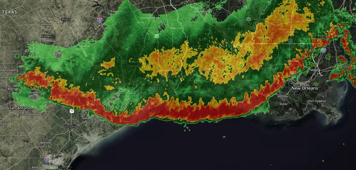
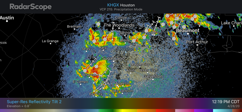
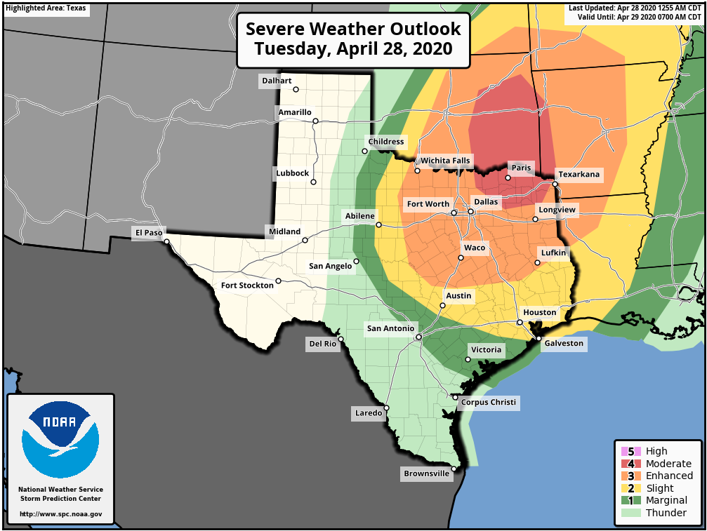
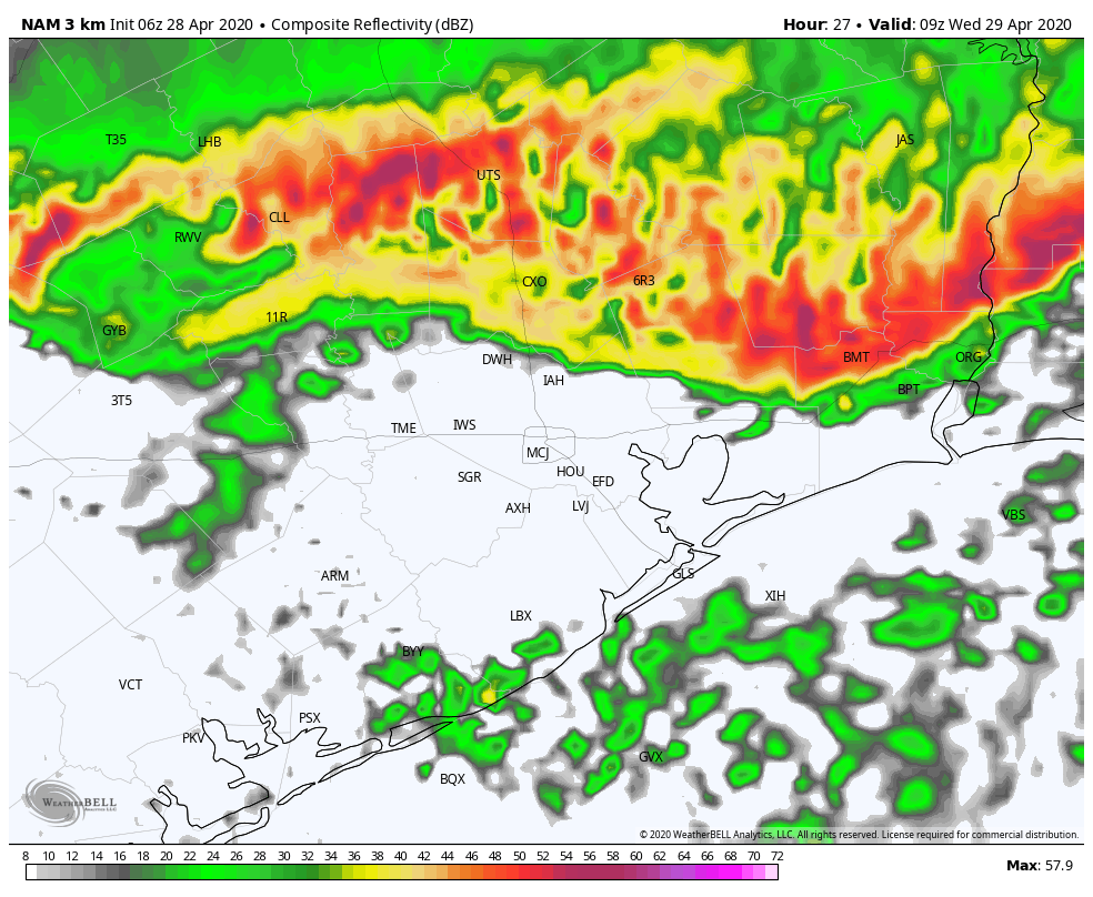
Good morning. Before we jump into the forecast here’s a quick look back at some of the damage caused by storms that bulled through the Houston area on Wednesday morning:

  • One man was killed in Huntsville when a tree fell on his master bedroom
  • 73 mph wind gust recorded on North Jetty in Galveston
  • 71 mph wind gust in Caldwell
  • Downed power lines in New Waverly, Galveston, Friendswood
  • Numerous areas reported tree damage and fallen trees

Wednesday’s early morning storms gave way to clear skies during the afternoon and a very fine evening. The region will have one more day with dry air, and another fine evening. So please enjoy this amazing late spring weather.

Thursday

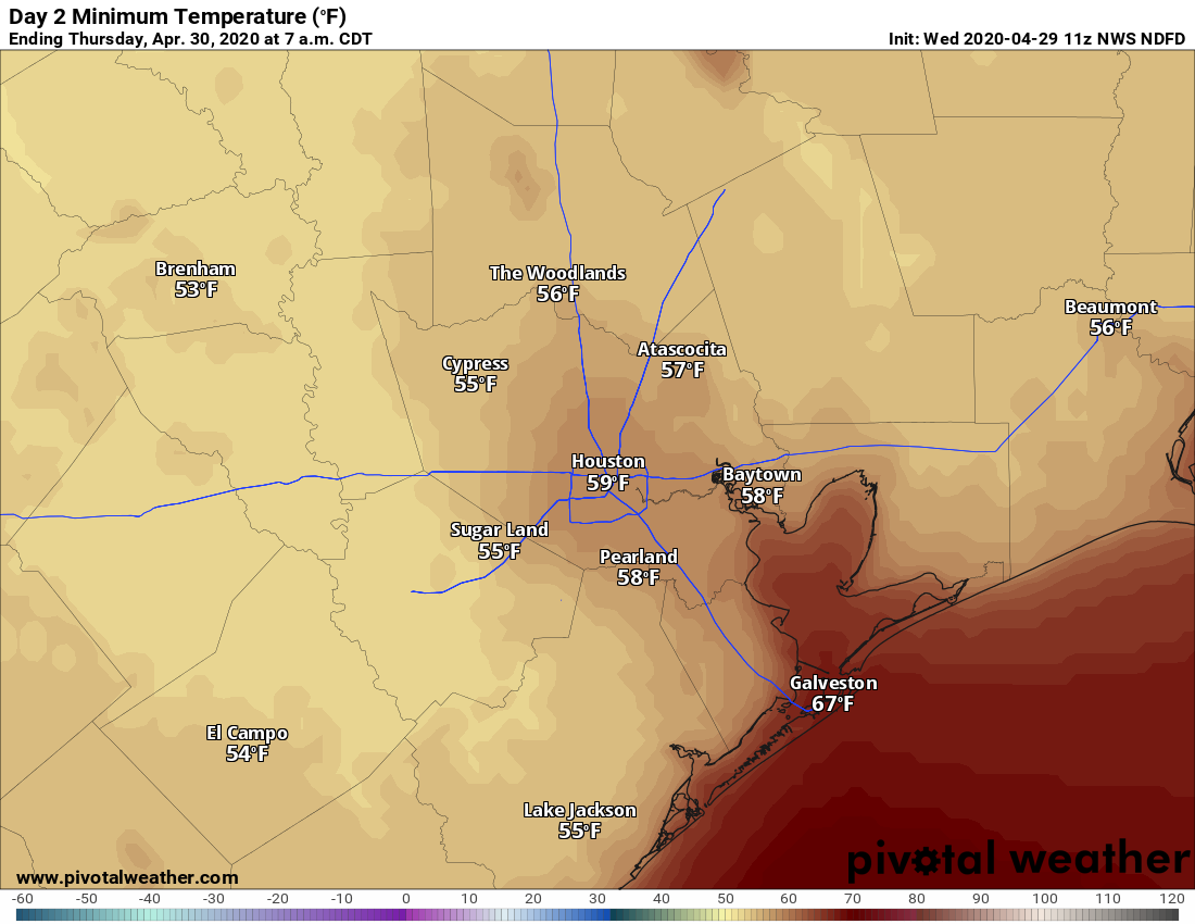
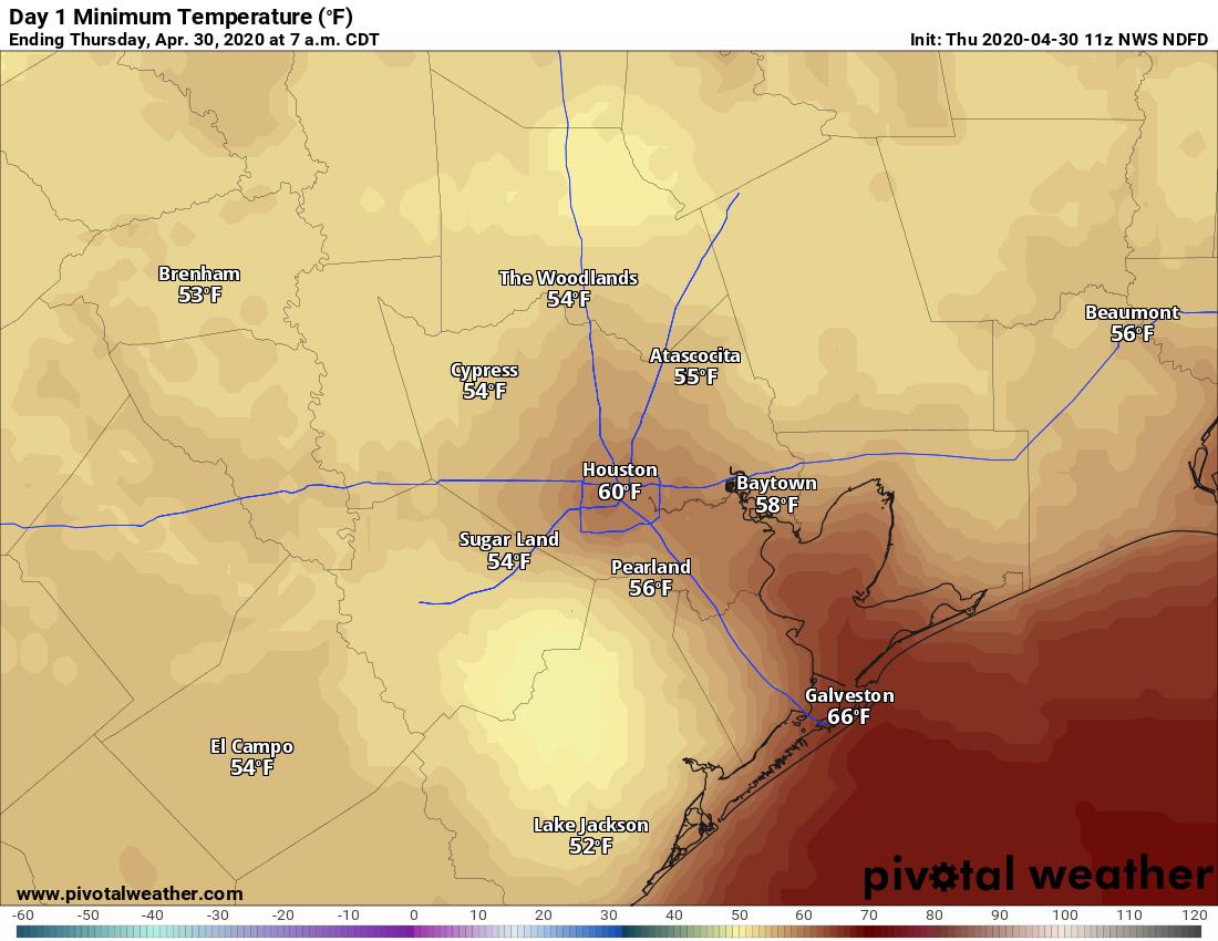
Lows this morning are quite chilly, dropping all the way down to 50 degrees in some parts of Montgomery County, and reaching the mid-50s or so for most areas but the coast. This is about 10 degrees cooler than normal for late April. With light, northwest winds we can expect highs today to reach around 80 degrees for most areas, with continued sunny weather. Low temperatures tonight will be about 5 degrees warmer, give or take, for your location with continued clear skies.

Savor Thursday night’s low temperatures, Houston. (Pivotal Weather)

Friday

Winds will swing about to come from the south by Friday, and this will begin the process of warming the region and bringing humidity levels back up. But Friday itself should remain fairly dry, with highs in the mid-80s under sunny skies. Lows Friday night will likely fall somewhere into the 60s for most.

See full post

Storms rumble through Houston, dry air will follow

Good morning. As expected, a squall line a storms rumbled through Houston early Wednesday morning. Some bowing segments of the line brought damaging winds and frequent lightning, knocking power out to about 160,000 residences and businesses. But it’s not just Houston—this impressive line of storms stretches from west of Austin all the way to the east of New Orleans.

Radar image at 6:15am CT. (kktv.com)

The worst of the storms for the Houston metro area is now rapidly moving toward the coast and offshore. This will set the stage for a few days of sedate, pleasant weather before we warm up over the weekend.

Wednesday

Temperatures this morning are in the mid-60s, and we probably will warm up into the low 80s this afternoon as skies begin to clear out. Although the heaviest rains are heading toward the exits, some light rains are possible through the mid-morning hours before drier air moves in behind the cold front. We’ll see gusty northerly winds this morning, but they should begin to ease back a little bit this afternoon. All of this will set the stage for a cool and clear night, with low temperatures likely dropping into the upper 50s for most of the region except the coast.

Thursday morning’s low temperatures will be quite amazing. (Pivotal Weather)

Thursday

The last day of April will be splendid—sunny, with light winds, dry air, and highs of around 80 degrees. There won’t be much more weather like this for awhile, so soak it up. Lows Thursday night will be a couple of degrees warmer than Wednesday night.

See full post

Storms looking more organized on Tuesday than anticipated

For the second time in four days Mother Nature has delivered a surprise. In today’s case, a capping inversion that was expected to hold sway over the Houston region during the daytime Tuesday is breaking. Thus, a cluster of strong thunderstorms is now moving into the region from the southwest along with an upper-level disturbance.

Houston radar at 12:19pm CT. (RadarScope)

With the cap breaking and plenty of moisture, it seems likely that this threat of heavy rainfall and thunderstorms may be with much of the metro area throughout the daylight hours today. Because of the high rainfall rates in some of these storms, we may see localized flooding throughout the afternoon hours. Storms should ebb this evening.

It still appears as though a bow-line feature will move through Houston after midnight, and push through the region from north to south, with the worst of it offshore by around sunrise or shortly thereafter. We still expect this system to deliver the kinds of severe weather we discussed in this morning’s weather post.

Storms Tuesday night may wake you up with winds, lightning

Good morning—it’s a sticky one with low temperatures only in the 70s with nearly matching dewpoints. Persistent southerly winds are blowing, and will continue to do so today, amping up moisture levels in advance of a storm system that will move into the region this evening and during the overnight hours.

Tuesday

Highs will climb into the mid-80s today for most of us, under mostly cloudy skies. As moisture levels rise today, some scattered showers and thunderstorms will probably develop, but the real action should wait for the overnight hours and the passage of a cold front. Most model guidance agrees that some sort of squall line will dip into, and through Houston between midnight and sunrise on Wednesday morning.

NOAA outlook for storms on Tuesday and Tuesday night.

The entire Houston region lies under a “slight” risk of severe weather, with the primary threat damaging winds, and a secondary possibility hail. Although these storms will be capable of producing heavy rainfall, they should move pretty steadily from north to south, precluding widespread flooding.

NAM forecast model prediction for Houston radar at 4am CT. (Weather Bell)

Rainfall amounts will undoubtedly vary, but most of the region should see about 1 inch, give or take. This will include areas near the coast that have been quite dry of late.

Wednesday

As quickly as Tuesday night’s storms spin up and push through, they should clear the coast by mid-morning Wednesday, with clearing skies by late morning or early afternoon. This will help temperatures climb into the low 80s despite a persistent northerly wind.

See full post