Good morning. I am sorry to say that Sunday’s forecast was a “miss” for us, in that we did not anticipate such widespread rain, nor so many thunderstorms. Candidly, I woke up and looked at the radar on Sunday morning, and upon seeing a mass of showers to the southwest of Houston said to myself, “What is that?!?” The showers also kept a lid on temperatures—with a high of just 79 degrees at Bush Intercontinental Airport. Anyway, I believe it is important to be honest with our readers.
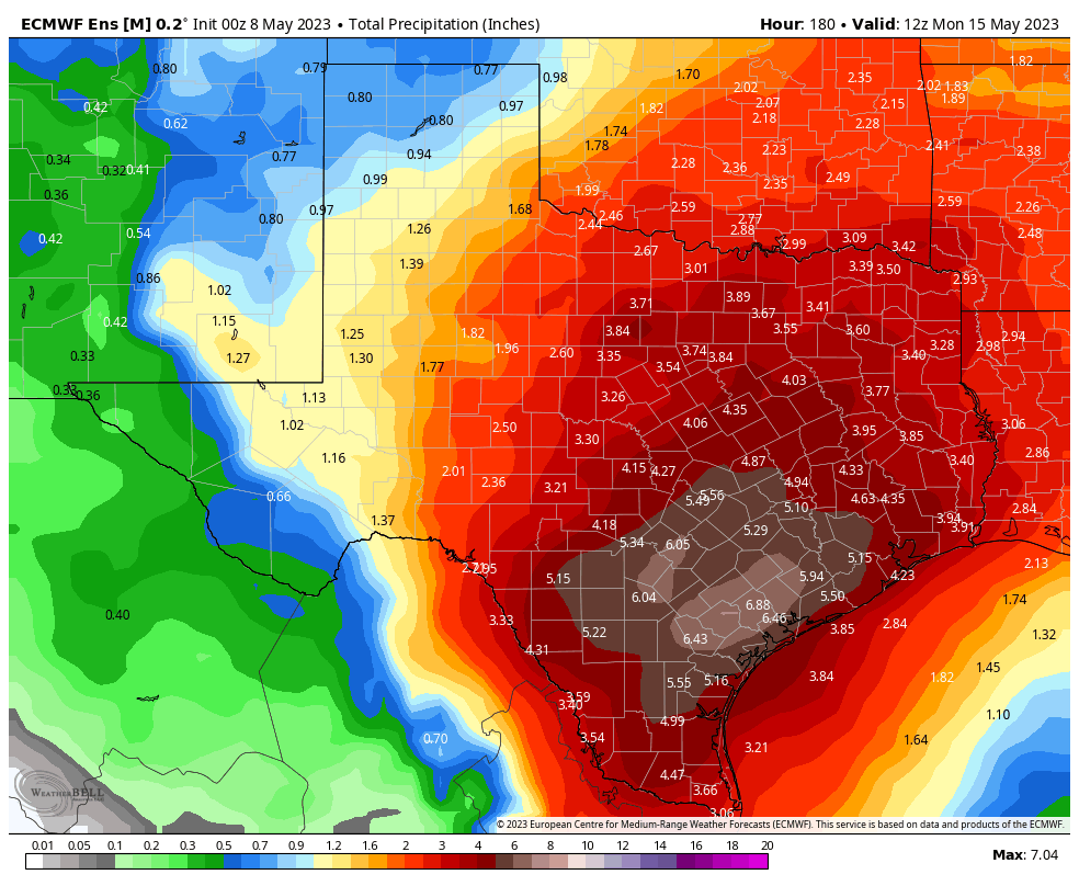
Sunday’s wet weather heralded a much wetter pattern for the week ahead. Most of the area should see 3 to 6 inches of rain between now and next Monday, and we’ll be on the lookout for the possibility of street flooding amid stronger storms. For this reason we are issuing a Stage 1 flood alert, beginning at noon today.

The overall pattern, in absence of high pressure, will be driven by a moist atmosphere with a series of passing atmospheric disturbances. As a result we’ll see on and off showers and thunderstorms for much of this week, and possibly through the weekend. This is the kind of situation during which you’ll need to be paying attention to conditions, as these storms may well pop up during after-school activities or the evening commute.
Monday
Conditions this morning should be fairly calm, with mostly cloudy skies and warm temperatures. However, along with daytime heating, I expect to see fairly widespread showers and thunderstorms pop up this afternoon. It is possible that we see some fairly strong thunderstorms this afternoon, from about noon to 6 pm across the metro-area, so be weather aware. Any storms that develop should weaken during the evening hours. Otherwise, expect mostly cloudy skies with high temperatures in the mid-80s, and southerly winds. Lows will only drop into the low-70s.
Tuesday
A similar day, with muggy air and a chance of fairly widespread showers and thunderstorms during primarily the afternoon hours. Not everyone will see rainfall, but much of the region will, and some of these thunderstorms could be quite strong. Again, this activity should wind down during the evening hours. Highs on Tuesday should again be roughly in the mid-80s, with southerly or southwesterly winds.
Wednesday and Thursday
Both of these days should see partly to mostly cloudy skies, with perhaps a 50 percent chance of rain. However, for now I think the chance of strong thunderstorms is lower. Highs will probably fall somewhere in the mid-80s, with muggy air.
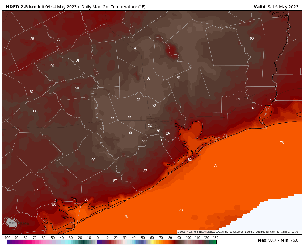
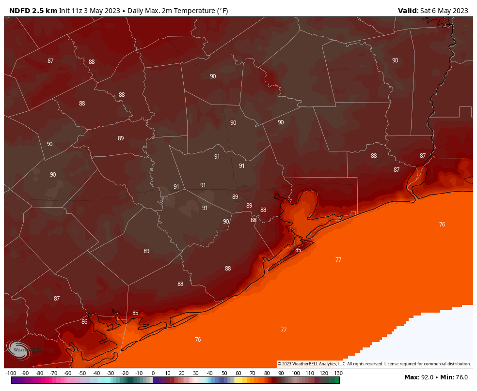
Friday, Saturday, and Sunday
Atmospheric moisture levels will surge this weekend, which could set the stage for even more widespread rainfall. However, whether this transpires will depend on the upper-level atmosphere and whether we see a robust low pressure system drop down toward Texas. So for now the weekend forecast ranges from somewhat wet—scattered, on and off showers—to downright wet with fairly widespread showers and the threat of heavy rainfall. I don’t have enough confidence to make the call yet, but I do know the air is going to be muggy, and we should see highs in the mid- to possibly upper-80s—the warmer temperatures would come in the scenario with less rainfall.
Next week
After the potential for more rainfall on Monday, most modeling suggests rain chances will die down somewhat for next week. It’s possible that some sort of weak front pushes through in about 8 to 10 days, but that’s not something I’m going to bet the farm on.