Expect a weak front this week, and some glimmers of hope on the horizon

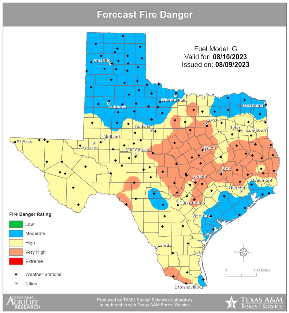
Good morning. It’s been a long, blistering hot, and largely rain-free summer in Houston, but we’re probably through the worst of it. Several readers have emailed in to ask for a comparison to 2011, and to put this summer’s heat into perspective, and we’re going to do that. But the proper thing is to probably wait until the end of August for an apples-to-apples comparison. A lot of that year’s heat was really baked in during August.

So, on to the forecast. This week is still going to be hot, but there’s a slightly twist. There will be a modest reprieve mid-week with some drier air that you won’t want to miss. And looking ahead to next week, things may really start to change a bit and bring us out of this scorching pattern.

Yes, those are non-extreme wet bulb globe temperatures in the forecast. (Weather Bell)

Monday

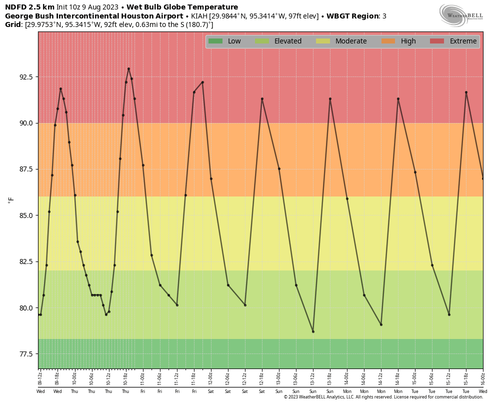
Well, sorry, but today is not going to yield much change. We are again looking at high temperatures of around 100 degrees, plus or minus, with sweltering humidity. Winds will be slight, generally from the southwest, at 5 to 10 mph. Rain chances are about 10 percent, so not impossible, but if you get a pop-up shower you should definitely go out and play the lottery. Lows tonight drop to around 80 degrees as winds pick up some.

Tuesday

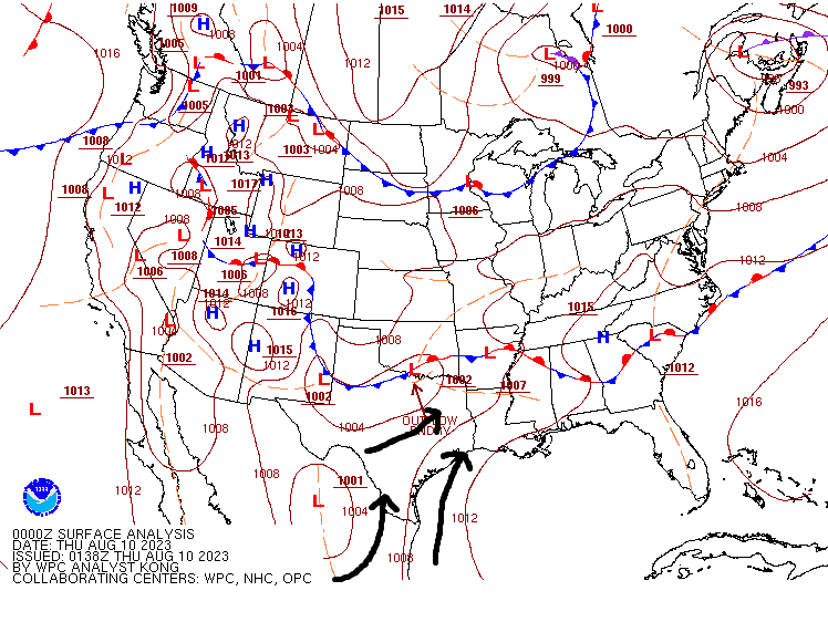
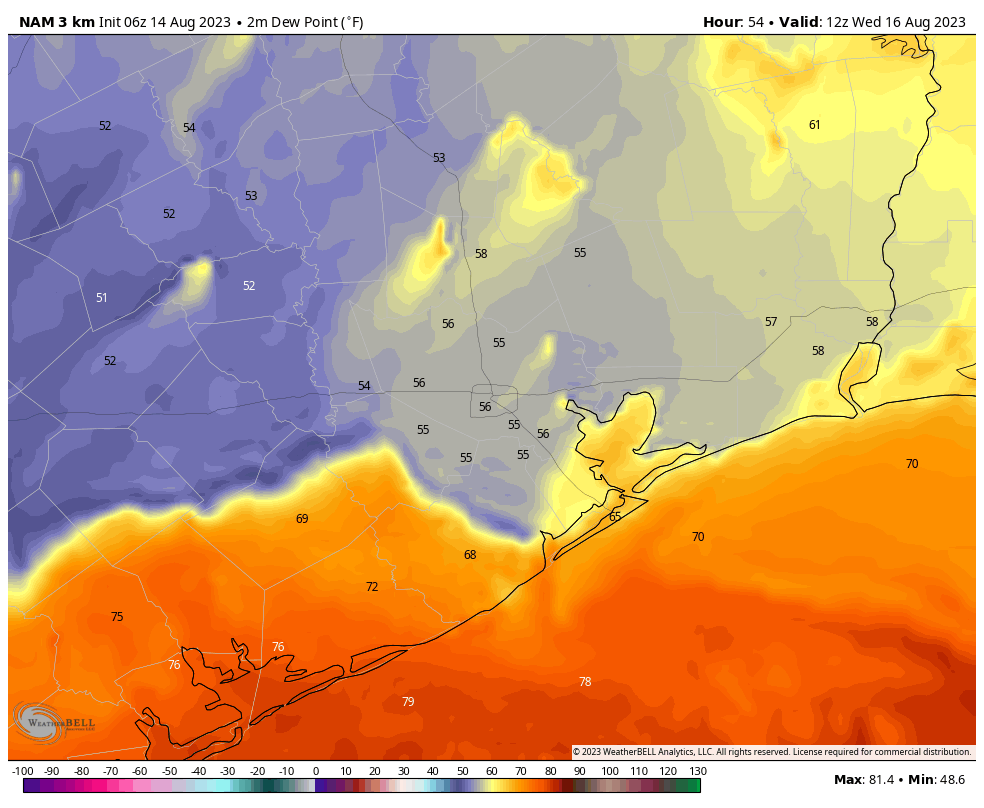
A honest-to-goodness cool front is going to arrive on Tuesday, but you really need to set your expectations accordingly. One, it’s mid-August, so there is no much (any) oomph in terms of cooler air. In fact, highs on Tuesday are going to be just as warm as Monday, in the low 100s with sunny skies. However, there will be drier air, with dewpoints dropping into the mid-50s on Tuesday night. The real question is just how far the dry air gets. I don’t think it will drop all the way to the coast, as the front itself will likely get hung up between the coast and Interstate 10. The forecast map below approximates the extent of the dry air.

In terms of wanting to “feel” a change in the weather, your best bet is probably around sunrise on Wednesday morning. Stepping outside won’t exactly feel refreshing, but at this point it’s going to beat the heck out of what has come so far this summer. Lows on Tuesday night will drop into the upper 70s for the most part.

Here is the dewpoint forecast for 7 am CT on Wednesday morning. It offers a good approximation for how far the front with its modestly drier air will reach. Dewpoints in the 50s will definitely feel less humid. (Weather Bell)

Wednesday

As noted above, this day should start with drier air for most of the region, and this will linger into the daytime. Expect highs of around 100 degrees, but at least you can act smugly like an Arizonian, and tell your friends, “At least it’s a dry heat.” Which it will be. Sort of.

Thursday and Friday

Alas the dry air will be fleeting, and we’re going to see the return of more humid days with highs in the low 100s.

Saturday and Sunday

The weekend looks hot and sunny as well. At this point rain chances are probably in the 10 to 20 percent range.

Next week

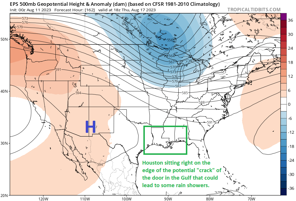
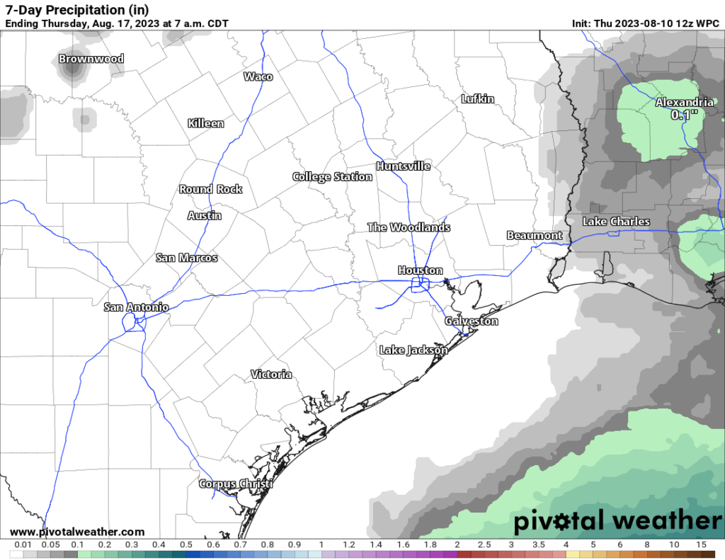
I almost hate to write this, because I don’t want to jinx things. Overall, the pattern shows some relaxation in high pressure next week, and the opening of the door to an atmospheric flow more favorable to rainfall. Right now these rains look most likely in the Monday through Wednesday time period, but because we’re just more than one week out from this, it’s difficult to put much definition on it. So I have some hope right now, but I don’t have details. But goodness knows we need some rainfall so I’ll be keeping tabs on this.

Entire Houston area officially in drought, as we dig for glimmers of rain chances

Yesterday’s drought monitor report was pretty much what you’d expect for the Houston area. Drought coverage doubled in size from half the region to the entire region. Severe drought quadrupled from just over 10 percent coverage to over 40 percent coverage, basically along and to the right of Highway 59.

Drought coverage has taken hold of the entire Houston area. (US Drought Monitor)

We’ve seen burn bans expand this week, and I believe we’re getting closer to seeing more water restrictions and conservation measures take hold across the area. Tomball entered that category this week, and I assume other subdivisions and communities are just about there as well.

Wildfire risk remains high to very high over much of the area today and again tomorrow. We may see some modest improvement in that next week with slightly less wind. That would help (though the breeze has certainly helped make the evenings a bit more pleasant at least!).

Wildfire risk remains high to very high today and tomorrow in the northern half of the Houston area. Hill Country is seeing “extreme” fire danger. (Texas A&M Forest Service)

So, today let’s focus on the chances we can maybe, possibly, potentially, perhaps, conceivably see some rain chances next week.

Today through Tuesday

Sunny, hot, breezy this weekend but a bit less next week, and highs in the low-100s and lows near 80 or in the low-80s. Each day. Today through Tuesday. Excessive heat warnings and/or heat advisories will be likely every day.

Yesterday was our 12th straight 100 degree day, as we hit 103° at Bush Airport. That’s Houston’s third longest streak on record. The next one to catch will be 14 straight days, set in 1980. The top streak of 24 days from 2011 will be challenging but the chances of eclipsing it surely are a good deal greater than zero. We still lag total 100 degree day records by a lot, however.

Beyond Tuesday

A lot of y’all have said our reports this week have been downright depressing. They have been! We’ve always promised honesty with you, and there’s been little sign of any real rain or “less hot” weather. So here’s the deal. I want to be optimistic about mid to late next week and some (modest) rain chances. But we’ve seen this happen more than once this year, where modeling sort of relaxes the pattern for a period and then it comes roaring back. So here’s our hint of optimism, but in reality, I would not be out buying umbrellas.

High pressure over the next 5 days is going to anchor near or over Texas. But after about next Tuesday, the high retreats into the Southwest as a pretty aggressive trough digs into the Great Lakes. This “weakens” the ridge over Texas some. By next Friday, any goodwill we have garnered is gone and it’s back to heat, but for those few days at least we might weaken things enough to at least allow for sea breeze showers each afternoon. Here’s a forecast upper level map on Thursday afternoon.

With Houston sitting right on the edge of a potential “weakness” between a ridge in the Southwest and the one east of Bermuda next Thursday, maybe that opens the door for lower-end rain chances next week. MAYBE. (Tropical Tidbits)

That’s only going to give us about a 20 to maybe 25 percent chance of afternoon showers. But that’s about 20 to 25 percent higher than right now. So I want to be realistic about the chances of any change (which is to say, it’s quite low), but I also want to try and keep us somewhat positive! We’ll see how this holds up over the weekend. Meanwhile, please stay cool and hydrated this weekend!

Southeast Texas continues to roast with no end in sight

The excessive heat warning is back for most inland counties in the Houston area, including Houston-proper, with high temperatures expected firmly above 100 degrees. Yesterday was 101 at both Bush and Hobby, but yesterday was also notable in that the 83 degree low temperature at IAH matched our warmest low of 2023 and ties with 10 other dates for the second warmest low temperature on record there.

Additionally, Eric noted that yesterday would be a bit breezier, and it was. I was out on the east side of the region for work, and I have to tell you, those onshore winds were ripping. Hopefully that provided a little relief in spots. With high pressure sitting over us, and a stalled out front across the Red River, we actually are ending up in a situation that’s a little reminiscent of springtime, albeit with August temperatures. Low pressure formed over northwest Texas, and the gradient (or difference in pressure) between that low pressure and surface high pressure off to our south and east has led to windier conditions than we’ve seen in some time.

Southerly winds were ripping on Wednesday thanks to a tighter pressure gradient than we’ve seen over our area in a minute. (NOAA)

For Bush Airport, yesterday was the windiest day (based on average wind speed) since May 12th!

Factor in winds and drought and dry air during the afternoons, and we continue to have a high risk of wildfires across a large chunk of Texas, including the Houston area. We’ve seen some sudden and erratic fire behavior at times from new starts in central Texas as well as in Louisiana. Today’s fire outlook from the Texas A&M Forest Service continues to show high or very high risk of wildfires in the northern half of the Houston metro area. Please use extreme caution across the entire area. The last time it was this windy in the area, the soil had a good deal of moisture. Things have really dried out since.

Fire danger today is in the high to very high category across the northern half of the Houston metro area. While risk is lower elsewhere, given the strong winds at times, please be extremely cautious. (Texas A&M Forest Service)

As far as the weather goes, it remains a pretty easy forecast.

Today and Friday

Sunny, hot, and breezy with highs in the low-100s and lows in the low-80s.

Saturday and Sunday

Sunny, hot, and breezy at times, with highs in the low-100s and lows in the low-80s.

The 7-day rainfall forecast from NOAA shows nada; absolutely zero relief. (Pivotal Weather)

Monday and Tuesday

Sunny and hot, with highs in the low-100s and lows near 80 degrees.

There is nothing in our models right now that makes us optimistic for a change in our pattern over the next 7 to 10 days. The good news is that one day it will change. We just can’t tell you what day right now.

In all seriousness, please take it easy and check on vulnerable friends and family. And once again, please use caution with respect to fire danger. Wildfire risk has not been to this level of seriousness in these parts of Texas since 2011.

At least there’s this: We have finally passed the peak of summer

I’m going to be real up front. The Houston-area forecast calls for more of the same very hot and sunny weather, with a lack of rain, through the middle of August. So at this point of the summer we’re grasping at straws. The one hopeful bit of news I can offer is that, on Tuesday, the Greater Houston region passed through the climatological midpoint of summer. Quite simply, this means that historically yesterday was the hottest day of the year.

Most of the Houston passed its climatologically “hottest” day of the year on Tuesday. We’re now (slowly) rolling downhill toward fall. (Brian Brettschneider)

That does not mean our weather is going to change right away, it really just means that we are headed in the right direction toward fall. We are about one month away from being able to realistically start looking for our first fall front. Typically this comes at some point during the second half of September, but this varies widely. Anyway, if you’re tired of the unrelenting heat, just know that it will eventually relent.

Over the last couple of days we have also been talking about increasing wildfire risk. In recognition of this, both Harris County and Fort Bend County issued burn bans on Tuesday. The burn ban, essentially, means that no outdoor burning is allowed, except in an enclosure that contains all flames and/or sparks. At this point all of the Houston region’s counties, with the exception of Brazoria County, are under a burn ban. Expect these to remain in place at least for a couple of weeks, if not longer.

Wednesday

Excessive heat remains the name of the game for the greater Houston area. High temperatures today will reach about 100 degrees in Houston, with slightly higher conditions for inland areas, and slightly cooler nearer the coast. The only really noticeable change has been somewhat stronger daytime winds, up to about 10 mph from the south, with higher gusts. Skies will, of course, be sunny, with a less than 10 percent chance of rain. It is the same as it has been since the start of August.

Thursday and Friday

More of the same.

Saturday and Sunday

With high pressure remaining in place, there really is little change. If anything, temperatures may tick up a degree or so this weekend. So, super hot.

Our afternoon heat will remain at extreme levels through the weekend, at least. (Weather Bell)

Next week

The early part of next week should bring more of the same. Realistically, we don’t have much hope for a pattern change for at least the next 10 days. After that there are some hopeful signs in some of the models, in terms of potentially better rain chances and somewhat cooler days. However I have to be honest, the current pattern is pretty well locked into place.

The tropics

We have not written much about the Atlantic hurricane season because there has not been much to say, and certainly no threats to the Gulf of Mexico. That continues to be the case, but we’re reaching the point where we can start to expect some uptick in activity in the Atlantic basin. If you want all of the nitty gritty, daily details, be sure to check out our sister site, The Eyewall.