After a pretty nice weekend—Sunday morning’s showers aside—our weather will turn warmer and more humid this week before a strong front arrives before next weekend. We’re not looking at anything too extreme, but we can definitely anticipate some showers and thunderstorms on Thursday and Friday.
Monday
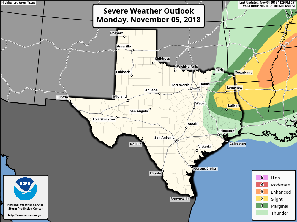
The weak cold front that pushed into the offshore waters on Sunday is moving back onshore today, and we’ll feel that later this afternoon in the form of stronger southerly winds and rising humidity. Expect highs in the low 80s, with mostly cloudy skies. A word of warning if you’re traveling up into east Texas or Arkansas today, as that area faces the potential for some severe weather due to a separate frontal system. Rain chances should be near zero in the Houston metro area itself.
Tuesday
Another warm day, with high temperatures in the low to mid-80s, depending upon the extent of afternoon sunshine in your area. Highs will probably be 8 to 10 degrees warmer than normal for this time of year, but the heat won’t last too long. Rain chances will be in the 10 to 20 percent range.

Wednesday
Another day in the low- to mid-80s for Houston, but a weak cold front should push into the area later in the day. This will bring a healthy chance of showers (40 percent inland, 60 percent closer to the coast), especially as the front nears the Gulf of Mexico where moisture levels are highest. Accumulations shouldn’t be too significant.
Thursday and Friday
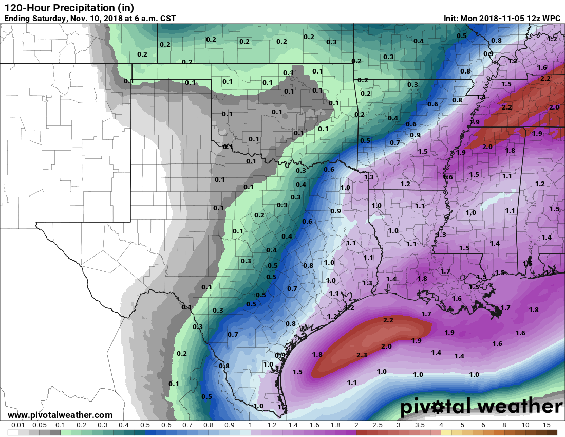
This will be another one of those fronts that kind of gets hung up along the coast, so we won’t see significant cooling from it right away. Thursday will probably see highs in the mid-70s. However, the upper level pattern will eventually push the front well offshore, and this process should also produce some widespread showers and possibly thunderstorms. Rain totals probably will range from 1-2 inches, so we don’t anticipate any flooding problems.
At this point the best chance of rain comes Thursday night into Friday morning, but the details are still a bit fuzzy. On Friday highs are unlikely to rise much above 60 degrees, with mostly cloudy skies.
Saturday and Sunday
The weekend looks chilly but clear. Both days should see highs in the 60s (Saturday might remain in the upper 50s for inland areas) with nighttime lows in the 40s for inland areas ranging to around 60 degrees right along the coast.
Severe weather? Looks like LA + AK + MS are expecting a significant avocado. Let’s make guacamole!
Just kidding! Thanks for all your work to manage our weather expectations. Our family starts our day at your site nearly everyday.
Thank you so much, Robin!
Mosquito season seems to be getting longer and longer…boo.
Thank you so much, as always, for your wonderful reporting. I am getting married this Saturday (early evening), and we hope to have an outdoor ceremony. So far, sounds like we will probably have clear skies?
That 10-20% chance of rain got me absolutely soaked in a five minute downpour today while block walking in Old Spring Branch. I found cover but I was already drenched. So it goes…
I’d say that’s a good an example of the excellent caveat this site regularly provides, forecasts of precipitation are extremely difficult to predict in terms of area and intensity.
Thanks, as always, for your excellent site!
Why are the early forecasts (2-3 days out) on rain associated with fronts significantly underestimating the rainfall on a consistent basis? This past Halloween was supposed to get a couple hour window of rain, but instead it rained almost all day.
I think that was a couple hour window of little to no rain.
Just curious if we know if winter will actually be wintery (i.e. in the 60s)
Next week will be wintery! Not sure about winter overall.