Good morning. The forecast for the Houston area remains more or less on track, with a warming trend through the weekend followed by some sort of front, and maybe some rain, on Monday or Tuesday of next week. I don’t want to make too much about the rain chances early next week—as some recent rain events have underperformed—but I am cautiously optimistic about what’s ahead.
Thursday
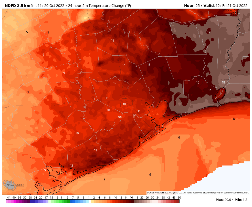
This will be our last cold morning of the week, with most of the area in the 40s. However change is afoot as high pressure moves off to the southeast, and our northerly breezes are replaced by a southwesterly flow. As a result highs today will be quite a bit warmer, reaching the low 80s, beneath mostly sunny skies. Winds will be out of the southwest at 5 to 10 mph. Lows tonight will drop to around 60 degrees in the city of Houston, with cooler conditions further inland.

Friday
A warmer day still, with highs in the mid-80s beneath mostly sunny skies. Overnight lows will only drop into the mid-60s. There will still be a modicum of drier air, but it will gradually be blown away.
Saturday and Sunday
The weekend still looks warm, with highs in the mid-80s, and for some inland locations possibly the upper 80s, to go along with partly to mostly sunny skies. Humidity levels will be on the rise, but we’re not going back to summertime humidity. Overnight lows are unlikely to drop out of the 70s. Rain chances are not zero this weekend, but they’re probably on the order of 10 percent. So near enough for most purposes.
Next week
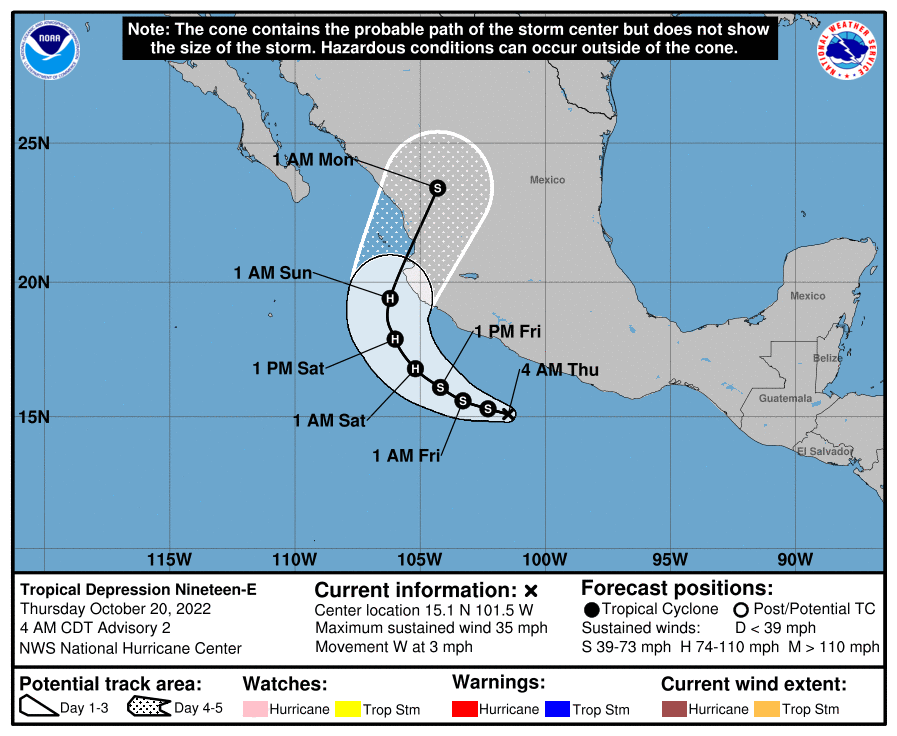
The big uncertainty in the forecast concerns the details of what happens next week. There remains a pretty large discrepancy in terms of the timing of the front, and that is important for determining our rain chances. Essentially, a Pacific Hurricane will be moving into Mexico this weekend, and it will push a large amount of moisture into Texas on Monday. If the front makes it through on Monday night or early Tuesday, it will synch up with this moisture and produce a decent amount of rainfall, perhaps 1 to 2 inches.

However, if the front is later on Tuesday or Tuesday night, it might miss this slug of moisture, and our rain chances and potential accumulations will be less.
Broadly speaking, most of next week and weekend do look cooler as not only are we getting some sort of initial front, but a secondary push of cooler air is expected later next week. So probably we’re looking at an extended period of highs in the 70s and lows in the 50s and 60s. It should be rather fall-like and nice if it all comes together.


Are there any risks that if the front and the moisture from the TD link up, there will be more significant rain… like widespread flooding? I’ve learned to be wary of the chaos that results from two or more rainmaking events happening at the same time.
Looking forward to the Wings Over Houston weekend forecast!
every rain predicition this year has “underperformed” give it up
You can’t spell and you are a whiney baby. I bet you’re a Yankees fan born sometime between 1946 and 1964.
Appreciate your forecasts, Eric! Is there a reliable source for wind direction/blooming that affects allergies (ragweed in particular)? Thx
I was told we weren’t going to see 90 again
We are going to see 90 again, aren’t we 🙁