The Houston region will enjoy one more sunny day before a three-day period in which we should see rain return to Houston, including the possibility of some intermittent thunderstorms before a cold front clears us out for next week.
Thursday
A pleasant, partly sunny day with highs in the mid-80s. We can’t rule out some scattered showers to the west and southwest of Houston, but I expect most all of the region to remain dry. After several cool nights, lows Thursday night probably won’t reach below 70 for most of the metro area.
Friday
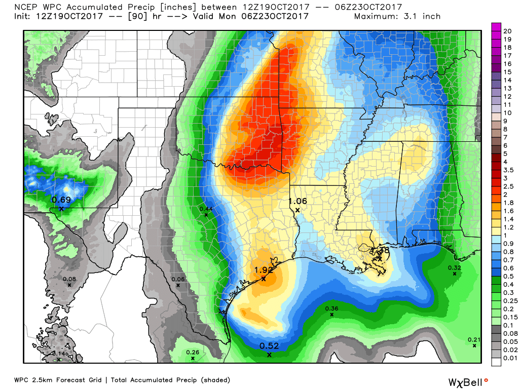
The combination of rising moisture levels and lower pressure in the upper level atmosphere will create favorable conditions for rainfall on Friday. We’re certainly not looking at anything extreme, as I think most of the region will see between 0.25 and 1 inch of rainfall on Friday. However, some of the showers could briefly pulse up to some heavy rainfall, so if you’re caught out in one of these take care. Clouds should limit highs to the low 80s.

Saturday
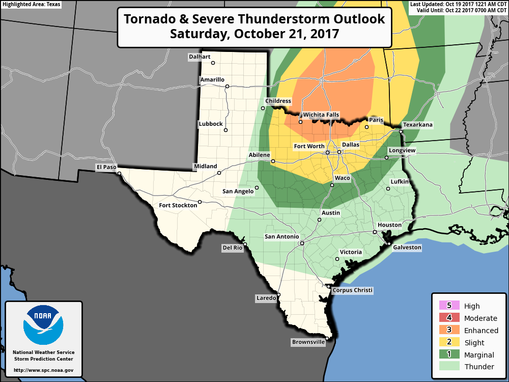
A fairly strong upper-level storm system will move down into the plains, including north Texas by Saturday. This could set the stage for severe thunderstorms and tornadoes well to the north of the Houston area, as shown in this graphic from NOAA’s Storm Prediction Center.
However, for Houston, I suspect we’ll see a partly sunny day with only scattered rain chances. Certainly some parts of the city will see a few tenths of an inch of rain, but other parts will remain dry. Bottom line, if you’re planning an outdoor activity for Saturday, not all hope is lost at this point.
Sunday
A cold front will move through Houston on Sunday, and appears likely to bring a line of thunderstorms with it. I’m still not particularly confident about whether this will happen in the morning or afternoon hours, but the front will move through, and set the stage for some pretty nice weather. Lows Sunday night should cool into the upper 50s, at least, for most of Houston except the coast.
Monday and beyond
The forecast for most of next week looks fall-like, and great. The details are still a bit fuzzy, but I think we’ll see several days with highs in the 70s, and lows in the lower 50s toward the end of the week. The latter should occur when a reinforcing shot of cooler air moves down into Texas by Tuesday or so. I do love me a good reinforcing cool front.
It’s always cool EVERY WHERE except for the coast…. but at least it’s not 90 and I can finally drive around with the top down!
Eric…..What caused all the heavy rain early Friday morning during the nite??? Upper level low??? Thanks Darrell