In brief: Today we discuss a bit about yesterday’s wider spread rain than expected in parts of the Houston area. A few additional storms are possible today before the heat parks itself back over Houston for much of next week.
Bertha recap
In terms of wind, Bertha was a nothingburger in Houston, as expected. In fact, I don’t believe any coastal location gusted much above 35 mph yesterday. In terms of rain, Bertha did overachieve in a chunk of the Houston area.
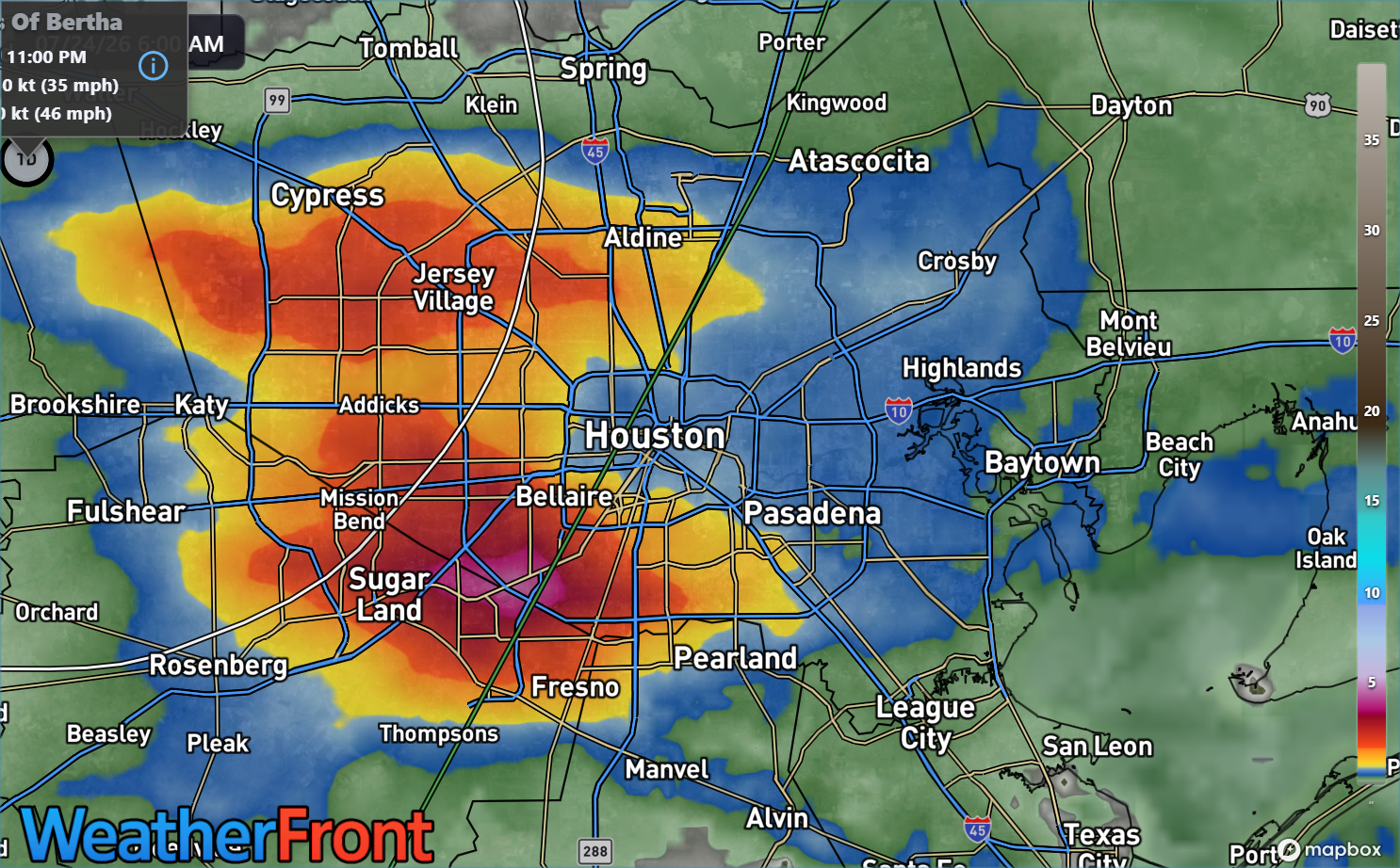
In Missouri City, several locations right along 90A picked up over 5 inches of rain which led to some rapid onset flash flooding. That extended back into Sugar Land as well. Meyerland saw about 3 inches of rain. Downtown Houston saw about 0.75″ of rain. In hindsight, while we mentioned that brief torrential rain was likely in spots yesterday afternoon, a Stage 1 flood alert probably would have worked best. It seemed as if the heaviest downpours would move fast enough to avoid that. Instead, everything congealed over Houston for a couple hours, and we got the above. While the tropical storm aspect of Bertha mostly did what was expected, the rain part remains a challenge.
Bertha’s remnants are passing southwest of San Antonio today, and they will continue through Mexico today and this weekend.
Today
A few showers or a thunderstorm are likely today across the area, with some onshore flow trailing Bertha. Atmospheric moisture levels are still pretty high, though decreasing. Still, that could mean again some locally heavy downpours this afternoon. Otherwise, look for highs in the mid-90s with sun and clouds.
Weekend
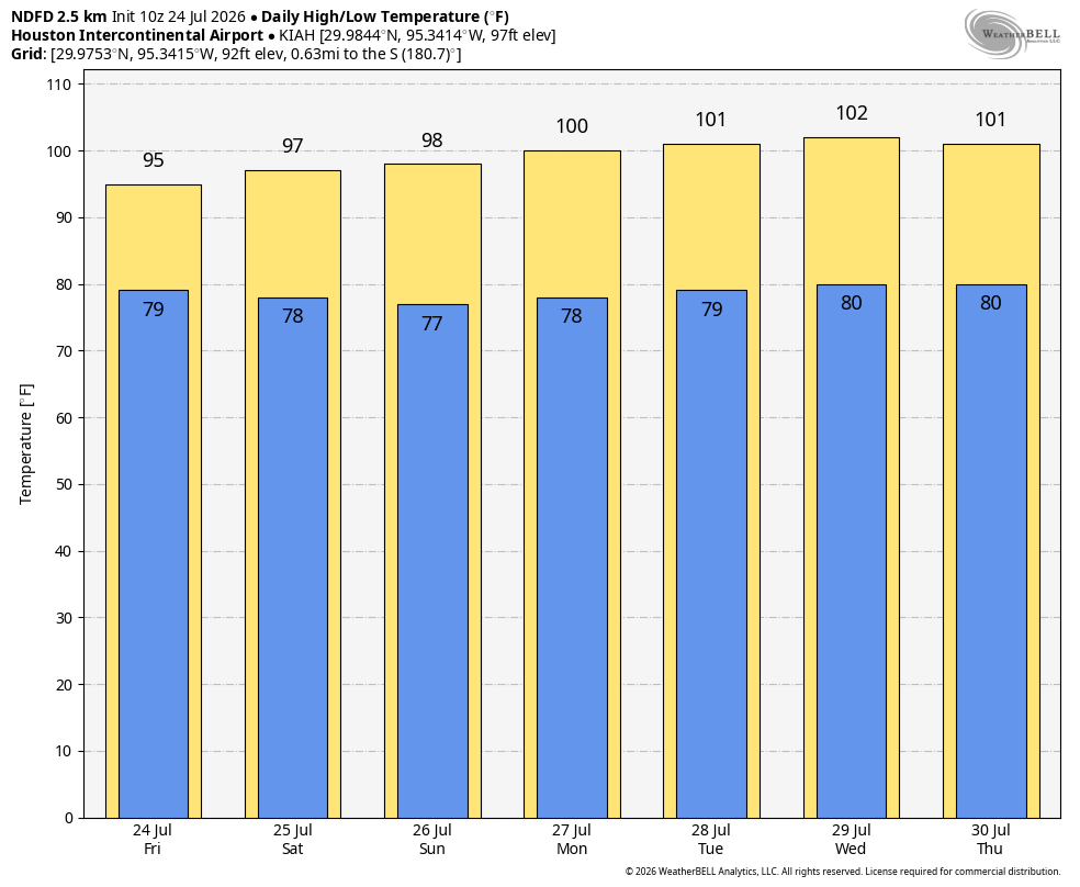
Saturday looks dry and hot with mid to upper 90s. Sunday should be similar, but there will be a slight tick up in available moisture for a few showers. So don’t be shocked to see that happen in a few spots.
Next week
Temperatures are going to surge once again next week back to near 100 degrees. Wednesday or Thursday should be the peak day, with highs around 101 to 103 in Houston. Rain chances will be shelved for the most part through Wednesday, but a backdoor front, sort of like what we saw on this past Wednesday evening could try to sneak through and provide a chance of storms either Thursday or Friday evening.
Slightly “less hot” weather is likely after Wednesday or Thursday, but we’ll watch trends through the weekend and update you on Monday.
