In brief: In today’s post we take stock of the good news, and the bad news about Houston’s weather so far this summer. Also, we look ahead to a blazing hot week. And we do mean blazing. Stay cool, y’all!
First, the good news
There are many ways of defining summer. Meteorologically, it lasts from June 1 through August 31. Practically, in Houston, it runs from mid-May through September. However what’s clear is that we are now a little more than half-way through summer. Plausibly, we are as little as six to eight weeks away from the first cool front of fall.
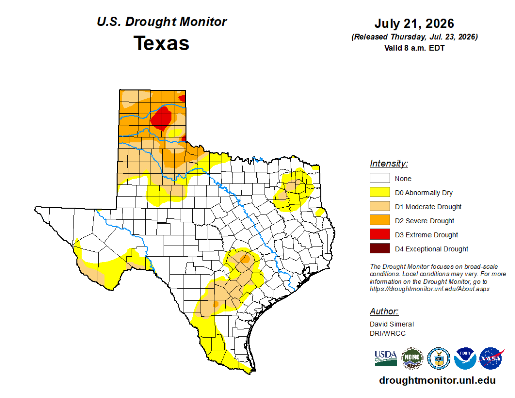
To date this summer has not been extraordinarily hot; rather we have been pretty much spot-on with normal temperatures for June and most of July. And finally, the greater Houston area (and much of the state of Texas) are drought free. This is often the season when droughts are typically blooming, but not this year. So all in all, so far this summer, we are doing pretty well.
Now, the bad news
I started this post with some positivity because, for most people, we are about to begin the grimmest time of year. August, the region’s hottest month, is days away. The next two weeks are, historically, the very warmest period for the city. And we are expected to have warmer than normal temperatures for at least the next week. So yeah, prepare to sweat.
The other thing is that we are nearing the height of hurricane season. For Texas, the peak lasts from mid-August through late September. So it is about time to buckle up. Crazily, the first two named storms of the season—Arthur and Bertha—both passed over the greater Houston area. Neither had super significant effects locally, but both were rainmakers for some parts of Texas and Louisiana. I have to tell you, we don’t want named storms hitting near us in August or September, when stronger storms are likely. Fortunately the next week or two, at least, things look quiet in the Gulf.
Finally, a word of thanks
I rely on a lot of people here at Space City Weather. We also have a great, long-term partner in Reliant who helps us keep the lights on. But most important of all is Matt Lanza, who stepped in last week to handle the site while I was on vacation, and wound up covering a low-end tropical storm. I take one week a year fully off from the site to recharge, and it happened to be last week. Thankfully we all survived and I’m back and in the saddle, ready for whatever the coming weeks will bring. Hopefully nothing of consequence!
Monday through Friday
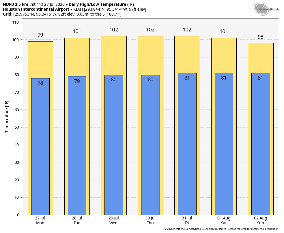
This week is going to be downright hot. The reason? High pressure is in place, and at least through the work week it’s not going anywhere. For much of Houston that will mean high temperatures in the vicinity of 100 degrees, with overnight lows only falling to around 80 degrees. Coastal areas will see daytime highs a few degrees cooler. In terms of humidity, you guessed it, days and nights will be sticky. Skies will be mostly sunny. Rain chances will be near zero. And that, my friends, is pretty much all there is to say about this week’s forecast.
Saturday, Sunday, and beyond
Is the high pressure system going to move away? Most of our best medium-range models indicate that there is a chance of change this weekend. Highs may drop a few degrees, and rain chances may rise to the 30 percent range (or higher). Next week also looks slightly cooler, but perhaps that’s only because the coming week looks so dang hot.
