Good morning! Whether you’ve been up all night shopping, up all night waiting on shoppers, or you sensibly just slept off a tryptophan high, welcome to the day after Thanksgiving. We’re now in the midst of the holidays, and our weather will get off to a good start. We’ll have a seasonably warm weekend, and then winter-like weather during the week ahead. We should remain sunny for most of that period.
Friday
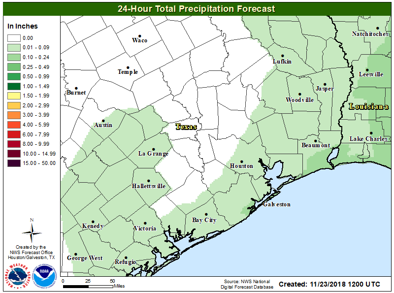
A low-pressure system along the coast and an onshore flow will combine to bring some lower-end rain chances into the region today—probably no more than 20 to 30 percent. These showers will move east by around noon or shortly thereafter, and accumulations shouldn’t be much to write home about. Mostly cloudy skies will limit highs to around 70 degrees. A weak front will arrive later this evening, or tonight, but the atmospheric profile does not favor any additional rain with this front, and it just should bring a wind shift (from the north) into Saturday morning.
Saturday
This still looks like a great day for anything you have planned outdoors. Friday night’s front will eventually wash out, but it should bring enough dry air to make for a pleasant, not too humid day in the mid-70s, with mostly sunny skies.

Sunday
Temperatures on Sunday will depend upon your location, as a stronger cold front should sweep through the region roughly between about noon (for northwestern areas) and sunset (for coastal areas). For the city and coastal areas, I’d expect another partly sunny day with highs in the low- to mid-70s ahead of the front. This looks like another dry passage, with fairly low moisture levels not supporting rainfall. Lows Sunday night will plunge back into the 40s for most everywhere except for immediately along the coast.
Next week
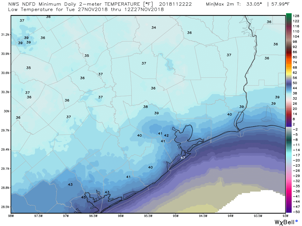
This front will have some staying power, leading to several sunny and cooler days to start the work week. I’m not sure highs on Monday and Tuesday will climb out of the 50s, and lows on Monday night and Tuesday morning should dip into the upper 30s for parts of Houston (and definitely for areas well inland).
We’ll see a warming trend for the second half of next week, with the return of some rain chances by Friday or Saturday into the metro area. The forecast for next weekend is far (oh so very far) from certain, but at this point I would not have particularly high confidence in another partly to mostly sunny weekend.
So our advice is to get outside and enjoy this fine weekend.
This is the best, most comprehensive weather report I’ve ever read. I’m adding this to my home screen and thank you for that!!
Always straight to the point weather information. Love it!
I was reading this forecast at 12:06 pm on Friday when the sun peeked out at my house for the first time all day. Impressive timing, since you said the rain chances would move out at “noon or shortly thereafter.” 😉
What temperatures do you think I should expect at the Renaissance Festival near Magnolia on Sunday afternoon? How warm does my costume need to be? 🙂
Ugh, it got up to 77 yesterday here in my corner of league city 🙁 I thought we were done with this crap.