After a mostly pleasant holiday weekend, a cold front came plowing through on Sunday and has brought us back to early winter as we start a new week. The good news is that it won’t be too cold for too long, nor will we have a lot of significant weather to discuss this week. Let’s get into the details.
Today & tonight
We’re starting off chilly this morning. We didn’t drop below the mid-60s on Sunday morning. But this morning, temperatures running a good 20 degrees or more colder than 24 hours ago.
It will eventually be a nice day today, albeit cool and breezy still. There’s an area of cloud cover that will be moving through the region this morning. It could perhaps have some showers or light rain with it as it passes through.
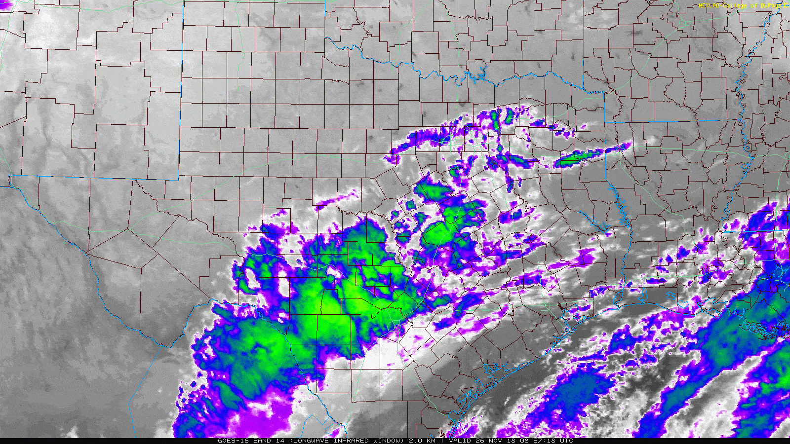
Once this passes by, we’ll see clearing this afternoon. So we’ll call it mostly cloudy with a chance of showers through about midday, then becoming mostly sunny. Winds will gradually subside through the afternoon. As long as skies clear out around midday, we should manage 50 degrees or lower-50s. If we stay locked in cloud cover into mid-afternoon, look for a struggle through the upper-40s.
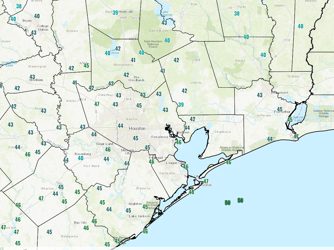
Clearer skies and lighter winds tonight will make it the coldest of the next several. Low temperatures will range from the low-30s north of Houston to the mid-to upper-30s in town and low-40s along the coast.
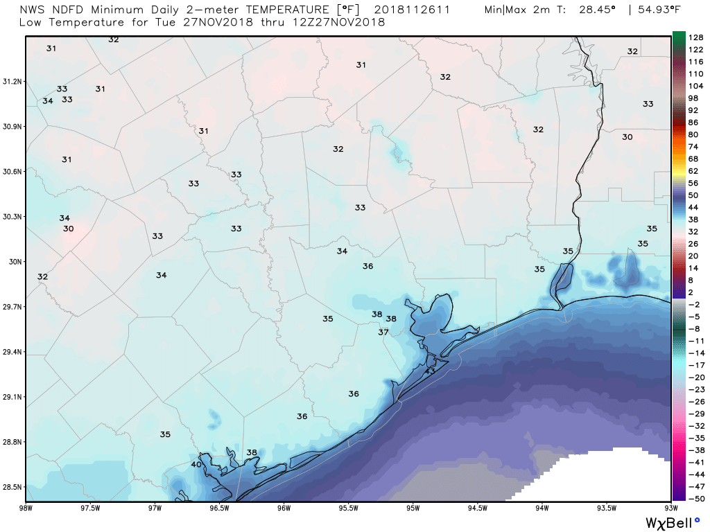
A light freeze is possible for places like Conroe or Huntsville tonight.
Tuesday
Look for another cool day Tuesday but with less wind and plenty of sunshine. We’ll do a few degrees warmer tomorrow than today, with highs topping off in the upper-50s.

Wednesday & Thursday
Wednesday should be a super nice day. We’ll be in transition between colder high pressure and the return of onshore flow. So it won’t be too cold, nor will it be humid at that point. It will start off cool once again, but instead of 30s, we should see mostly 40s in the area, with the exception of perhaps the far north extremes of the Houston area. Expect sunshine and high temperatures a good bit warmer than Tuesday. We should top off in the upper-60s to around 70 degrees in most spots.
That onshore flow will strengthen a bit more Wednesday night, when we won’t drop below the upper-50s. With it will come low clouds and milder temperatures for Thursday. We’ll call it partly sunny with 70s in much of the area.
Friday & weekend preview
After a bonafide blizzard yesterday in parts of the Plains and Midwest, another complicated storm system will begin to organize in the middle of the U.S. this weekend.
KC Snow recap:
– 5.8" of snow yesterday was a record for the date breaking the old record of 3.7 set in 1895.-It was the 2nd snowiest Nov day all time for KC behind the 9.1" in 11/29/1923.
-First time KC got 3+ inches of snow in 1754 days (a record by far)!
— NWS Kansas City (@NWSKansasCity) November 26, 2018
As it does so, we’ll probably see increasing humidity and winds on Friday off the Gulf, along with perhaps a few showers. I would expect a good chance for a period of showers or thunderstorms Saturday before another cold front plows through, bringing colder, drier weather for Sunday. We’ve got a few days yet to iron the specifics of this one out, but we are hoping for a 50/50 weekend right now. We’ll have more through the week.
This is cool, winter weather I can get excited about. Thanks Matt for all you do! I really appreciate your daily weather updates.
Our construction project has been delayed since September because of rain. We need about 2-3 weeks to dry out. What are the chances we see 2-3 weeks with little to no rain any time soon?
A 2-3 week stretch of dry weather is going to be hard to come by I think. At least things should slow down a little this week…it’s a start.
So I guess it’s looking like typical weather in Galveston for Dickens on the Strand this weekend – really nice one day; really nasty the other.