A cold front is moving through Houston this morning, and this will bring much drier air into the region through Saturday. Then, our roller coaster continues with temperatures on the upswing through Wednesday of next week before a series of cold fronts cool us back down again. In terms of precipitation, there’s not too much to write home about until at least early next week.
Thursday
There is a wide range of temperatures across our region this morning, with far inland areas dropping into the 50s behind the front, and coastal areas in the low 70s before its arrival. The front will be off the coast by 8 or 9 am CT this morning, with rapidly dropping dewpoints and brisk northerly winds heralding its arrival. Temperatures this afternoon will hold at about 60 degrees before dropping tonight into the low 40s in Houston, with colder conditions further inland. Gusty winds today should start to back off some overnight.
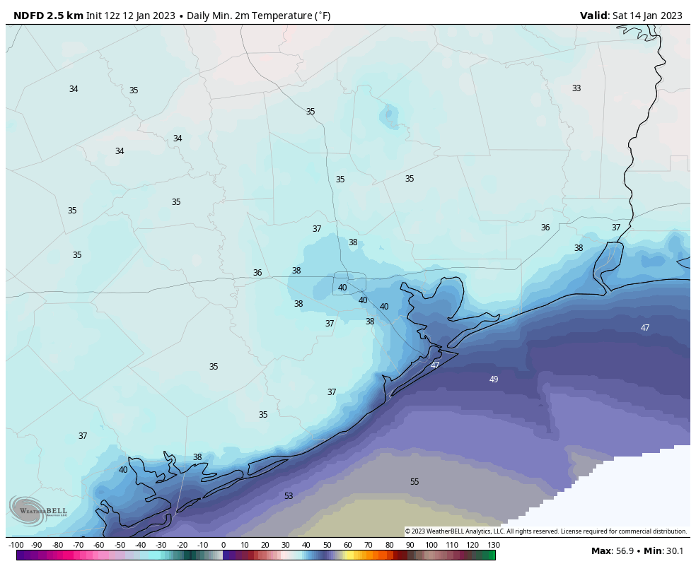
Friday
This will be a fine winter day, with high temperatures around 60 degrees, and moderate northerly winds of about 10 mph. Friday night will be the coldest of the week, with lows dropping to 40 degrees or so in Houston, and the mid- to upper 30s for outlying areas.
Saturday
This will be another sunny day, with highs in the low 60s. As winds turn more southerly, however, we’ll start to feel the effects of the onshore flow with a little humidity in the air, and warmer temperatures on Saturday night. Lows will drop to around 50 in Houston.
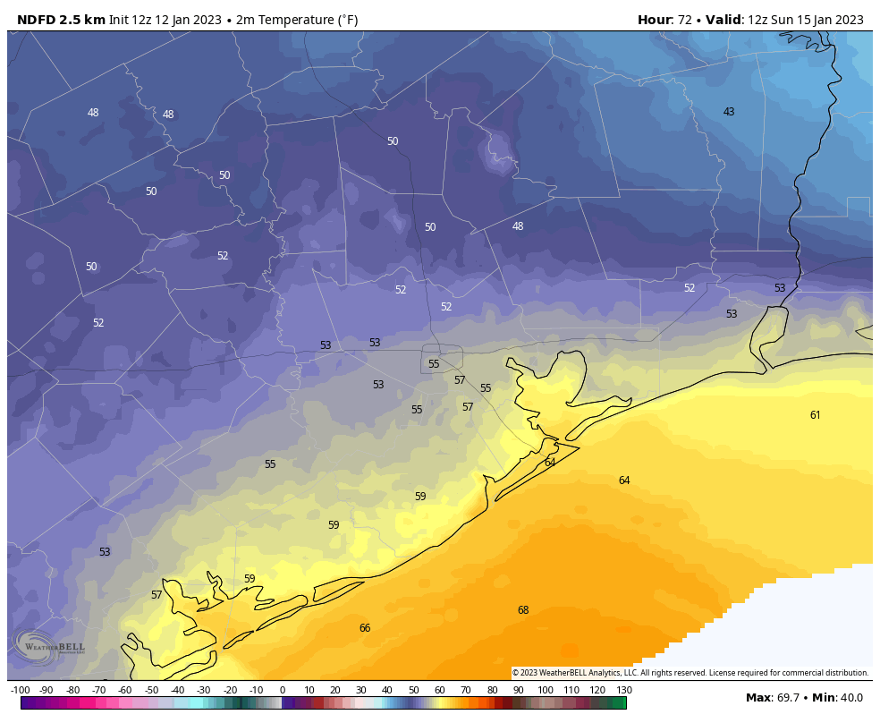
Sunday
A full on warming trend will be underway by Sunday. Start-line temperatures for the Houston Marathon will likely be in the mid- to upper-50s, climbing toward a high in the mid-70s with a decent amount of humidity. With increasing atmospheric moisture, I expect Sunday will be partly to mostly cloudy, but rain is not a concern. Winds may be a bit gusty out of the south, at 20 to 25 mph. Lows on Sunday night will only drop into the mid-60s.
Next week
This warming trend will persist through about Wednesday, with daily highs in the upper 70s to 80 degrees, partly sunny days, and warm nights. Some scattered showers are possible each day, but overall chances probably will be low until Wednesday, ahead of the next front. This first front should knock lows into the 50s, and models are hinting that an additional shot of colder air could be in the cards for next weekend, dropping lows into the 40s or possibly 30s. But that’s a long ways out for now, so we’ll just have to wait and see what unfolds.


Hello there! Thank you all you do! Been checking and rechecking the weather for Sunday in particular (starting line conditions and all) and noticed tonight that in the app, the 8 day outlook with highs and lows shows 75 as the high and 64 as the low…which doesn’t match y’alls actual forecast. data glitch? Thankfully its there for me written out 🙂