Look, it’s late October now, and it’s decidedly autumn. The weather and calendar this weekend are somewhat out of sync, but, you know, that’s to be expected this year. Anyway, the weather looks warm to hot in the coming days, but that will not stop us from celebrating the end of the extreme heat we all endured this summer. Please do join us on Sunday at the lovely McGovern Gardens in Hermann Park. It should be a good time. You can pregame with us before the Astros game 6 at 7 PM! Ain’t no party like a Scranton Space City Weather party!

Today
Friday will be one of those days where the right combination of ingredients comes together to potentially allow us to test records. Our official record high in Houston is 93° from 2004, and we currently have a forecast of 91° at IAH, where official readings are taken. Why? We’ll have a combination of an offshore wind, decreasing humidity, sunshine, and a relatively hot air mass in place. Drier air heats up more efficiently than more humid air, and thus we should easily make 90 or better today. Even though it’s cool this morning, you will want shorts this afternoon.
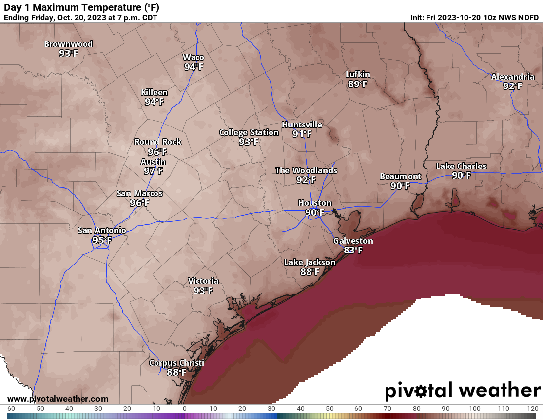
One other note: Today is also an ozone action day, meaning poor air quality so those of you that need to take precautions on those days should be exercising them today.
Weekend
Both weekend days should be fine with sun and clouds. Sunday may have more clouds than sun as the day progresses. Otherwise, look for a pleasant start to Saturday with 50s and 60s and generally low humidity. We’ll warm to 90 degrees or a touch hotter again. With clouds and increasing humidity on Sunday, look for a warmer morning with mid-60s or warmer, followed by a slightly less hot afternoon (mid to upper 80s). Saturday should see mostly light winds with a bit of a breeze out of the south on Sunday.
Next week
The forecast for next week will be dominated by a stalled out front over the Central U.S. and moisture being funneled up from the Pacific. The combination should produce locally heavy rain in interior Texas up through the Plains next week with several inches. Locally, the forecast is a bit trickier. With most forcing for storms off to our north and west, those areas may hog the majority of the moisture for most of the week, leaving us partly sunny and very warm and humid with just some scattered showers.
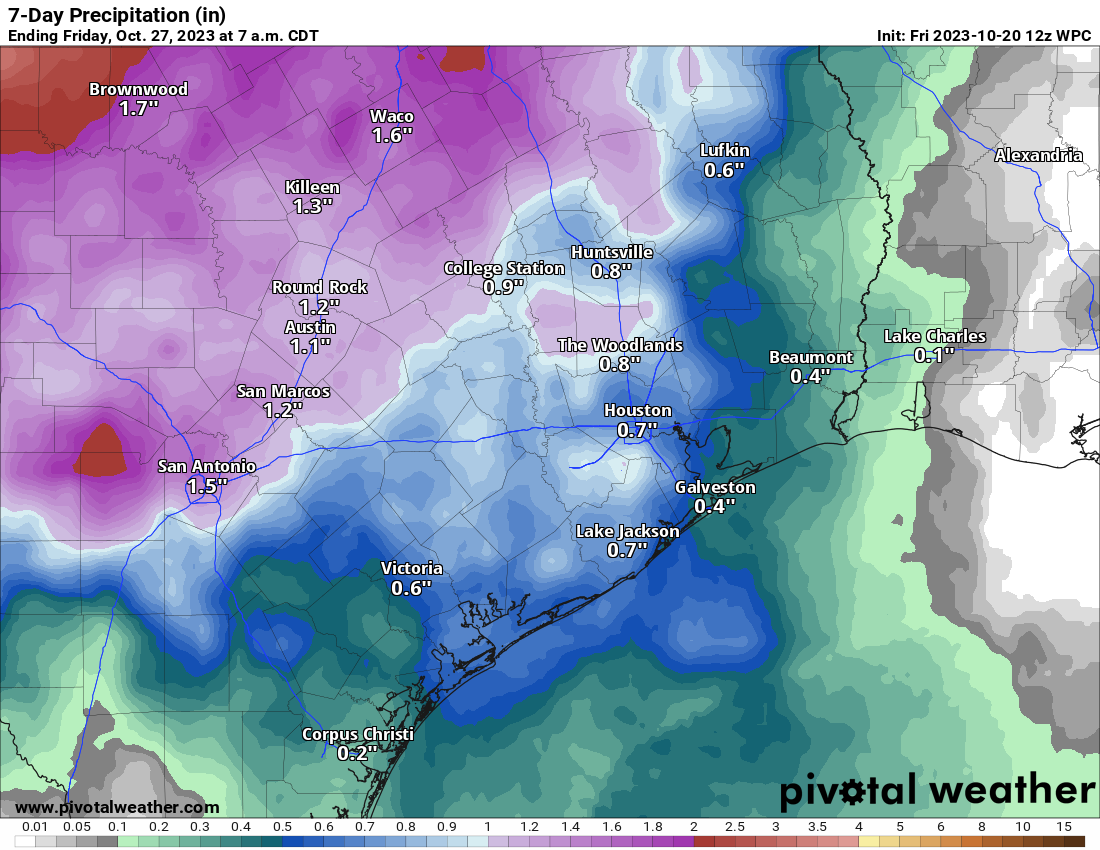
Basically, I would say to expect a couple periods of showers or storms next week, with the highest odds off to the north and west of the Houston area. But places like Abilene, Wichita Falls, and probably the DFW Metroplex would be more likely to see heavier, more organized rains next week. We’ll have more for you Monday!


Looking down the road a bit, it appears there’s better chances for Halloween to be sweaty vs chilly this year.
I teally hope you’re wrong about the rain coverage. 😕
In October 2004 there were several days of mid 90s and everyone was complaining. It was so unusual. (Haha Then on Halloween night a big cold front came and it went down in the 40s and it was Fall from then on. Can we have that again please?!
And just a couple of months later we had that miracle Christmas snow.
Disgusting
😀 “Scranton?” Northeast of the famous town of Wilkes-Barre, PA?
Personally I prefer Clark’s Summit PA
I grew up about 200 miles away in Baltimore. A brother had an Army friend from Wilkes-Barre, who later was a professor at Penn State. I think there’s still an underground coal-mine fire in the Wilkes-Barre area.
Shorts and tee shirts are out of the question because of the terrible mosquito infestation I’m having!