In brief: The track for Hurricane Beryl has shifted northward during the last 24 hours, and a landfall is now expected near or south of Corpus Christi. This does increase the threat of significant impacts to the Greater Houston area, but we continue to think the system will be mostly manageable locally. Needless to say we’re following things closely.
Hurricane Beryl track changes
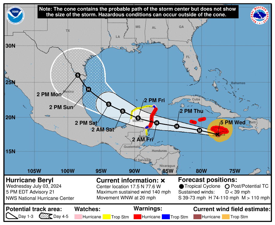
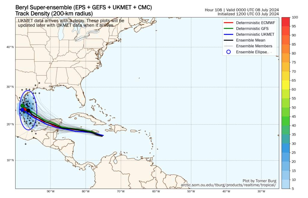
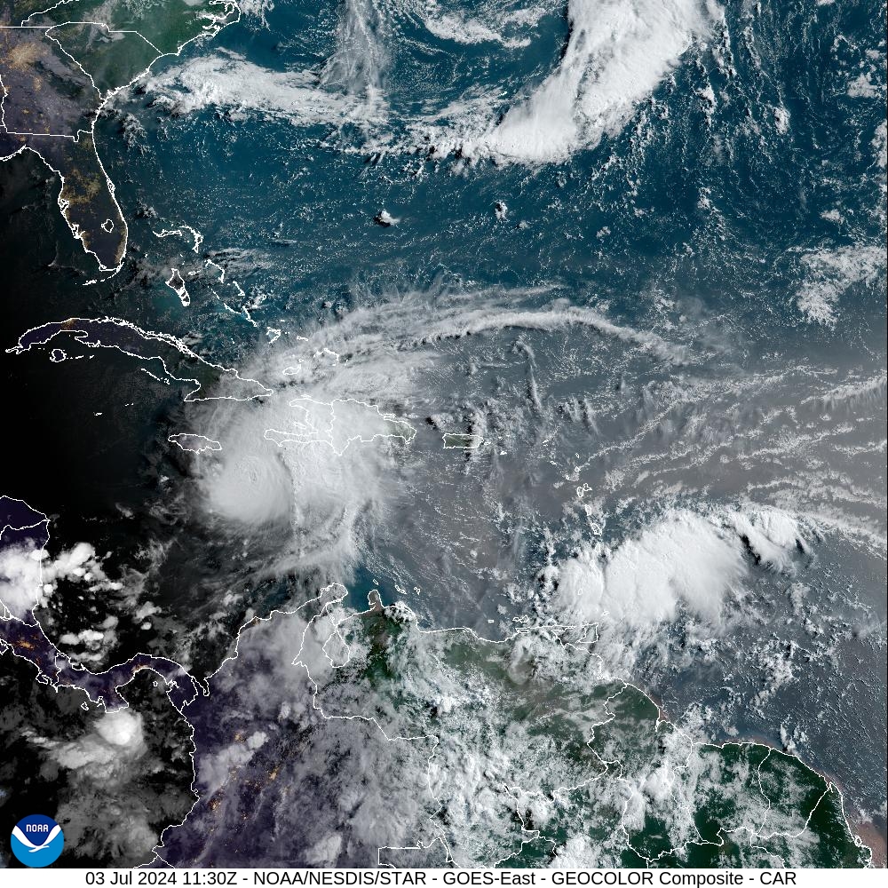
During the last 24 hours we have seen a significant move northward in the track forecast for Hurricane Beryl, which has just moved into the Yucatan Peninsula this morning. The storm, with 100 mph winds, has remained a little stronger than expected, and this supports the notion of a sharper northwestern turn in the coming days. This post will discuss the current thinking of Beryl, and its impacts to Houston’s weather early next week, which could now but a little more significant than anticipated.
In terms of additional coverage, we will share a post from The Eyewall here later this morning on the broader effects for Texas. And we’ll have an additional update this afternoon on the latest with Beryl. But first, a quick look at the forecast for this weekend.
Friday
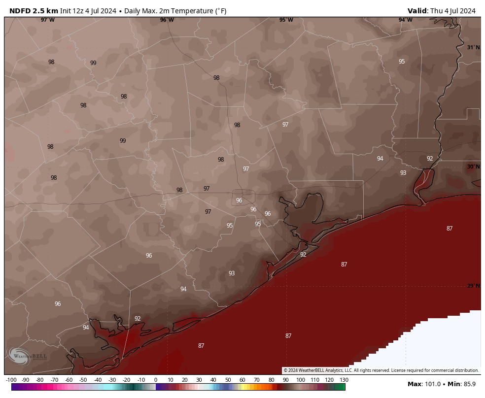
Today will be our last hot and mostly sunny day for awhile, given the impending influx of tropical moisture. Look for highs in the upper 90s to 100 degrees for most inland locations, with slightly cooler temperatures near the coast. Winds will be very light, perhaps at just 5 mph from the south. There is perhaps a 10 percent chance of afternoon showers. Lows tonight will drop to around 80 degrees.
Saturday and Sunday
Rain chances increase to about 50 percent on Saturday as a weak front approaches the Houston metro area from the north. This is not going to bring much (any, really) cooler or drier air into our region, but it should help increase cloud cover, and allow for air at the surface to rise. Rain accumulations don’t look crazy, more on the order of passing, scattered showers most likely. As a result of the cloud cover, look for highs in the mid-90s.
By Sunday our weather may start to become influenced by Beryl, but the storm is now not expected to come to the Texas coast until Monday morning. My best guess for Sunday is highs in the low 90s, with partly to mostly cloudy skies, and perhaps a 50 percent chance of rain. This is unlikely to be heavy rainfall, as the threat of that probably holds off until Monday. Southeasterly winds will increase.
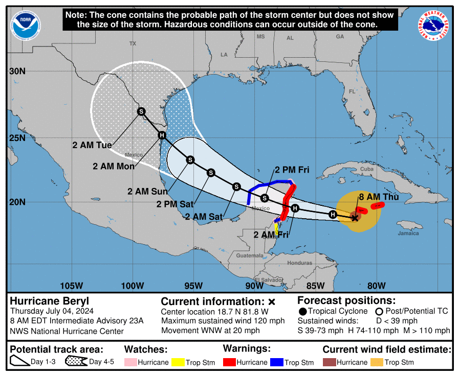
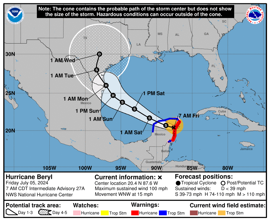
Hurricane Beryl’s track
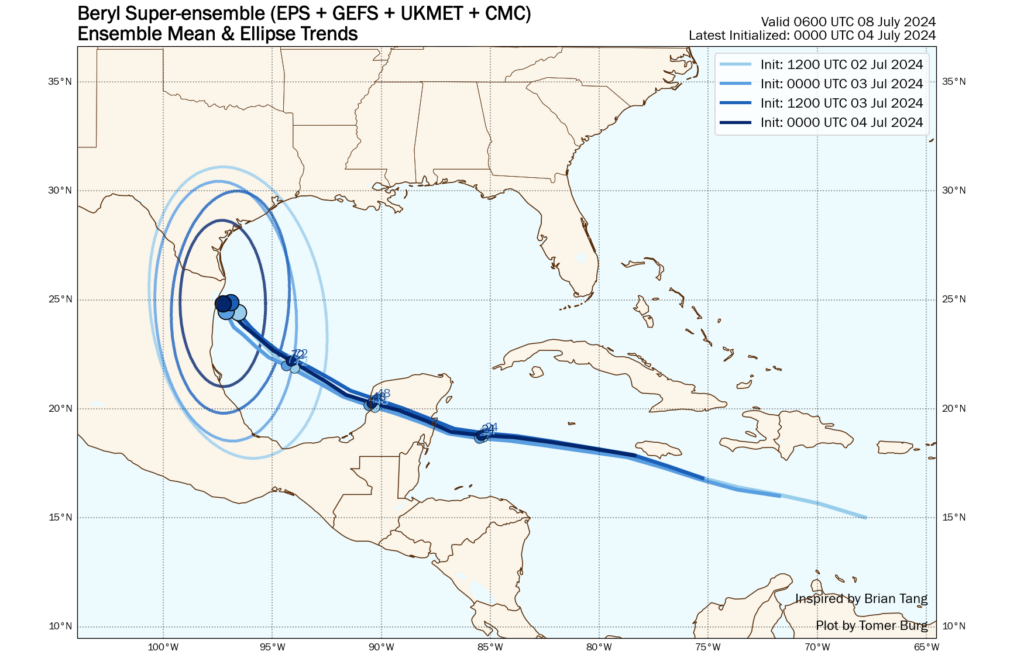
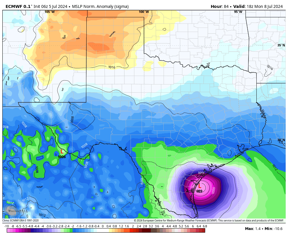
The northward shift in Beryl’s track can be attributed to a stronger system over the last day or so, and something of a northward wobble on the Fourth of July. Our typically best performing models, including the GFS and European, and the hurricane specific models, have all shifted northward overnight. They now generally indicate a landfall between Brownsville and Corpus Christi about three days from now.
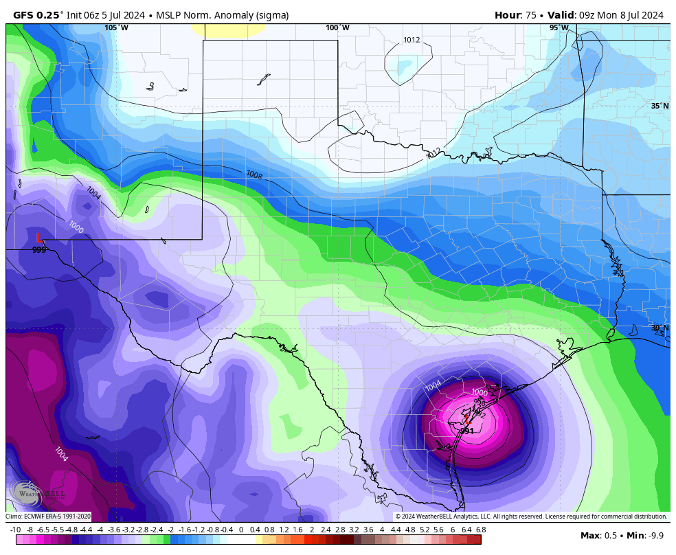
Where Beryl ultimately makes landfall will depend on how far the high pressure system over the southern United States retreats. The landfall location is complicated by the contour of the South Texas coastline, which is very nearly north-south relative to the Gulf of Mexico. This means that, as Beryl turns northwestward around the ridge of high pressure, even a relatively small deviation in course can change the landfall location significantly.
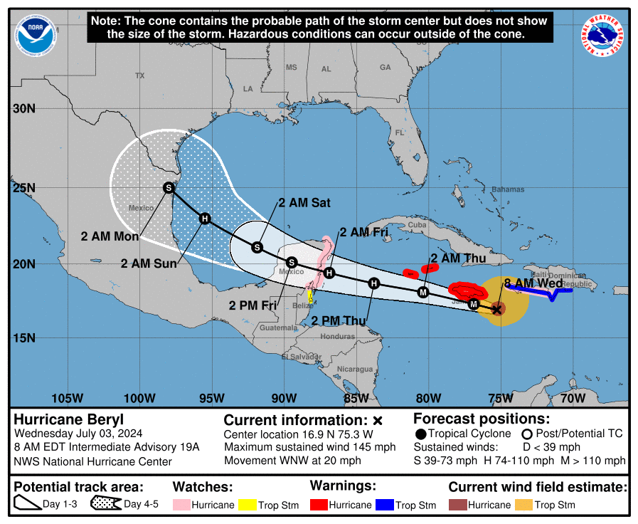
Regarding Houston, I would love to be able to tell you with certainty that Beryl will make landfall near or south of Corpus Christi. I truly think that will be the case. But as Beryl’s track has moved significantly in the last 24 hours that is not something I can guarantee you. The entire Texas coastline, for what it’s worth, lies in the National Hurricane Center’s cone of uncertainty.
Beryl’s intensity
Beryl made landfall in the Yucatan Peninsula this morning, and will spend most of today traversing the Mexican peninsula before emerging into the Gulf of Mexico this evening or tonight, likely as a strong tropical storm. The storm will then have about two days, or a little longer, to re-strengthen over the Gulf of Mexico before making a final landfall late on Sunday night or, more probably, Monday.
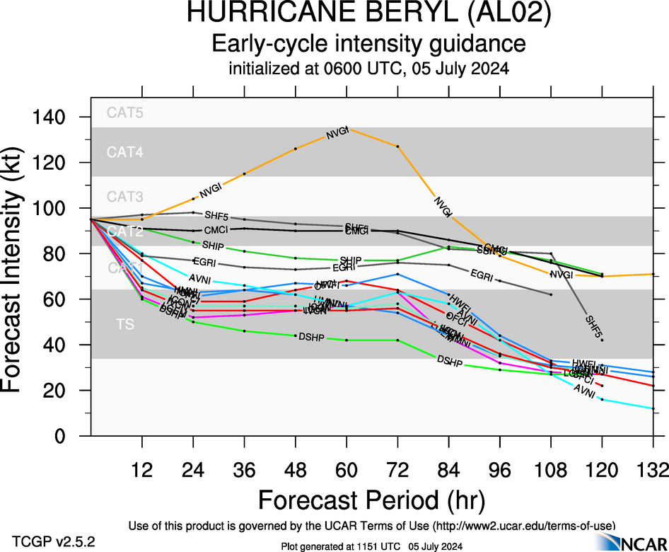
Given that Beryl will have plenty of time over the Gulf, it is likely that the storm intensifies back into a hurricane. Nearly all of our guidance shows the system remaining a Category 1 hurricane as it nears the Texas coast, but certainly we cannot rule out a slightly stronger storm.
Houston impacts
At this time the Houston area is still unlikely to see severe impacts from Beryl, but obviously we are watching the situation closely due to the evolving track. I would anticipate about a 20 percent chance of Galveston experiencing tropical-storm force winds on Sunday or Monday, with lesser odds for inland areas. In terms of storm surge, at this point Beryl should remain far enough south to preclude a significant surge into Galveston Island and Galveston Bay. We are talking tides maybe a few feet higher than normal, not dissimilar to the effects of Tropical Storm Alberto a couple of weeks ago. Obviously we’ll monitor this closely.
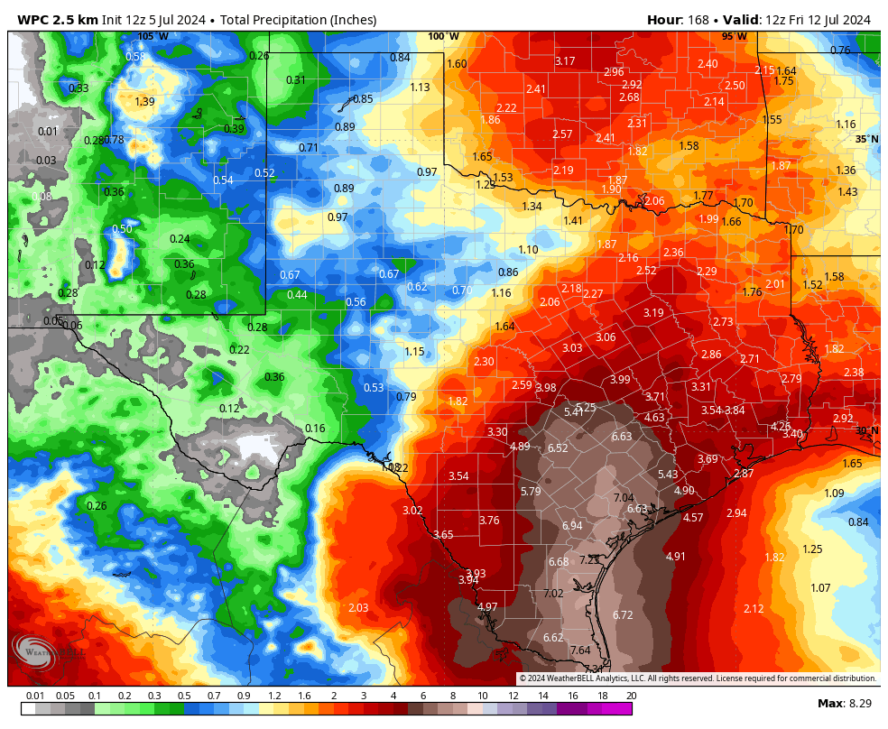
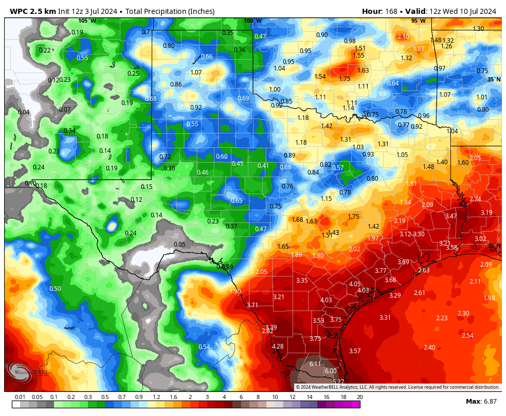
What hasn’t changed much is the precipitation forecast. Much of the Houston area is still likely to see 2 to 4 inches of rainfall over the coming week. Our concern remains the potential for higher bullseyes, driven the tropical nature of rainfall from Beryl, on Monday, Tuesday, and Wednesday. That is something we have not had great confidence in predicting, and still don’t. But the bottom line is that there remains no signal for major flooding in the Houston area at this time.
Final thoughts
I realize some readers will be disconcerted by the changes in Beryl’s track. It has been a surprising move, but not one out of the realm of probability, and this is ultimately the nature of tropical weather. Matt and I don’t think there’s a great chance that Beryl comes inland into Texas north of Corpus Christi. But is there a chance that could happen? Yes. It is certainly higher than it was on Thursday when we looked at the data. We are at the point where the greater Houston region, including Galveston Island, should be wary of Beryl, but not overly worried. Expect multiple updates today to keep you as best informed as possible.