Summary: Houston faces a few more warm days before we get a brief reprieve from the heat and humidity starting on Sunday. We’re also watching for the potential of heavy rainfall to the north of Houston on Saturday night in association with the cool front.
Thursday
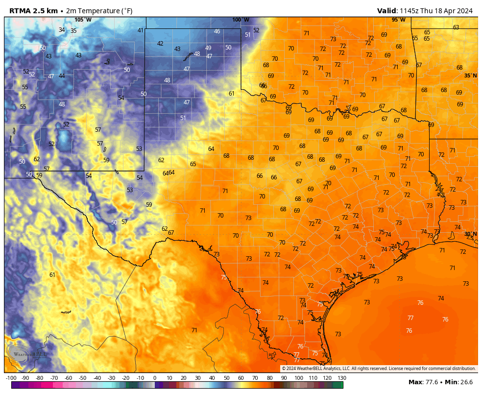
You guessed it, more warm and humid weather is on the way for Houston today. High temperatures will reach the mid-80s in the city, with the possibility of upper-80s if we get much sunshine this afternoon. And that’s possible, with the potential for a few breaks in the clouds after this morning. Winds will blow from the southeast at 10 to 15 mph with higher gusts, and rain chances are about 10 percent. Lows tonight will only drop into the low 70s.
Friday
If you liked Thursday, you’re in luck. Friday will be much the same. Highs again will be in the mid- to upper-80s with plenty of humidity. Expect another warm night.
Saturday
Most of Saturday looks fine, if warm, for outdoor activities. Highs will be slightly cooler, but still in the low- to mid-80s with cloudy skies. Some light showers will be possible in Houston during the afternoon and evening hours, but we’re not expecting anything wild ahead of a frontal push overnight.
The forecast begins to change Saturday evening, or perhaps during the overnight hours. Showers and thunderstorms will mass to our northwest, with areas such as College Station at risk of 2 or more inches of rain, with higher bullseyes. How much of this heavier rainfall filters down into Houston is an open question, however. At this point I expect milder conditions in the city, and down to the coast, where accumulations of 0.25 to 0.75 inch of rain appear more likely. Thunderstorms will be possible, although less likely. Lows on Saturday night should drop into the mid-60s.
Sunday
A chance of showers will linger in the morning, near the coast. But for the most part this should be a cloudy and cooler day, with highs in the lower 70s, and lower humidity. We’re going to get one fairly cool night with this front, and it comes Sunday night. Most of the city will drop into the 50s heading into Monday morning.
Next week
Monday should also see highs in the 70s before the onshore flow really starts ripping again. We’ll accordingly warm up, and will likely reach the mid-80s by mid-week, and upper-80s toward the end of next week. Highs potentially in the 90s are definitely in play, but we’ll have to see how things shake out.
We’ve got a couple of major outdoor athletic endeavors next weekend, the Texas Bike MS 150 and IRONMAN Texas event in The Woodlands. A precise forecast remains impossible, but the overall pattern looks warm and humid. I’m guessing highs in the upper 80s, with a fairly pronounced southerly wind. Rain chances, at this vantage point, continue to look fairly low.

Could this be is our last front until Sept/Oct? April is coming to a close soon, and I can’t recall many pronounced cooldowns in May.
I remember one. That’s it 🙁
There’s still a chance for a cold front in May, however that’s also when these fronts start to get really sparse, only having one or two strong fronts the entire month most of the time. Savor it while you can.
Thanks for the Ironman forecast! 80s, sunny, and a little wind makes it somewhat tolerable.
Has Space City Weather discussed the effects of the smoke from the Mexican agricultural fires? I had forgotten that issue until yesterday’s TV coverage.
Already getting lightning alerts within seven miles here at the plant, and hearing thunder. Wind picking up, too.