Summary: Houston will enjoy a fine spring fling this week, with dry days and cool nights. By later on Saturday the sunshine will largely go away, likely bringing us mostly cloudy skies for the eclipse on Monday. Rain showers are likely for the first half of next week.
Wednesday
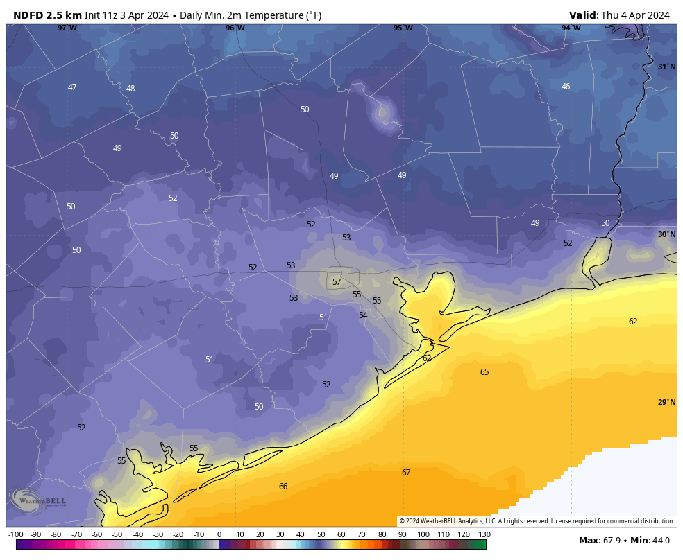
Today will be a fine, sunny day. With northerly winds at 10 to 15 mph, with higher gusts, the air is going to be plenty dry. (In fact, we’re unlikely to see dewpoints drop this far down, to about 40 degrees, many more times this spring). Highs will reach the mid- to upper-70s this afternoon before temperatures fall this evening. Overnight lows will drop into the mid-50s.
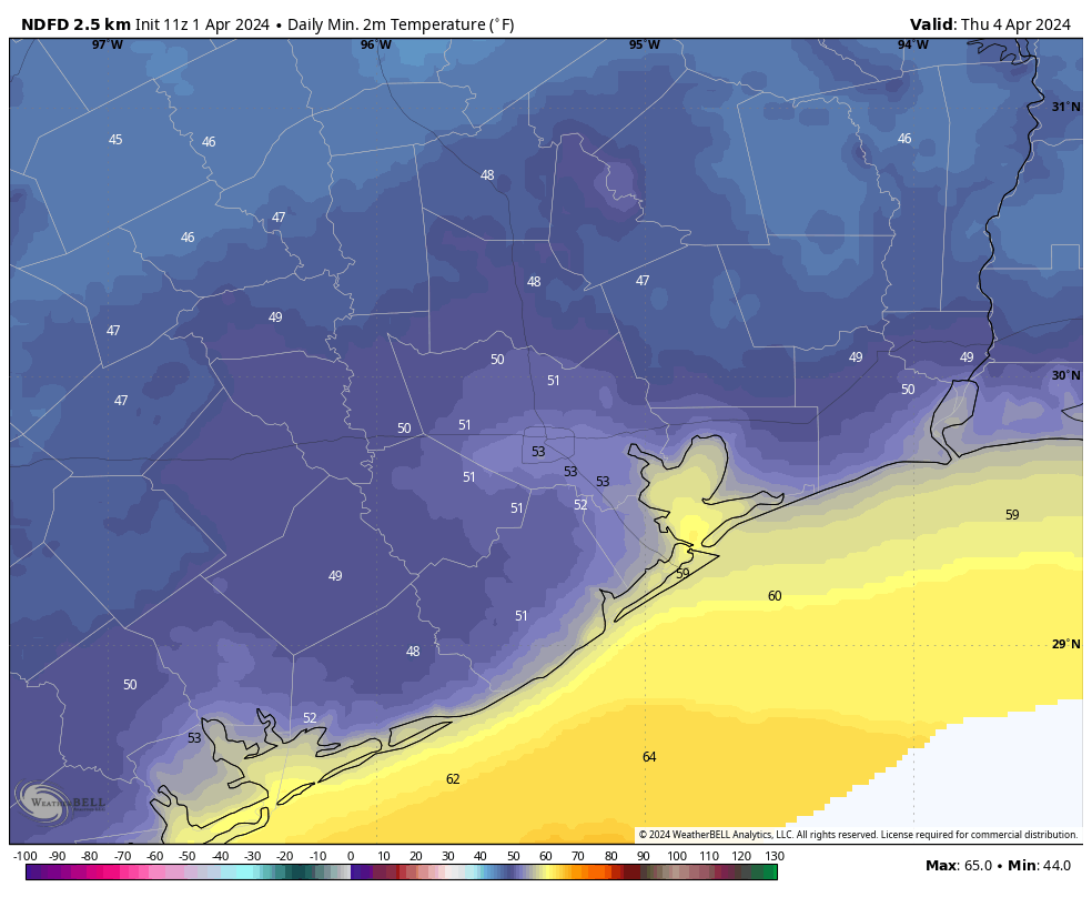
Thursday
This will be another sunny day with dry air. Winds will be lighter, and come from the west. Highs will be a bit warmer, reaching about 80 degrees. And overnight lows will only drop to around 60 degrees.
It’s perhaps worth noting that we’re now in early April. Spring still has some string to run out, but these weekly fronts we’ve been seeing are likely about to become less frequent. Savor the dry air while it’s here. Because one day fairly soon, it will be gone.
Friday
Expect more sunshine on Friday. But as winds swing to come from the south we’ll see warmer air. I expect highs to push into the mid-80s on Friday, with overnight lows dropping into the low 60s.
Saturday
The first half of the weekend will see partly sunny skies, with highs of around 80 degrees. These conditions will be somewhat marred by an approaching front, which will help generate strong southerly winds from the Gulf. Gusts on Saturday afternoon could reach about 30 mph. Lows on Saturday night will only drop to around 70 degrees.
Sunday
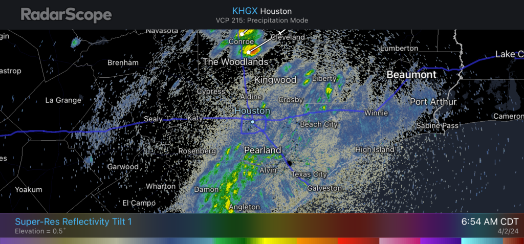
Sunday will be cloudy, with highs of around 80 degrees. Some light, scattered showers will be possible, as the aforementioned front stalls out near Houston, but I suspect most of the area will see sprinkles at most. The air will feel fairly humid. Lows on Sunday night will drop to around 70 degrees.
Monday
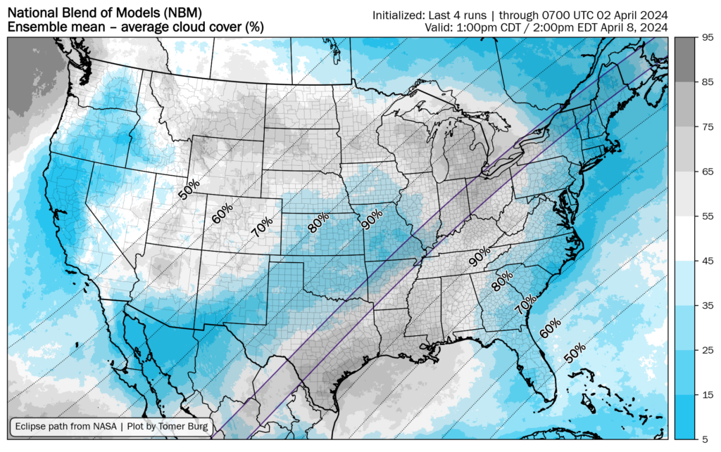
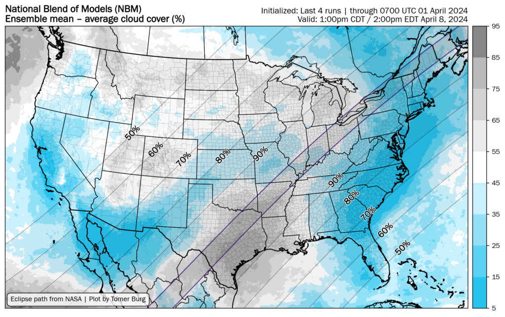
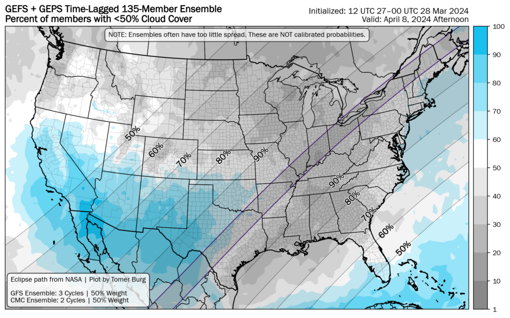
We’ve been tracking the eclipse weather for awhile now, and the forecast continues to look poor. We’re likely to see cloudy skies in the Houston area on Monday, with scattered light to moderate rain showers. In Houston the Moon will begin covering the Sun shortly after noon, peaking in coverage at 1:40 pm CT. So it will get fairly dark in the early afternoon hours. Highs will reach about 80 degrees.
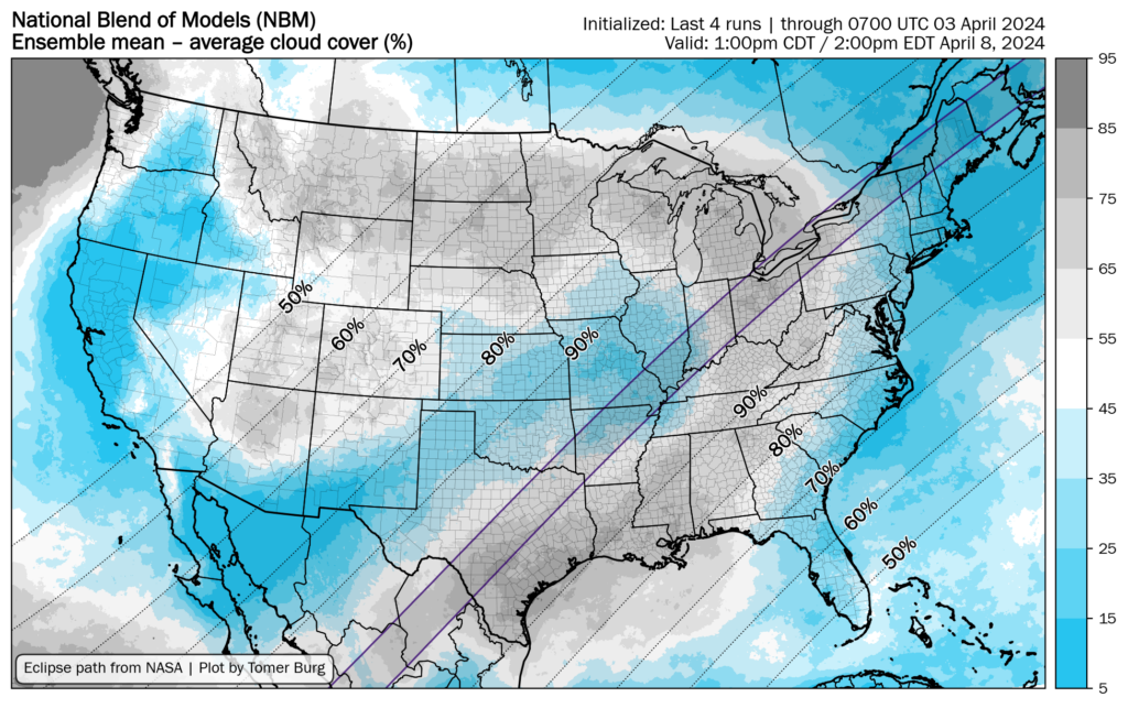
Of course the path of totality for the eclipse runs through Texas, along much of the Interstate 35 corridor. The forecast there looks a little bit better, but only a little. Most of our major global model guidance continues to show cloudy skies for much of Texas, with perhaps the northern part of the state having the best chance for some partly cloudy skies. We’ll take a deeper look into this tomorrow morning.
Next week
Tuesday and Wednesday should see additional healthy rain chances before some kind of front finally pushes through. It looks fairly weak, but could drop overnight lows back down to around 60 degrees.