Summary: The forecast remains on track, with a warmer and wetter period for the next few days ahead of a cold front on Sunday. That will bring sunnier, cooler, and drier weather back into Houston for a few days. If you’ve been wondering about the vague rumors about another polar vortex outbreak at the end of the month, Matt addressed them yesterday.
Thursday
It’s quite a bit warmer this morning across the region, with lows only dropping into the low 60s with a southerly flow in place. Skies will be cloudy today, with a light to moderate wind from the south, and highs pushing into the low- to mid-70s. The question is whether it will rain, and for the most part the answer is no. A few areas will see some light showers, but I expect them to be isolated with almost unmeasurable accumulations. Lows tonight should drop into the low 60s, with the possible development of some light fog.
Friday
This day will be quite similar to Thursday, with the exception of a bit gustier southerly winds. Friday night will be warm again, with a slight chance of showers.
Saturday
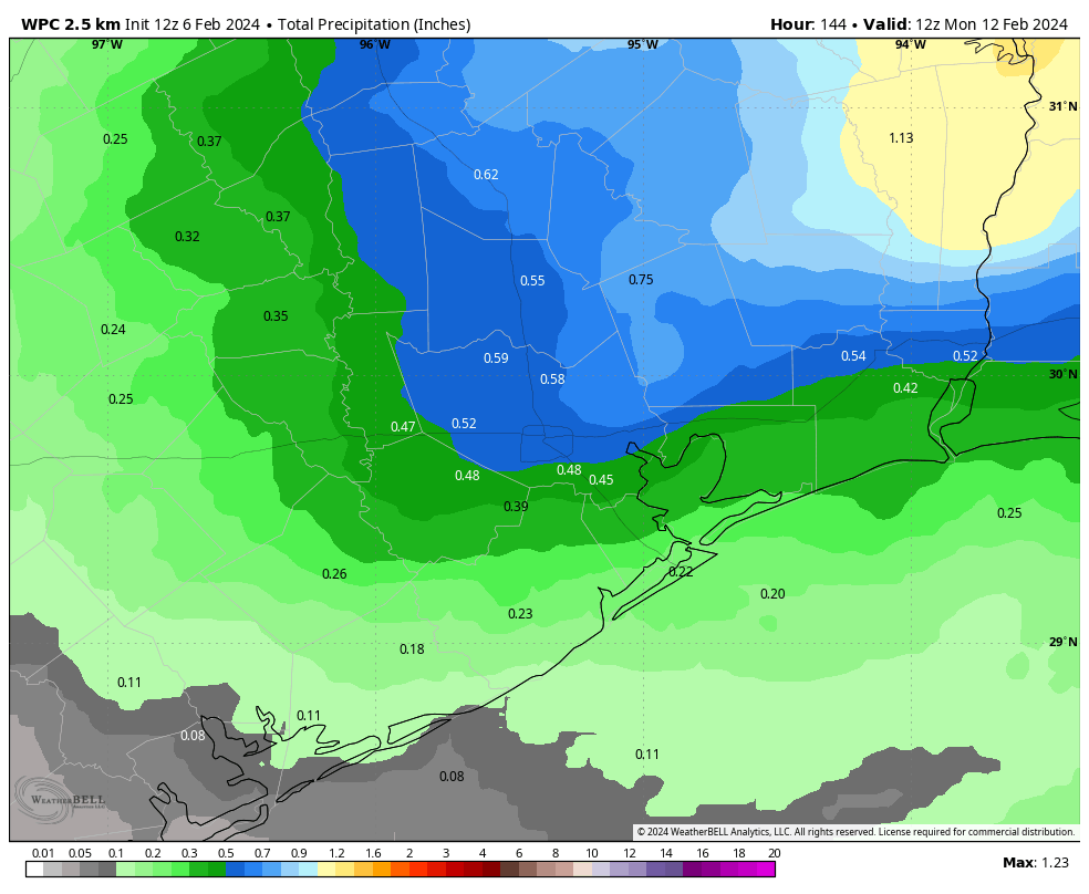
The weekend, alas, looks wetter. An increasingly perturbed atmosphere and an approaching front will produce widespread showers starting Saturday morning. Accumulations don’t look crazy. I expect most of the area to pick up between 0.25 and 1 inch of rain this weekend, with higher totals possible to the north of the metro area. This is not a flooding issue, but it will be a concern for any outdoor activities. Highs will likely be in the low 70s with cloudy skies.
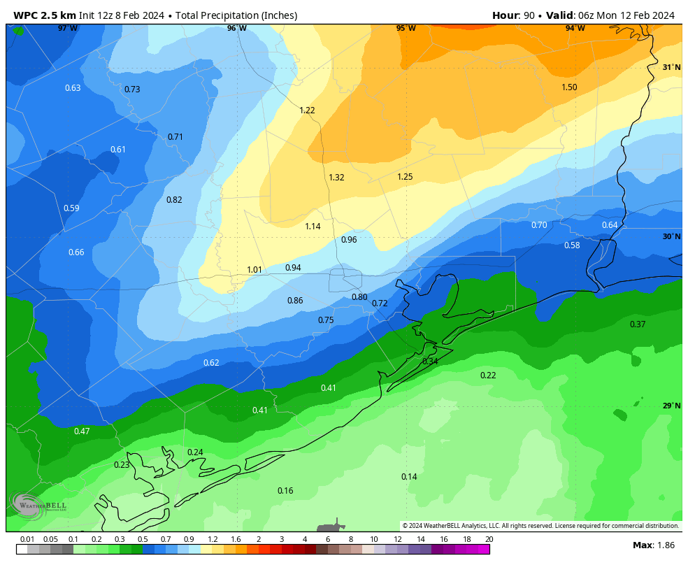
Sunday
Sunday morning should bring more of the same before the front arrives, likely sometime during the afternoon hours. This may start to clear out our skies during the late afternoon or evening hours, ending the rain. Lows on Sunday night should drop into the 40s in Houston.
Monday and beyond
This looks to be a sunny, breezy, and colder day as we see the additional influx of northerly air. Highs may only reach the upper 50s, with northerly gusts up to 30 mph. Monday night looks to be rather chilly, with lows dropping into the upper 30s in Houston, possibly.
We’ll then see a gradual warming trend, but I’m not sure highs will climb out of the 60s. Additionally, after a couple of sunnier days, clouds return, and we could see several days of rain beginning on Thursday or Friday. I hate to make a prediction for another wet weekend, but yes, it’s possible.