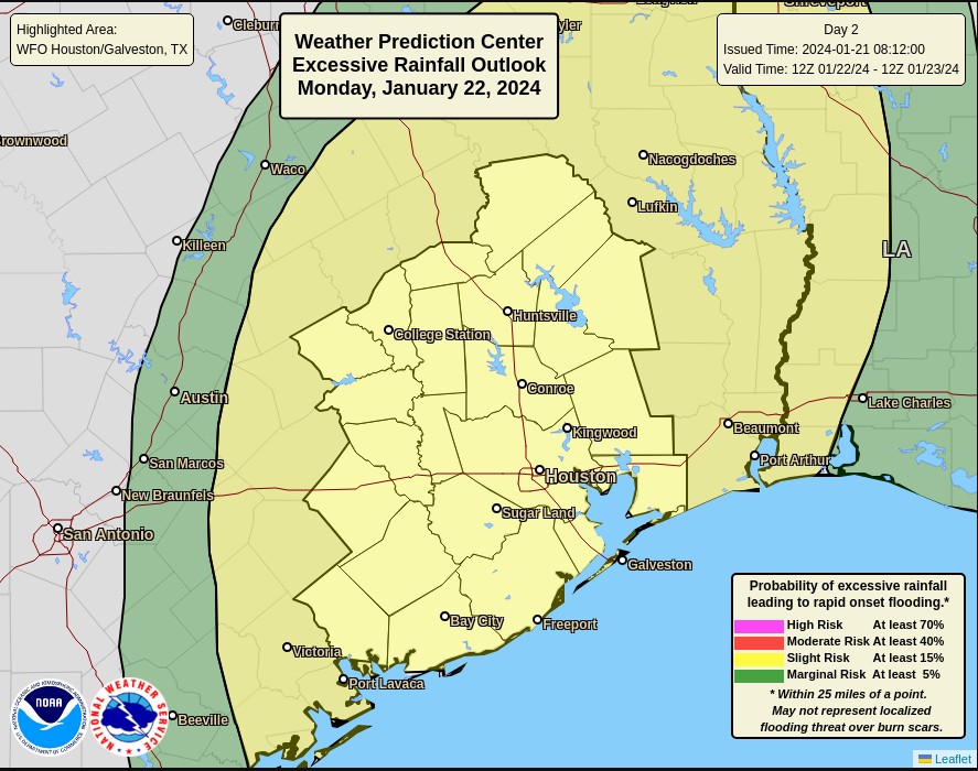
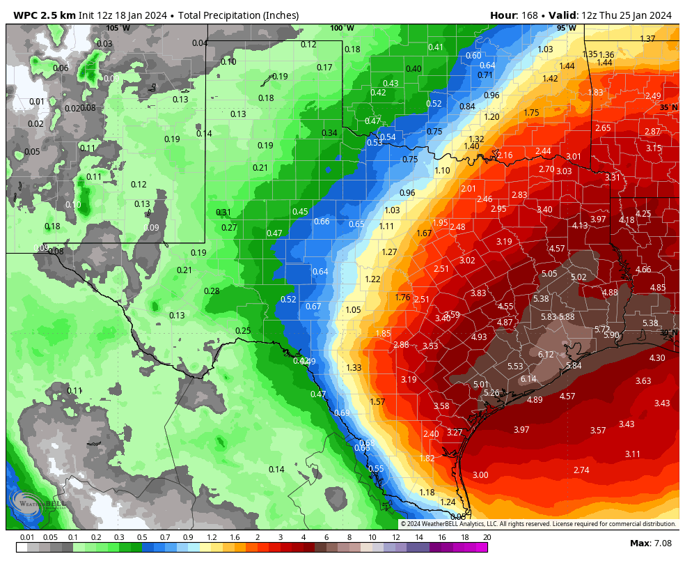
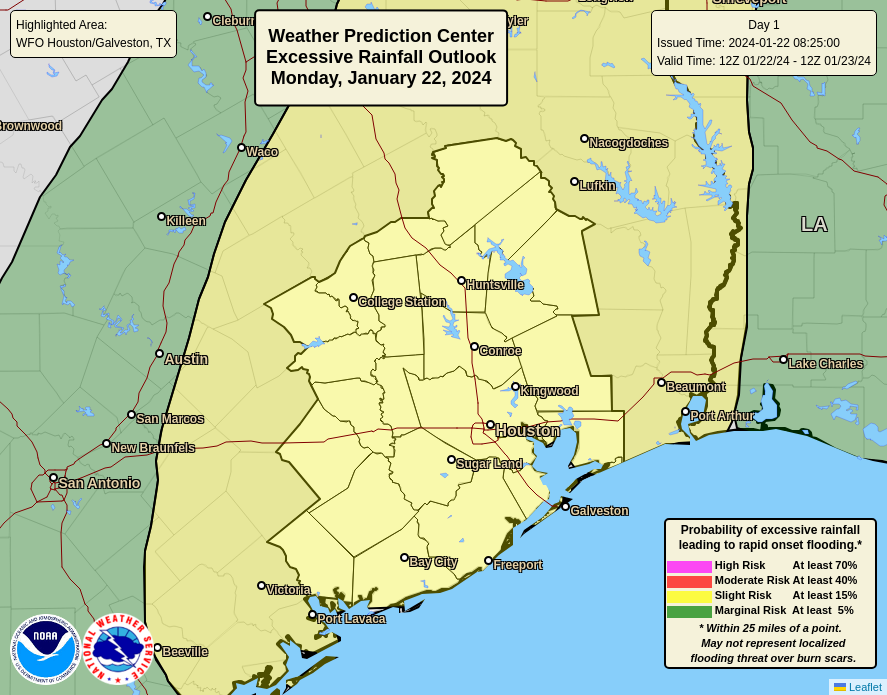
Summary: Rain showers are moving into the Houston area from the west, and we’ll see the threat of heavy rainfall from now through Wednesday. It will be a decidedly soggy period, and we have instituted a Stage 1 flood alert to account for the potential of street flooding.
Monday
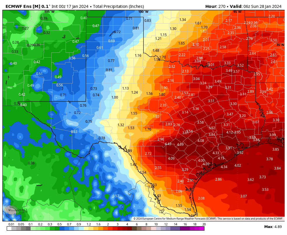
As expected, an upper-level storm system is inching toward our area, and this is producing widespread showers to the west of Houston. These showers and thunderstorms will spread across the metro area this morning and remain with us for much of the day. I expect most of the area, from the Brazos Valley on down to Galveston, to pick up 1 to 4 inches of rainfall today and this evening. Rain chances are effectively 100 percent with a saturated atmosphere and ample sources of lift. The one good thing I can say about the showers is that, generally, individual storm cells should push through fairly quickly from west to east. So the overall threat of ‘training’ storms is lower. There may be a brief lull in rain showers this evening or during the overnight hours before a second round of showers pushes in early on Tuesday.
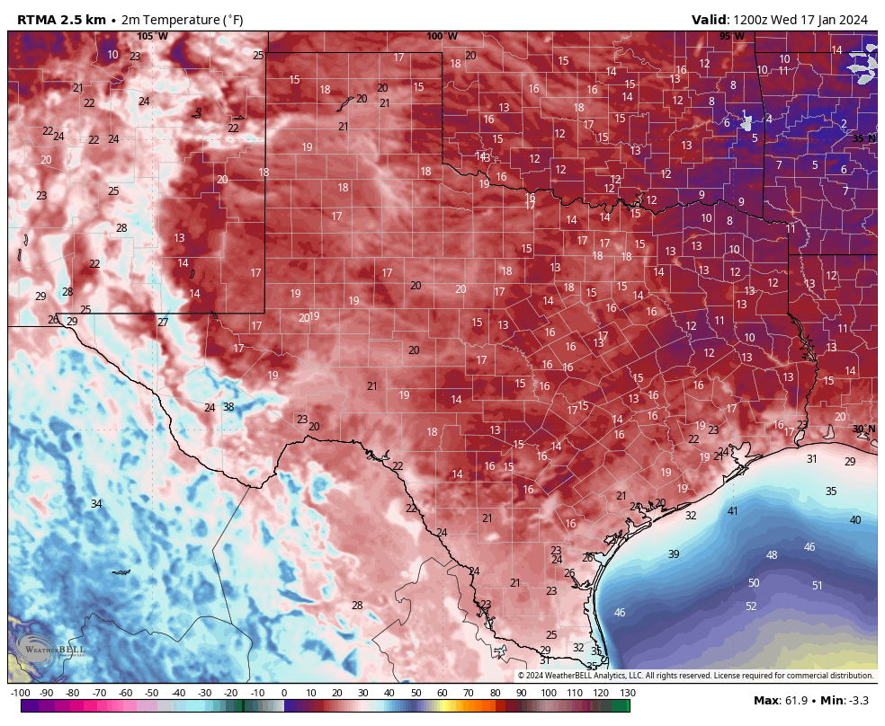
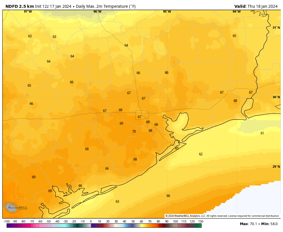
In terms of temperatures, after a cold weekend, we’re seeing a surge of warmer air that will remain with us for most of this week. Highs today should reach the low- to mid-60s, with low temperatures tonight only dropping to around 60 degrees. Winds will also be noticeable today, blowing from the southeast at 15 or 20 mph, with gusts up to 30 mph. So yeah, not a great day for a picnic.
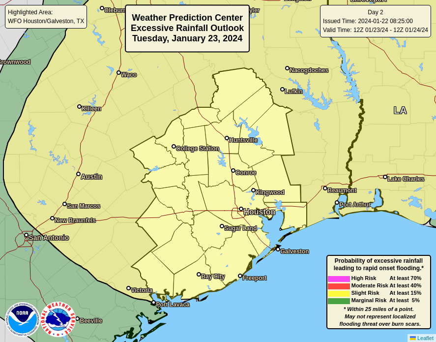
Tuesday
This will be another day that favors widespread rainfall. However, it’s possible that this setup will produce higher rain totals to the north of Interstate 10, and areas further inland, instead of closer to the coast. In any case, much of the area could pick up an additional 1 to 3 inches of rainfall. Highs will again be in the 60s to near 70 degrees. It’s possible that we see another lull in rain chances during the evening or overnight hours.
Wednesday
This should be the region’s final day of widespread showers, although conditions look marginally less favorable than on Monday and Tuesday. Still, pretty much everyone is going to see rain, with totals in the vicinity of 0.5 to 2 inches, probably. Highs will be in the upper 60s. I expect most people to pick up 4 to 6 inches of rainfall through Wednesday, with some areas seeing greater bullseyes.
Thursday and Friday
These will be a pair of partly sunny days, with highs around 70 degrees, slightly less humidity, and nights in the 50s. Rain chances won’t go away entirely, but they should drop down to about 20 or 30 percent each day.
Saturday and Sunday
Saturday should be partly sunny, with highs perhaps in the 60s. We’ll see a decently strong front push through sometime during the early morning hours or daytime, and there may be a smattering of rain with the front. Afterwards lows drop into the 40s. Sunday should be sunny, with highs perhaps around 60 degrees.
Next week
Most of next week looks quiet, with highs in the 60s and lows in the 40s. Rain chances look fairly low through at least Wednesday or so, giving us some needed time to dry out.
Site note
Matt and I will be monitoring today’s rainfall closely, and if an update is needed to our flooding expectations, we’ll update accordingly.