Summary: After a very cold night, Houston will emerge from the icebox over the next couple of days. Another front arrives Thursday night to cool us down for the weekend, when a light freeze will be possible. And after that? It will be warmer next week, with the likelihood of widespread showers. It’s too early to be too concerned about heavy rainfall, but something wet this way comes.
Wednesday
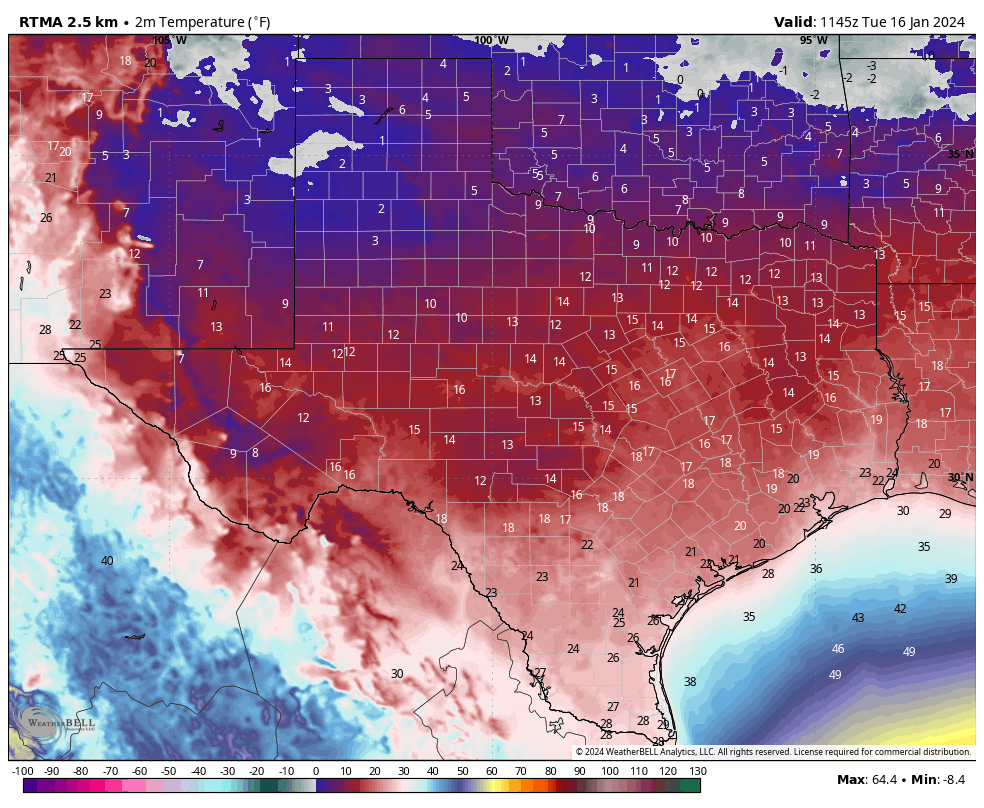
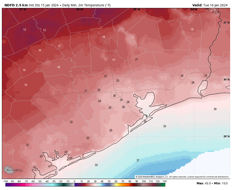
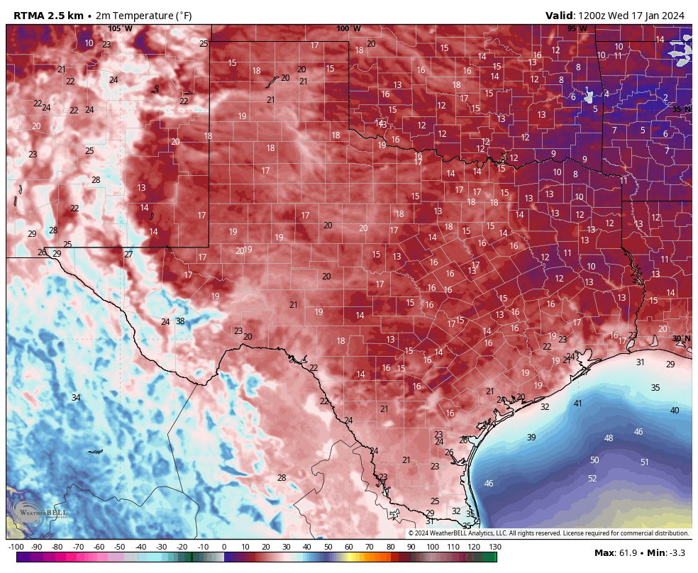
It’s really cold this morning. (Fun fact: Tuesday’s average temperature of 26 degrees was 28 degrees below normal. Alright, maybe that fact wasn’t that much fun). Temperatures across the metro area range from the mid-teens up in the middle of Montgomery County down to the upper 20s right on the coast.
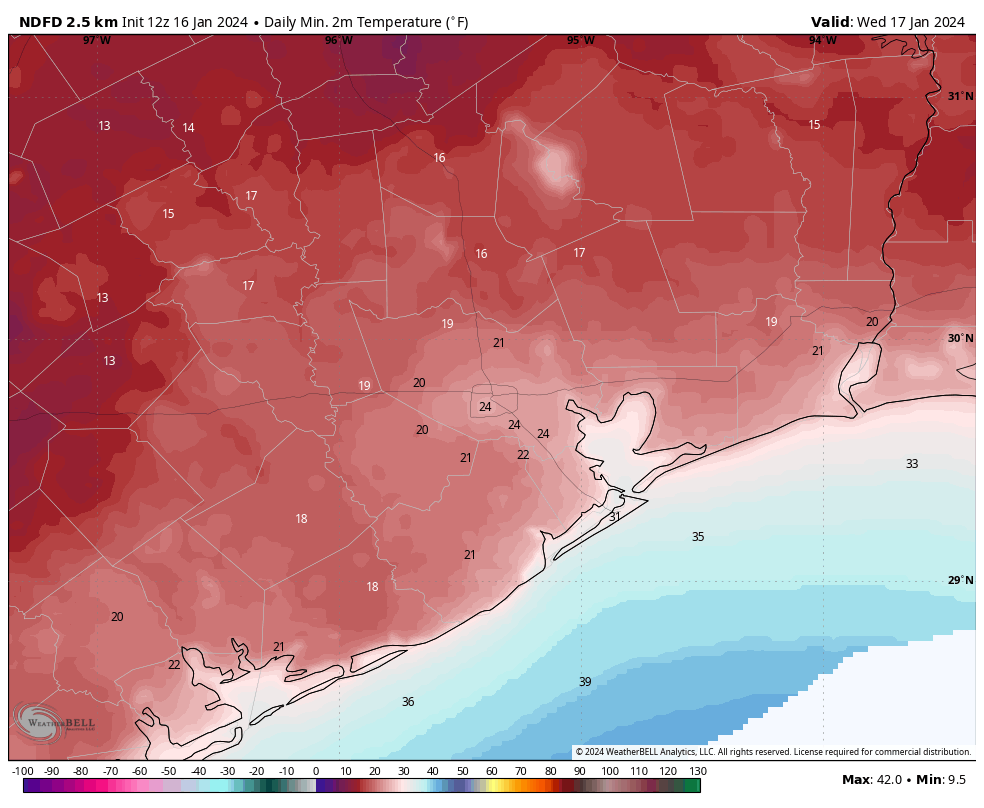
Fortunately, this is as cold as it’s going to get. As soon as the Sun comes over the horizon, we’re going to see temperatures start climbing. Most of the region should be above freezing by 10 or 11 am CT this morning, on our way to highs in the mid-40s with sunny skies. As high pressure shifts to the east, we’ll see winds turning from the north to come from the southeast. As a result, lows tonight will only drop to around 40 degrees, with cloudy skies.
Thursday
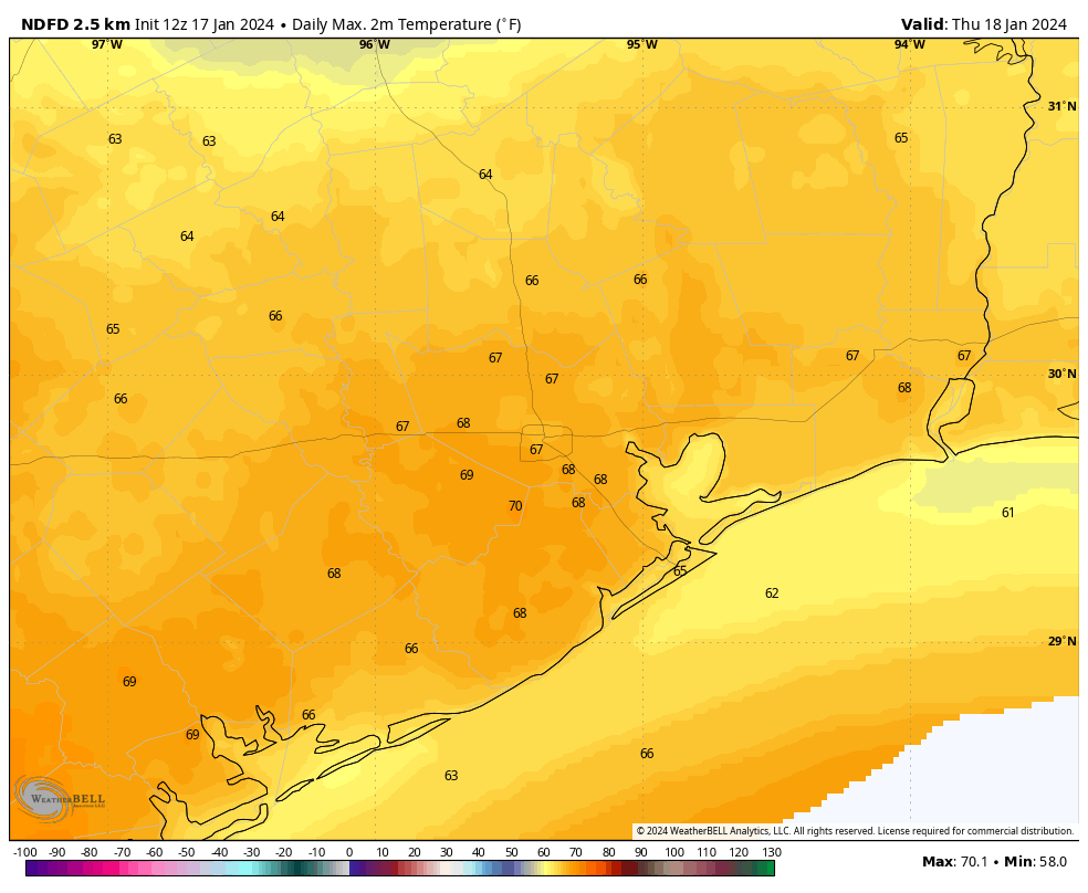
This will be the warmest day of the week. Skies will start out cloudy, but we should see lots of sunshine during the afternoon hours. Look for highs to rise into the upper 60s to 70 degrees. Winds will be a bit gusty from the south, but it should feel pleasantly warm outside. But don’t get too attached as a front will come through on Thursday night, bringing an additional shot of colder air. The front’s passage should be a dry one, with lows dropping into the 40s overnight.
Friday
It will be sunny and cold on Friday, with highs perhaps only reaching 50 degrees. It’s also going to be rather windy, with gusts up to 30 mph from the north. Friday night should see a light freeze descend upon Houston again, with a hard freeze possible for far inland areas. Still, this night looks nothing like the cold were presently experiencing.
Saturday
Saturday should start out brisk and sunny. Highs are likely to only reach the mid-40s, and we’ll probably see some clouds developing during the afternoon hours. (If you’re wondering about weather in Baltimore on Saturday afternoon for the Texans game, it looks blustery and cold. Game-time temperatures should be in the low 20s, with gusty winds up to 30 mph. The wind chill will be about 10 degrees. No chance of snow, however. In CJ we trust, right?) Back in Houston, temperatures will again flirt with a freeze on Saturday night, but I wouldn’t be surprised if the urban core of Houston stays above freezing.
Sunday
I expect the sunshine to be largely gone on Sunday, with highs perhaps in the low 50s, give or take. Rain is definitely coming, but at this point I expect it to hold off until Sunday evening or the overnight hours.
Next week
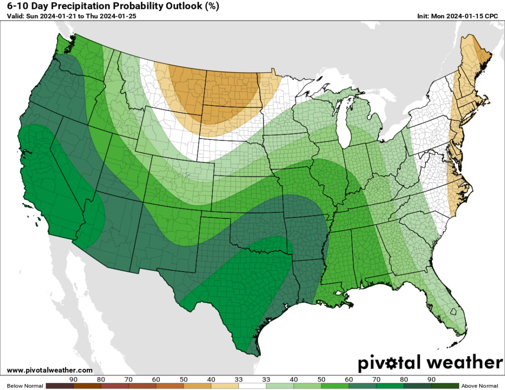
It’s a bit too early for confidence in the details, but we’re going to see some distinct changes next week. Instead of very dry air, our atmosphere will turn more humid, indicative of much more moisture. Temperatures are going up, with daytime highs around 70 degrees, and nights likely somewhere in the 50s. And we’re going to see a series of disturbances move in from the west that will increase our rain chances.
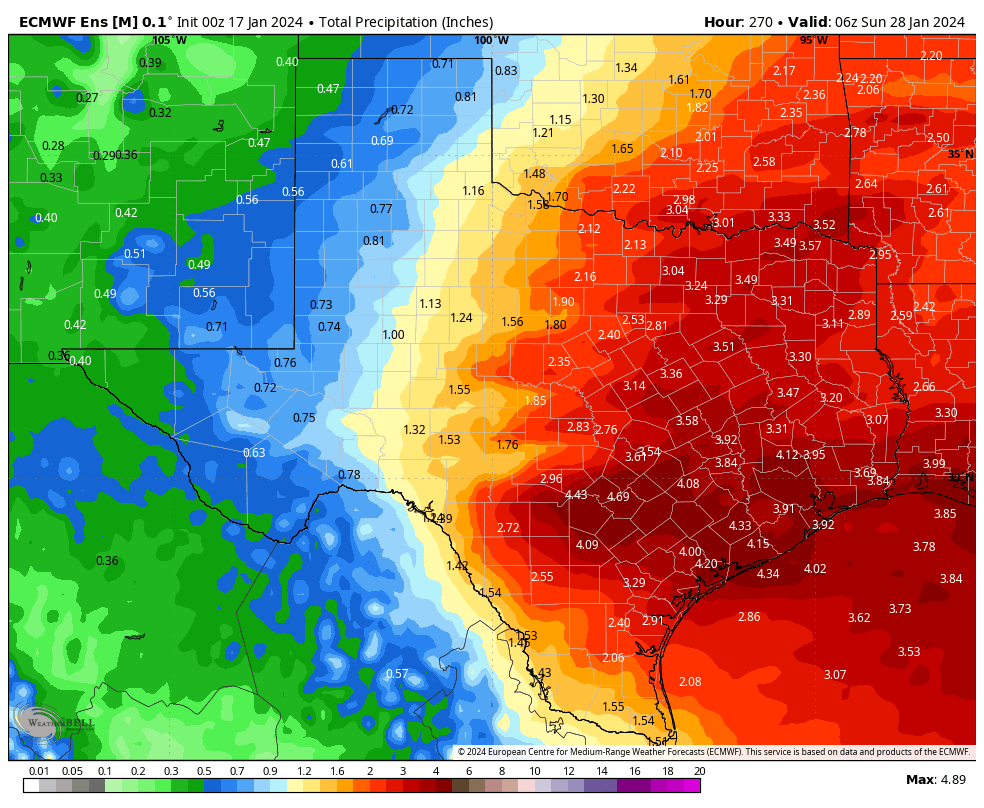
Alongside this favorable setup, there is a pretty strong signal for rain showers during the period of Monday through Thursday across the models we look at. As a very preliminary guess, I’d say we’re probably looking at accumulations on the order of 2 to 6 inches. In the winter months rains pile up more quickly, because the evaporation rate is slower. So we’ll be keeping a tab on the potential for street flooding and other impacts. It’s not something to worry overmuch about right now, but if you have outdoor plans next week, well, good luck.