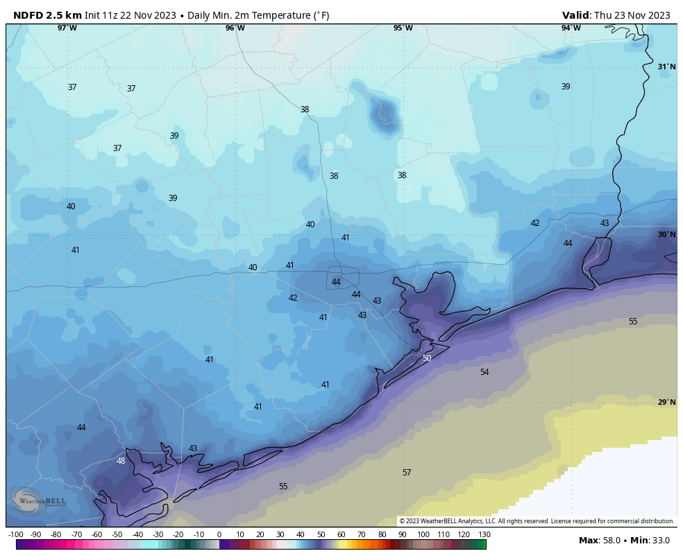
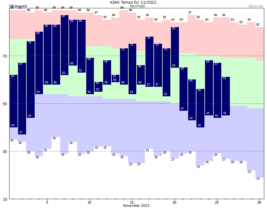
Good morning. Low temperatures have dipped into the upper 30s for much of Houston outside the urban core, and away from the coast. With chilly conditions expected for the remainder of November, it looks like this month will be the first one since May to record a below normal temperature.
The average temperature so far this month—calculated by adding the daily high and low, and dividing by two—is presently a little less than 63 degrees. That will slip a bit this week. It seems notable that while Houston recorded an exceptionally hot summer this year, the spring and fall have been rather temperate.
We’re also in the final days of our annual fundraiser. The response so far this year has been tremendous—thank you so much. There’s still time to buy merchandise or donate if you would care to.
Monday
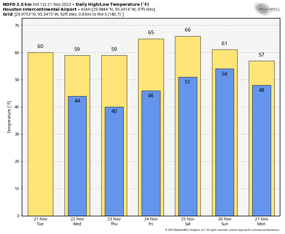
Our overall pattern this week is fairly straightforward. We face three chilly days and nights before transitioning to a warmer pattern with higher rain chances beginning Thursday. This morning is likely to be the coldest of the week, with lows in the upper 30s. With partly cloudy skies, temperatures will be slow to warm, but we should eventually get into the upper 50s today, with light northerly winds. Low temperatures on Monday night should be a degree or two warmer than Sunday night.
Tuesday
This is the one day this week when we’re pretty much guaranteed sunshine, so be sure and soak it up. The combination of sunny skies and a more easterly flow should allow highs to reach the low 60s. Tuesday night will, in turn, be a degree or two warmer than Monday night, with lows likely dropping into the low 40s for much of the metro area.
Wednesday
With winds becoming more southeasterly, we’ll see a more humid flow beginning later on Wednesday, but it will take some time for the air mass to modify. As a result, I expect partly sunny skies on Wednesday, with highs in the mid- to upper-60s. As the Gulf of Mexico air moves in, we should see more clouds on Wednesday night, with lows dropping only to around 60 degrees.
Thursday and Friday
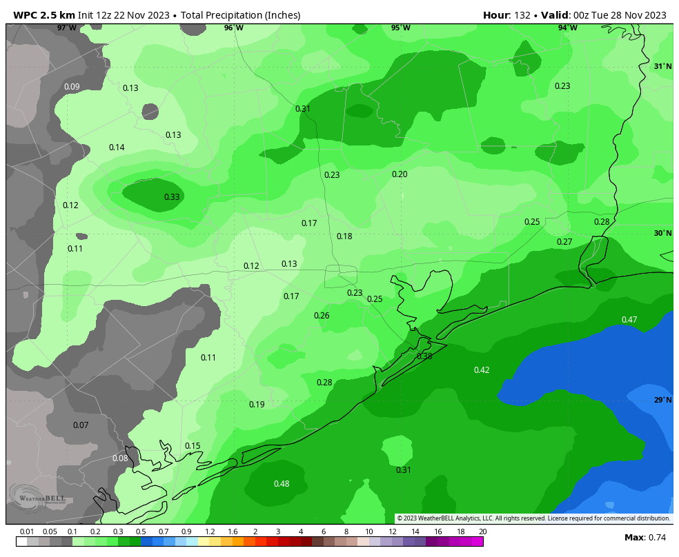
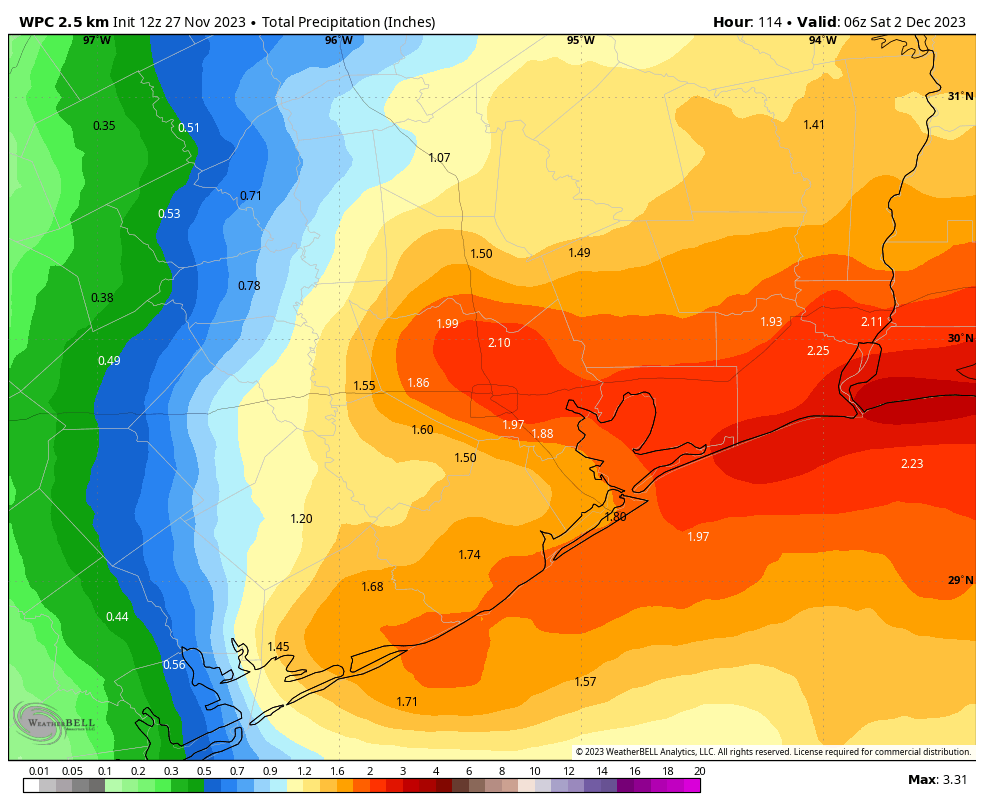
A low-pressure system will driver higher rain chances toward the end of the week, with Thursday likely to be the wettest day. Much of the area could see 1 to 2 inches of accumulating rain on Thursday. This should not be enough to cause flooding, but it should make for a fairly dreary day. Highs will be about 70 degrees. Rain chances continue Thursday night, and still should be 30 to 50 percent on Friday. This will be another warm day with a decent amount of humidity, with highs around 70 degrees.
Saturday and Sunday
The forecast for this weekend is somewhat uncertain as a cold front advances toward Houston on Friday, and then probably moves just off the coast. Our temperatures and rain chances are going to be dependent on the position of this front, and I’m just not entirely confident how far it pushes offshore. So for the time being, I’m going to predict high temperatures in the upper 60s this weekend, with lows somewhere in the 50s. Rain chances will be pretty decent for coastal areas, but likely less for inland areas. All of that is subject to change, of course.
Next week
Given the uncertainty over the weekend, I don’t feel strongly about next week’s outlook either. I do think we’ll probably see some clearing skies by Tuesday or so, and some slightly cooler weather thereafter. But we shall see!