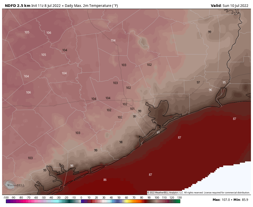
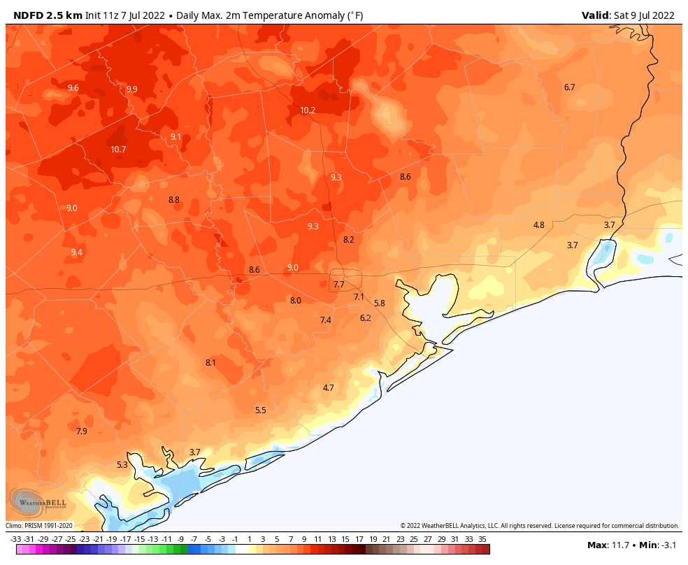
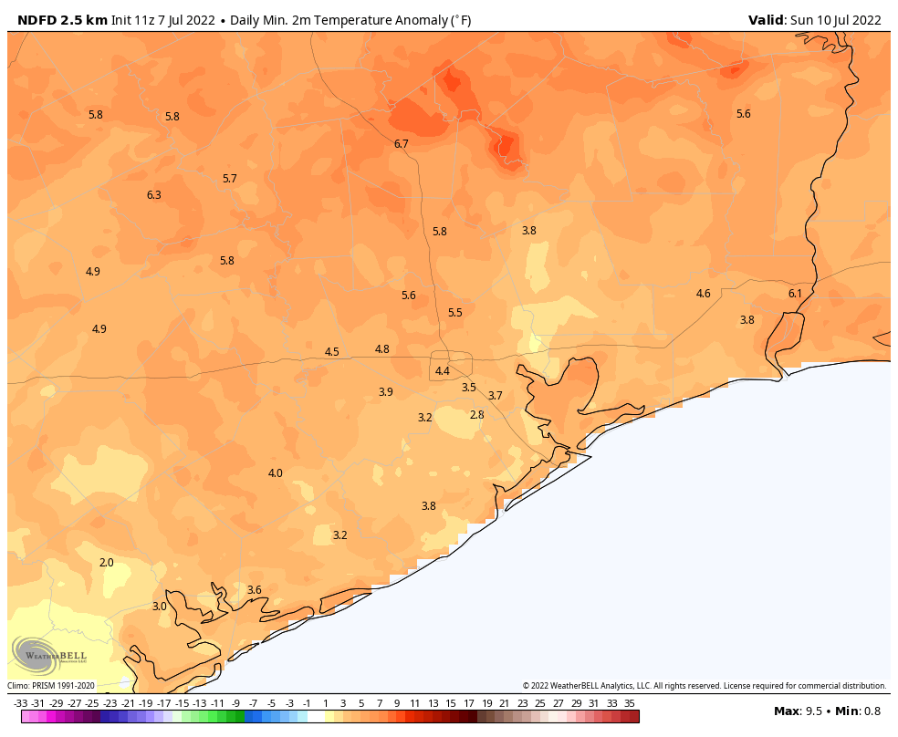
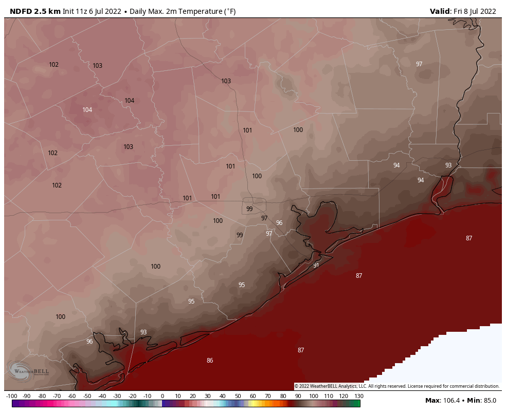
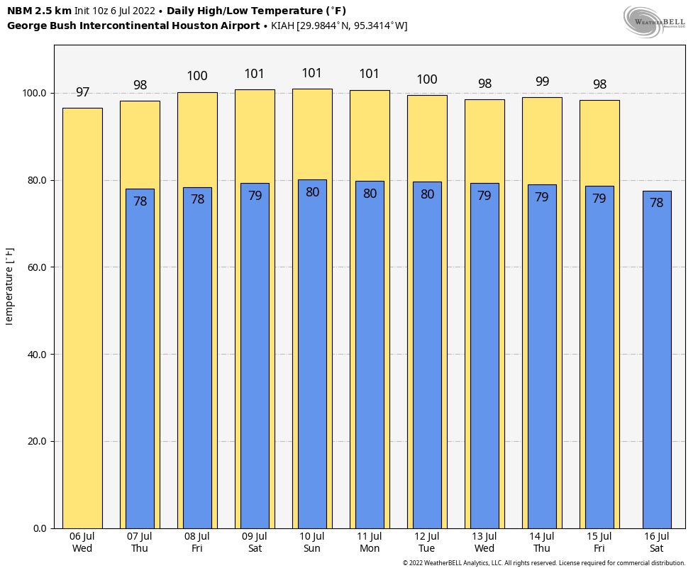
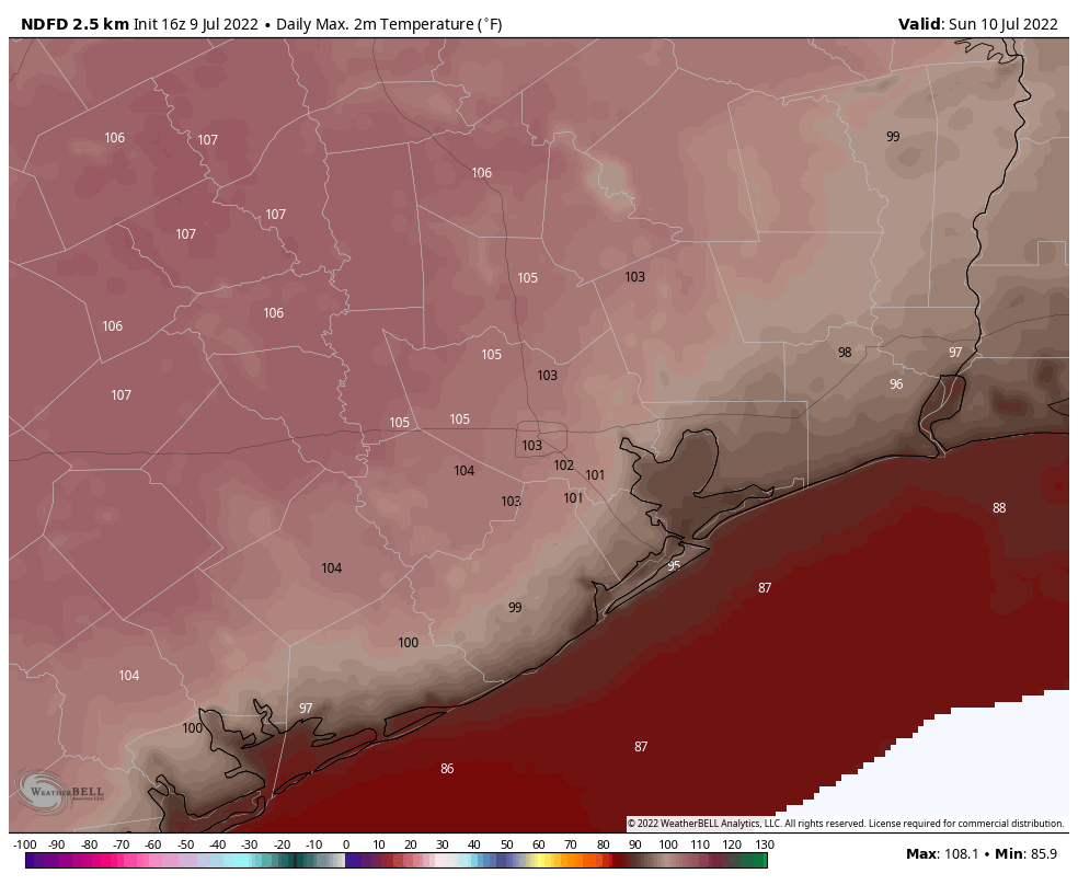
Hi everyone. Just a quick weekend post here to call attention to the extreme heat our region will see today, Sunday, and possibly Monday. Yes, we know it gets hot in Houston during the summer. But temperatures this weekend, particularly on Sunday, will reach 105 degrees or higher for some inland locations as we see peak high pressure. This is rare and dangerous heat that warrants precautions.
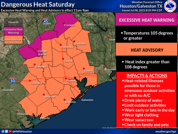
To that end, the National Weather Service has issued an “excessive heat warning” for far inland areas, including College Station, for Saturday. The rest of the metro area, including the city of Houston, falls under a “heat advisory” criteria. This warning area for excessive heat could be expanded further southward on Sunday, as we warm further. The last time the city of Houston, itself, fell under an Excessive Heat Warning was August 31, 2020.
This will be the hottest weather that Houston has seen this year, and raises the threat of heat related illnesses. Outdoor activities should be limited during the middle of the day, and you need to stay well hydrated.
The heat should peak on Sunday, but Monday still has a pretty good shot at hitting 100 degrees for much of the metro area. After this we should revert to a more summer-like pattern, with high temperatures starting to drop back toward the mid-90s and chances for at least some scattered rain showers. Until then, please take things easy outdoors.
A Message From Our Sponsor, Reliant
Our thanks to Eric and Matt for keeping Texans informed during another hot Texas summer. With the high temperatures in the days ahead, Reliant wants to ensure everyone has the latest information to manage their energy usage and stay cool. Below are helpful tips you can apply, regardless of your electricity provider:
- Follow the 4×4 principle. Set your thermostat four degrees higher when you’re away from home for more than four hours to save on energy usage and costs.
- Rotate your ceiling fan counterclockwise for a wind chill effect. This can make the temperature in a room feel up to 4 degrees cooler allowing you to be more comfortable and adjust your thermostat to save money. Don’t forget to turn off your fan when leaving the room.
- Use blinds or curtains to reduce solar heat gain by up to 50 percent. Direct sunlight can increase the demand on your AC by as much as 30 percent.
- Beat the Heat Centers are located across Houston to provide a safe place for seniors and other vulnerable neighbors to cool off, allowing them to decrease their energy usage at home. To see a full list visit reliant.com/beattheheat.