Good morning. You’ll notice that today headline is yet another acrostic, in which the first letter of each word spells out Houston. Because there is not much else to challenge a forecaster when high pressure dominates our weather, I’m going to challenge my creativity with words and acrostics until the heat breaks and we see some more widespread showers. And when will that happen? There is a chance of some small relief by the middle of next week.
On another note, if you’re going to be in the bay area this weekend, and particularly if you live close by Johnson Space Center, please note that they’re conducting a pressure test of a lunar habitat on Saturday. Effectively this means that engineers are going to pump up the pressure in a habitat to see how high it can go until it bursts. The burst test will begin at 8 am, with the culminating boom likely to come between 11 am and noon. Don’t freak out if you hear a loud noise!
Thursday
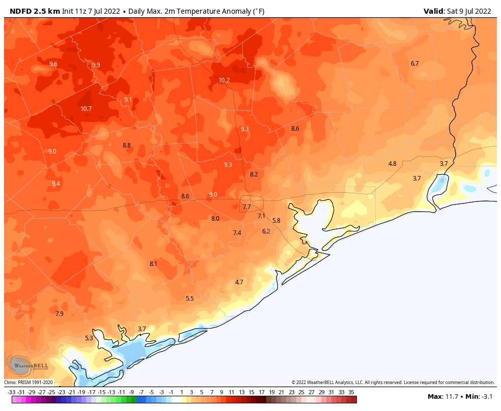
Conditions today will be similar to Wednesday in that high temperatures will generally reach the mid- to upper-90s beneath mostly sunny skies. Also like on Wednesday, there is the potential for some isolated to scattered thunderstorms. While virtually all of us saw no rain yesterday, a thunderstorm just east of downtown Houston popped out 1 to 2 inches of rain across a couple of miles near Galena Park. There may be a couple of those rainy areas today, as well. Otherwise, winds will be light, out of the south.
Friday and Saturday
Hot and sunny, with highs near 100 degrees, if not reaching triple digits. Rain chances fall to 10 percent or less. Winds will generally be light.
Sunday and Monday
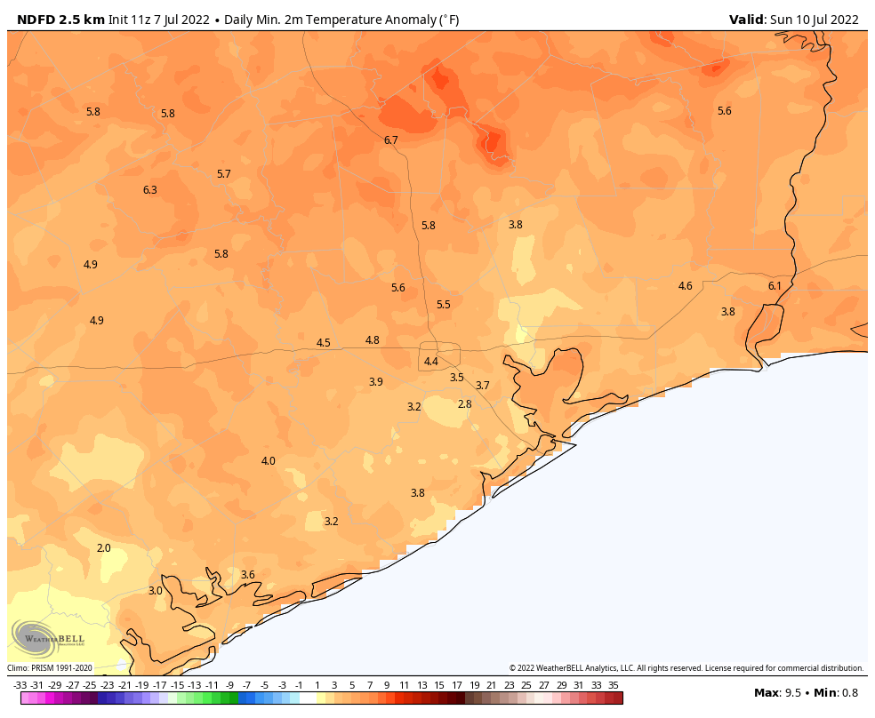
Temperatures remain about the same, but rain chances may increase slightly to 10 to 20 percent during the afternoon. Skies remain mostly sunny.
Tuesday and beyond
It looks as if the high pressure ridge may start to back off by the early part of next week, and this could allow for temperatures to start to drop into the mid-90s. This may also introduce better daily rain chances along the sea breeze. There are no promises here, but only potential. We’ll see.
The rain missed me yesterday, but I had heavy cloud cover throughout the hottest part of the day. What a difference that makes. I’ll take it!
It rains more at my place of work than it does at my house and I wish I could transplant the rain to my yard! The acrostics are fun but I’ll be happy to give them up for some moisture to hit the ground instead of making everything in the air sticky…
Lows in the 80s should be made illegal.
Shades of the summer of 2011.
“Acrostic” and burst test loud noise, along with sticky humidity…Holy Cow!!!
This relentless heat saps my energy on the drive home – and it really demoralizes me to go for my pre-dawn walk. Why can’t we beam some of this heat to Neptune?
Had a short 5-minute shower in Sugar Land North just now. I heard it first and couldn’t believe it was really RAINING.
Can you comment on the microclimate on the East End between the Buffalo Bayou and Brays Bayou sensors? We’ve received a lot more rain than anywhere else in the county and tend to get lots of micro storms like these every year.
2.9 inches of rain at my house today!! We’re located in 77007 along the Washington corridor. Rained steady for ~2 hours and we lost power for a couple hours as well, after a lightning strike nearby. I’ll take it!