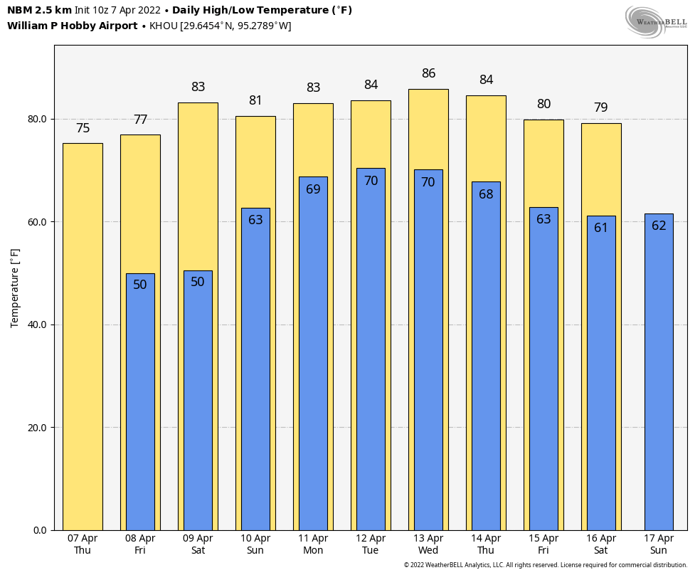
Good morning. A weak cold front is on schedule to move in late this afternoon and evening, possibly bringing some brief showers and thunderstorms. The dry air associated with this front will be long gone before the weekend, however.
Wednesday
Today will be a warm and humid affair for Houston, with southwesterly winds gusting up to 25 or possibly 30 mph. Highs will reach the mid-80s for most of the area, but may rise a little higher than this for western parts of the region. A cold front is on the way, however, and it will push into the area late this afternoon and this evening. It looks like a thin line of showers and possibly a few thunderstorms may accompany the front, perhaps reaching downtown around 6 to 8 pm, and the coast an hour or two later. Low temperatures tonight will drop to around 60 degrees.
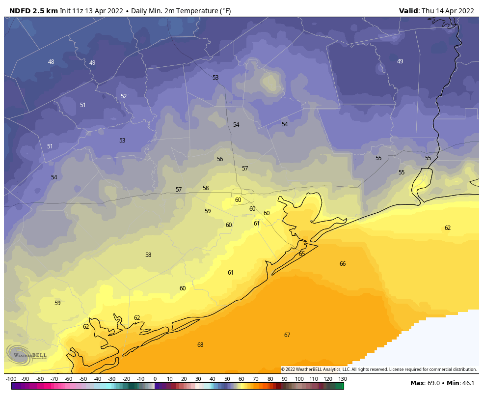
Thursday
This will be a pleasant, sunny day with high temperatures around 80 degrees. Winds will come from the northeast, perhaps gusting to 15 or 20 mph at times. As winds shift to come from the east overnight, lows Thursday night will be a few degrees warmer than Wednesday night.
Friday
The aforementioned cold front, which stalled over the northern Gulf of Mexico on Thursday, will lift back north across the region on Friday as a warm front. Effectively that means we’ll see a rapid rise of humidity, and increasing clouds, with highs likely somewhere in the low 80s. Winds will be light, out of the southeast. There’s a slight chance of rain as atmospheric moisture levels increase.
Saturday
The first half of the weekend will be partly sunny and quite warm, with highs likely in the mid- to upper-80s for most. Winds will be from the south, and there probably is about a 10 percent chance of a brief shower.
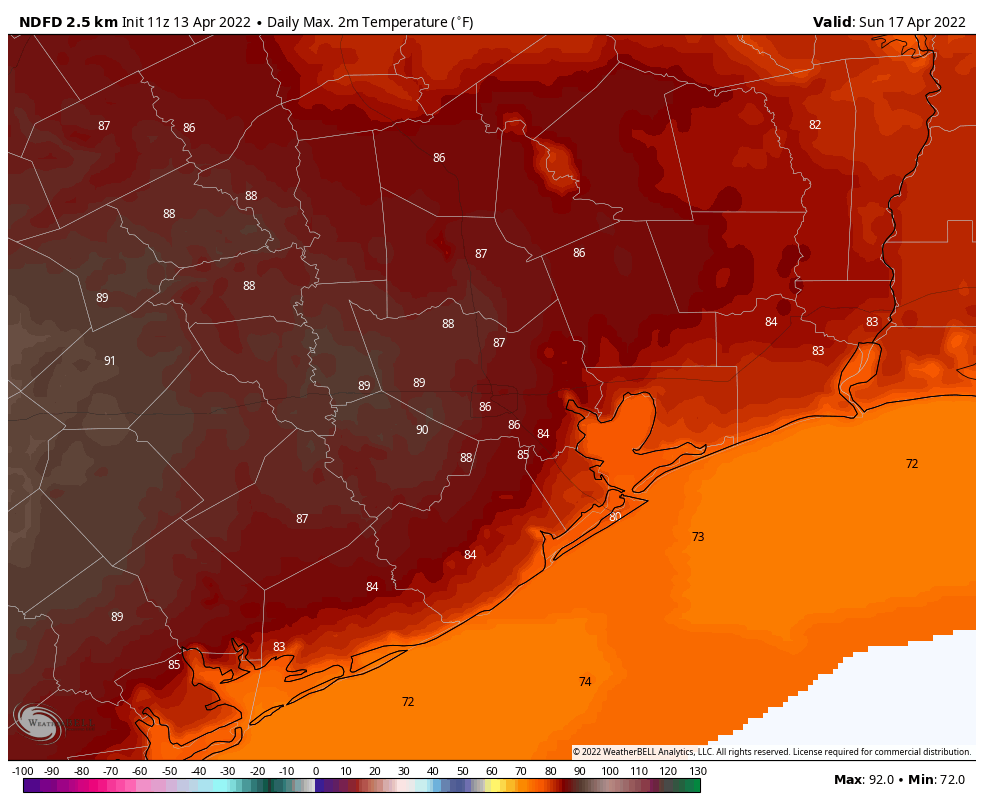
Sunday
Easter Sunday will also be warm, with much of the area likely seeing highs in the upper 80s to go along with partly sunny skies. Humidity levels will, of course, be soaring as well. Easter will be a heater, therefore. Winds will be out of the south, probably at 5 to 15 mph. Rain chances, again, are probably in the range of 10 percent.
Next week
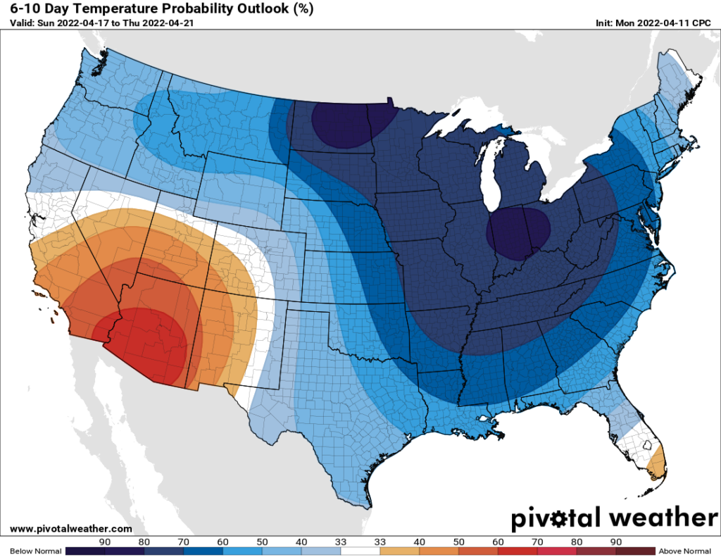
We still lack clarity on the timing and strength of next week’s cold front. It certainly looks a lot less impressive than it did a few days ago, with much of the cold air now getting shunted off to the east, rather than diving due south into Texas. So Monday and Tuesday of next week should start to see some cooler and somewhat drier weather, but how cool, and how dry? I have zero confidence in predicting that right now.