Good morning. Houston faces the threat of severe weather later today, and especially tonight, as a slow-moving cold front advances toward the region. This system will be bringing storms across central and east Texas during the next 24 to 30 hours before it finally moves east. During that period we face both the threat of severe thunderstorms, including hail and tornadoes, as well as heavy rainfall. To account for this heavy rainfall, we have instituted a Stage 1 flood alert for the Houston region for areas north of Interstate 10.

Monday
We’re not expecting too much action during the daytime. There will be some scattered showers, but nothing too extreme, as temperatures reach the low 70s beneath cloudy skies. Winds, however, will be noticeable out of the south, with gusts of 30 to 35 mph or even higher at times. For areas west and north of downtown Houston, conditions will start to become more favorable for strong thunderstorms around sunset. At that point storms are likely to sag southeastward, toward central Houston and the coast overnight.
Monday night and Tuesday morning
There will be an abundance of moisture and energy in the atmosphere tonight, which translates into the potential for vigorous thunderstorms. This system will be capable of producing large hail, briefly strong wind gusts, and tornadoes. While this system will be dynamic, and the details are to be determined, generally I think we can expect an initial round of strong thunderstorms during the overnight hours, to be followed by a band of heavier rainfall (with less potential for severe effects like hail and tornadoes) sometime around sunrise on Tuesday morning.
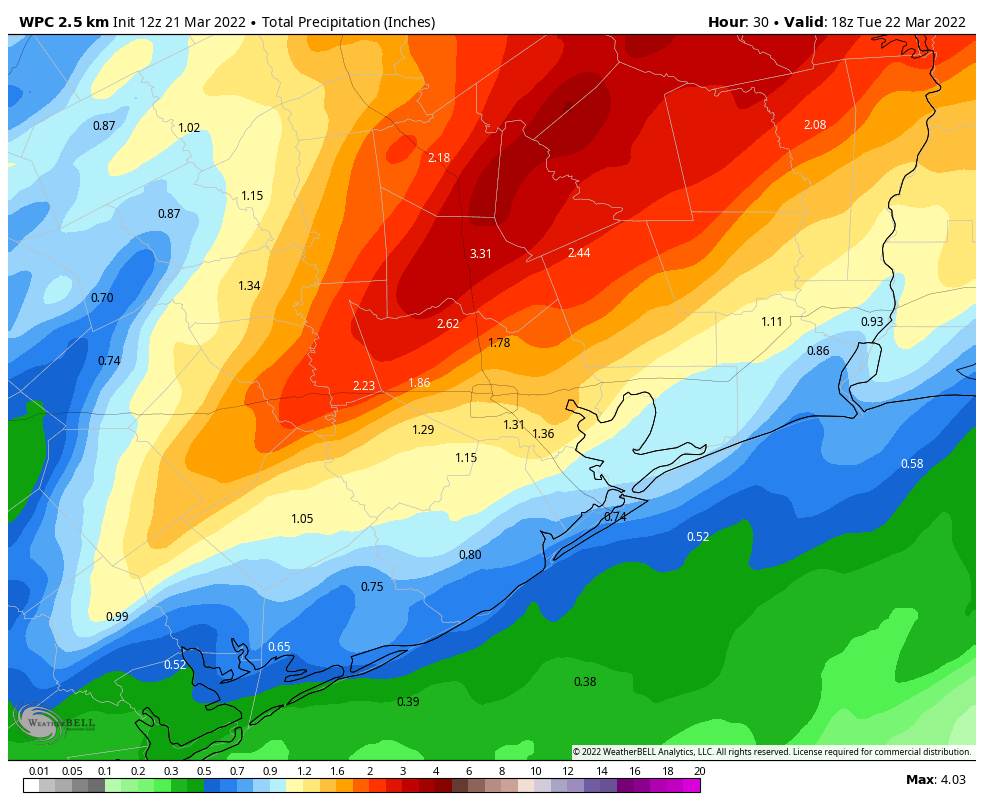
Overall rain totals will likely be 2 to 4 inches for areas north of Interstate 10, and 1 to 4 inches for locations south of the freeway. Some inland locations will see more than 4 inches, and therefore we have placed areas north of Interstate 10 under a Stage 1 flood alert. Street flooding is the most likely outcome.
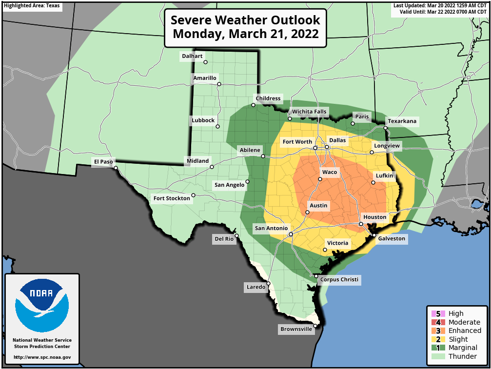
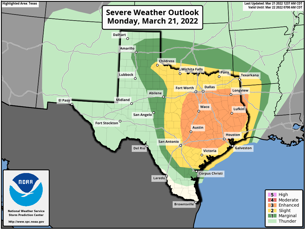
If this forecast gives you anxiety, please consider that NOAA’s forecast for storm activity locally is mostly in the orange or “enhanced” category (see above). This is relatively high, but there are two higher gradients of storm potential. So while our area is likely to see some severe activity, your personal chances of being directly affected by a tornado are really very low. With that said, due to the potential for inclement weather, this is time to pay attention. It is important that you have one or more ways to get weather warnings tomorrow night (such as you phone, a weather radio, etc.) Matt and I will provide additional updates today, tonight, and Tuesday morning.
Tuesday
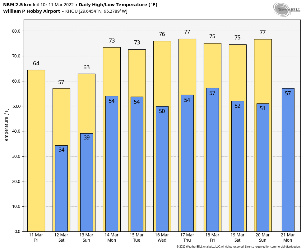
As the front moves through on Tuesday morning it should begin to sweep away the rainfall, with rains likely ending mid-morning for most locations. Skies should clear out fairly quickly on Tuesday as drier air pushes in, with sunny skies in the afternoon and highs in the 70s. Lows on Tuesday night should drop into the upper 40s for Houston, with cooler conditions inland.
Wednesday, Thursday, and Friday
The rest of the week should yield mostly sunny, pleasant weather with highs in the 60s and 70s, lows in the 40s and 50s. Look for a reinforcing shot of drier air sometime around Thursday.
Saturday and Sunday
At this vantage point, the weekend looks nice as well. Look for highs in the 70s or possibly low 80s, lows in the 50s, and partly to mostly sunny skies. Dewpoints will recover some, but the air should still feel pleasant dry outside.