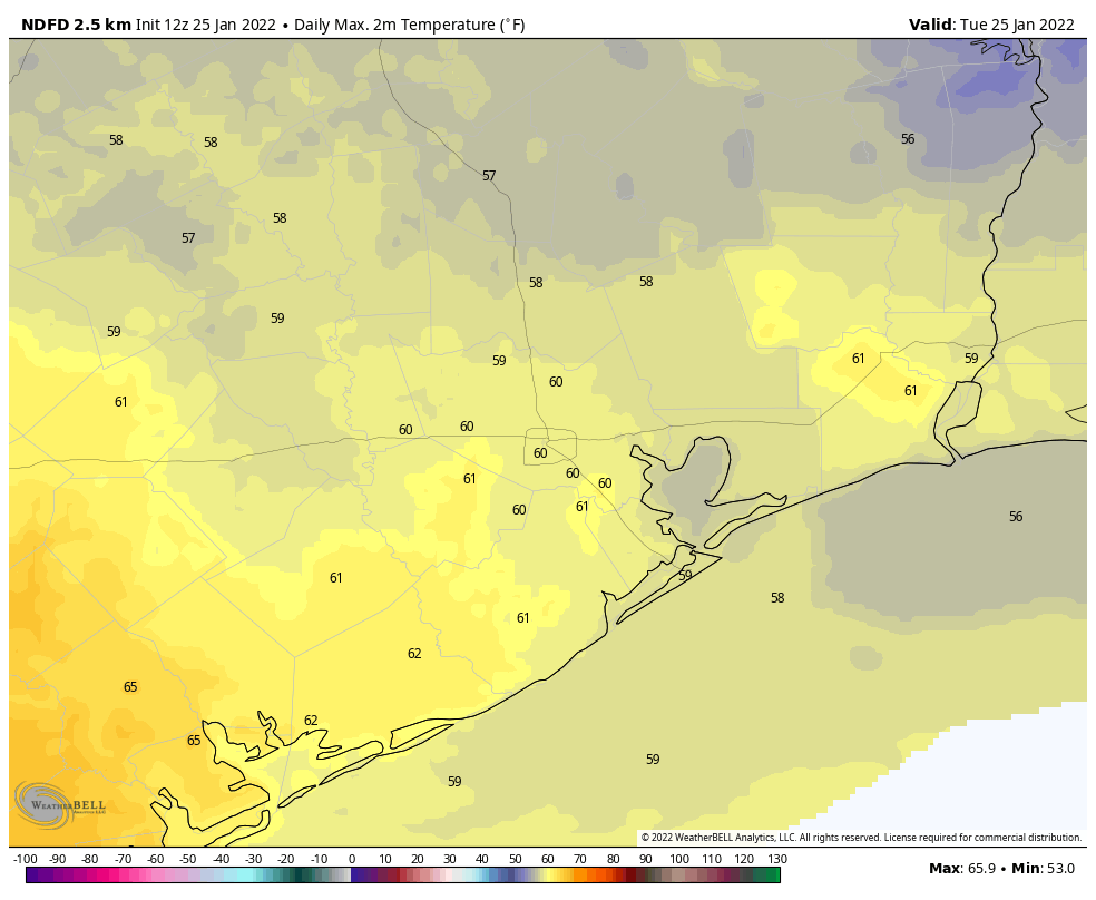
It is such a lovely day across the Houston region today it’s difficult to imagine unpleasant weather. But we’ve got plenty of that on tap for the week ahead, so we’re jumping in with a Sunday post to keep you in the loop.
Monday’s rains
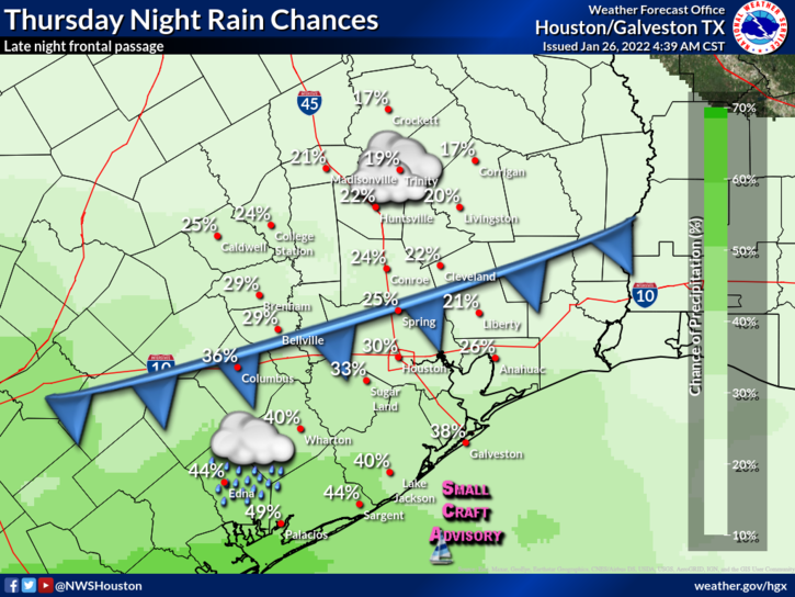
We continue to expect that a low-pressure system will produce widespread rainfall across the Houston region on Monday, generally from the late-morning hours through around midnight. Rainfall amounts are going to vary widely with this system, as some areas pick up less than one-half inch of rain, and other locations 2 to 4 inches, if not a bit more. Because these rains have the potential to produce some nuisance street flooding, we think it’s worth instituting a Stage 1 Flood Alert. This will primarily affect areas south of Interstate 10, and west of Interstate 45.

Generally, the closer to the coast you live, and the further west of Houston, the more likely you are to see heavy rainfall. The good news is that we don’t anticipate any severe weather beyond heavy rainfall on Monday, so tornadoes or strong winds are unlikely. These rains should end over night with partly sunny skies on Tuesday.
Mid-week freeze
The next event on our radar—if you thought I was going to spare you weather puns because of the Sabbath, you thought wrong—is a cold front that will arrive on Wednesday night. Some additional rain showers may well accompany this front, but I think our atmosphere will dry out before the coldest air arrives. This should preclude any wintry precipitation for the Houston metro area, but I’m not ready to entirely rule that out yet.
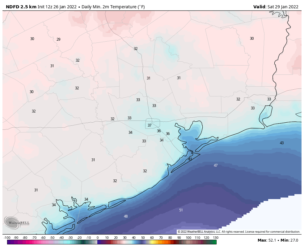
The bigger story will be colder air, with low temperatures likely dropping into the 20s for Houston on Thursday and Friday nights. Even Galveston Island may see a light freeze on Thursday night. These temperatures should be about 10 degrees warmer than the region experienced during the freeze last February, but it will nonetheless be quite cold. As we get closer, we’ll be able to fine tune the temperature forecast.
Still more significant impacts are likely for inland parts of the state this week, particularly the Dallas area. Beginning late Wednesday afternoon through Thursday, snow and ice are likely for the Metroplex. Low temperatures on Thursday night probably will get into the teens. So if your plans take you north of Houston this week, roads and more could be mess.
If you’re wondering what this means for the Texas power grid, the answer is I don’t know. We’re not going to see the cold extremes we saw in 2021, but it will still be plenty cold across the entire state.
More tomorrow.